2:30 PM | *Wall of cold to sweep across the country next week*
Paul Dorian

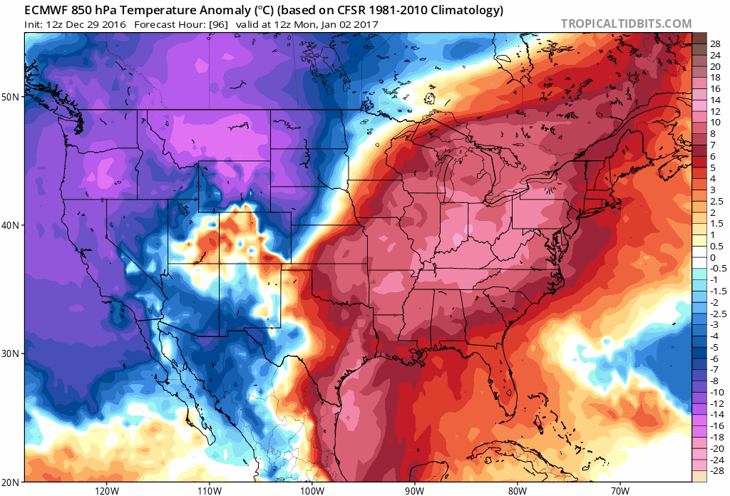
12Z Euro model forecast of 850 mb temperature anomalies from Monday, January 2nd to Sunday, January 8th (24-hour increments). The wall of cold (depicted in blue, purple) spreads across the country reaching the eastern states at the end of next week. Maps courtesy tropicaltidbits.com
Overview
If the first week of the new year is going to be any indication as to how active the weather will be in 2017 then we are going to have some very interesting times ahead of us. A major blast of Arctic air will sweep across the country next week from the northwest to the southeast so that by the weekend of January 7th and 8th, it’ll be colder-than-normal virtually from coast-to-coast. This wall of cold will be preceded by a significant warm up in the eastern US during the first half of next week, but then a mid-to-late week cold frontal passage will begin to turn the temperature pattern upside down. In addition to the cold wave that will spread across the US next week, there are some early signs that a significant storm system could pull out of the southern states and head towards the eastern seaboard by the weekend of the 7th and 8th.
The coming wall of cold
In a pattern somewhat similar to this current week, it looks like there will be a significant warm up early-to-mid next week in the eastern US that will precede a significant late week cool down. Rain is possible during the warm up in the first half of next week in much of the eastern US and temperatures could climb into the 50’s in the DC-to-Philly-to-NYC corridor on Tuesday and Wednesday. Later next week, the tide will turn as far as temperatures are concerned and it is not quite clear yet if we’ll experience a more gradual “step down” to the cold or if it’ll be a quick transition. The 12Z Euro model forecast of 850 mb temperature anomalies shows the significant warm up during the first half of next week in the eastern US (red, orange) and then there is an initial cold push later next week, but the full brunt waits until the weekend (Saturday, 1/7). In any case, there is little doubt that cold will encompass most of the country by the time the weekend of the 7th and 8th rolls around.
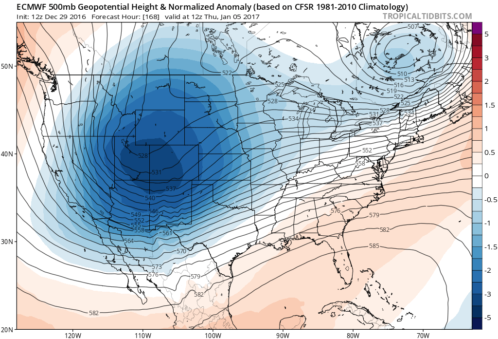
12Z Euro forecast map of 500 mb height anomalies on Thursday, January 5th showing a vigorous upper-level low over the Rockies which could spawn a storm to develop in the southern states; map courtesy tropicaltidbits.com
The potential storm
In terms of storm potential, the 12Z Euro is showing a deep upper-level wave of energy over the Rockies around Thursday the 5th. This feature is likely to act to pull a lot of moisture out of the Gulf of Mexico and the end result could be a significant storm system that heads towards the east coast from the Deep South – all at around the same time much colder-than-normal air reaches the eastern seaboard. Whether this storm actually brings in the cold air to the Mid-Atlantic or encounters enough cold air already in place for a possible big frozen precipitation event is just too early to say right now. This potential storm late next week is all just speculation this far out; however, the overall pattern does raise some red flags for just such as possibility.
Stay tuned.
Meteorologist Paul Dorian
Vencore, Inc.
vencoreweather.com