12:05 PM | *The Arctic Express and increasing chances for snow*
Paul Dorian
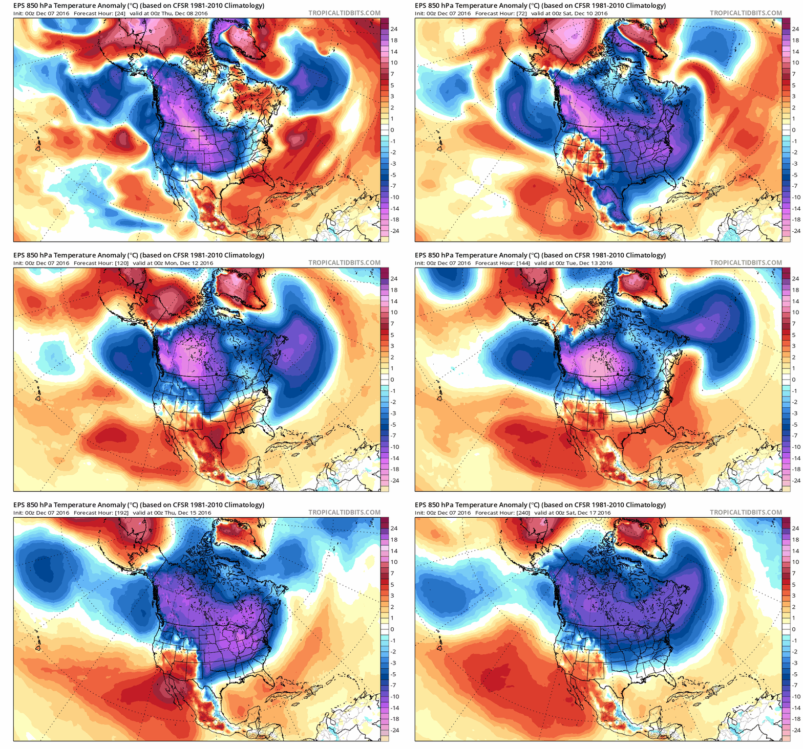
10-day loop of lower atmosphere (850 mb) temperature anomalies from last night's run of the Euro Ensemble model (at 24-hour increments from tonight through Friday night, December 17th); maps courtesy tropicaltidbits.com
Overview
The flood gates appear to have opened up for multiple Arctic air masses to plunge from northwestern Canada/Alaska into the US over the next few weeks and this type of weather pattern will surely increase the odds for snow around here. By no means is there anything set in stone yet for the snow, but the unfolding weather pattern will be much more favorable compared to recent weeks. One Arctic blast is already being felt today across the northwest and north-central part of the country and will arrive here later tomorrow/tomorrow night. By Friday, temperatures will be confined to the 30’s for the afternoon highs, strong NW winds will produce even lower wind chill values, and there can be some snow shower activity. A second Arctic blast will drop out of Canada into the northern US early next week and it should arrive here during the middle of next week. Looking even farther ahead, there are signs for yet another (third) Arctic blast to follow as we progress into the second half of December.
Actual temperatures from this morning associated with Arctic blast number one; map courtesy coolwx.com
Details on the cold
The coldest air mass of the season so far has dropped temperatures to near or even below zero today in portions of Wyoming and Montana and this cold air mass will continue to spread to the south and east. It will overtake the Great Lakes region on Thursday and temperatures in Chicago will drop into the teens tomorrow night where there is some snow cover. The colder air will begin to be felt around here later tomorrow and then temperatures on Friday will do no better than the 30’s along with strong NW winds which will bring wind chill values down into the teens. The cold push will also drop way down into the Deep South bringing colder-than-normal temperatures from Texas to Florida by Friday. The unseasonable chill will remain through the weekend here and then we’ll get some modification during the early part of next week (~Monday). This modification in temperatures, however, will be quite brief.
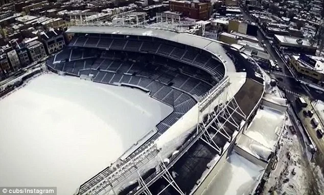
Current look at snow-covered Wrigley Field in Chicago, IL; image courtesy Cubs, Instagram
Another Arctic blast is destined to cross the northern US early next week and reach the Mid-Atlantic region during the middle of the week. As a result, temperatures should drop back down to well below normal levels for much of the second half of next week. Last night’s run of the European ensemble model shows well the express train of Arctic air masses from Canada into the US over the next ten days. The loop of lower atmosphere (850 mb) temperature anomalies over North America runs at 24-hour increments for the 10-day period from tonight through Friday night, December 17th (colder-than-normal in blue, purple).
12Z GFS forecast map for Sunday afternoon, December 11th; map courtesy tropicaltidbits.com, NOAA
Outlook on the prospects for snow
As far as snow is concerned, as the cold air becomes better and better established over the next several days in the eastern US the chances for snow around here will increase. In fact, there are multiple snow threats shaping up for next week with the first coming Sunday night and Monday. It may be cold enough for some of this potential event to contain some snowfall; especially, at the onset. Another system could threaten us with some snow later next week as more Arctic air floods into the Mid-Atlantic region. There could even be a third threat for snow a few days after that during the weekend of the 17th/18th. In general, these threats are associated with northern stream systems which is rather typical for weak La Nina winters. All of these potential threats are still several days away and nothing is set in stone by any means, but the main point is that the overall evolving pattern does favor increasing odds for snow.
12Z GFS forecast map for early Thursday, December 15th; map courtesy tropicaltidbits.com, NOAA
Get ready – the fun is about to begin.
Meteorologist Paul Dorian
Vencore, Inc.
vencoreweather.com


