3:00 PM | Nuisance accumulating snow still a threat for later tomorrow, tomorrow night and it wouldn't take much to end up with even more
Paul Dorian

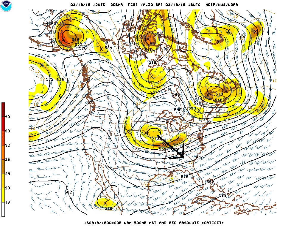
Current upper-level map (500 mb) showing upper level low over Iowa; map courtesy NOAA
“Front-runner” moisture (indicated by arrow on radar image) has resulted in some rain in the DC metro region early this afternoon which has recently begun mixing with a bit of snow and sleet and it should change to all snow by late today in many locations north and west of the District before winding down later tonight. This batch of moisture has so far stayed primarily south of the PA/MD border, but there can be some mixed precipitation across southeastern PA by late today and early tonight. Meanwhile, there is an important upper level low spinning over Iowa this afternoon (indicated by arrow on radar image) and it will drop southeastward over the next 12 hours or so reaching the Southeast US by early tomorrow. After that, low pressure will move out of the Southeast US and towards the Mid-Atlantic coastal waters later Sunday and begin to intensify as it pushes northeastward. Precipitation is likely to expand northwestward from the surface low pressure system later tomorrow as it slowly intensifies and this could generate nuisance accumulating snow in the DC, Philly and NYC metro regions. In fact, there is still a chance that some snow could fall as late as late tomorrow night from the Philly metro region northeast to NYC and across New Jersey.
All areas from DC-to-Philly-to-NYC can receive accumulations by late tomorrow night on the order of a coating to 3 inches which would be primarily on grassy surfaces and after dark - perhaps even more accumulation that that across New Jersey. Should the coastal low pressure system strengthen more rapidly on Sunday and Sunday night than currently expected - not unreasonable given the potent upper-level low - then it still can turn out to be more than just a nuisance snowfall in the I-95 corridor from DC-to-Philly-to-NYC. We’ll continue to monitor it closely over the next 24 hours or so - stay tuned.

Current US radar image showing "front-runner" moisture and echoes where upper-level low sits (Iowa); map courtesy University of Wisconsin
Meteorologist Paul Dorian
Vencore, Inc.