12:30 PM | *More active weather arrives late tonight and continues into Thursday with heavy rain and strong thunderstorms on the table; especially, south of the PA/MD border*
Paul Dorian

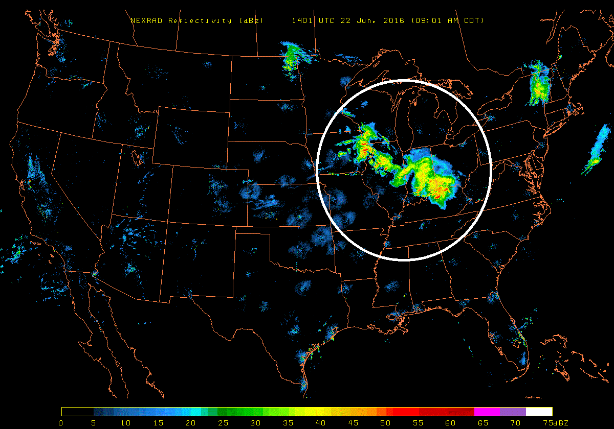
Latest NEXRAD radar image with an extensive area of showers and thunderstorms across the Ohio Valley and Upper Midwest (circled region); map courtesy University of Wisconsin/AOS; NOAA
Overview
The overall weather pattern will remain quite active in the I-95 corridor over the next 24 hours and it could result in some heavy rainfall and strong thunderstorm activity; especially, to the south of the PA/MD border. This will not be the conventional “late afternoon/early evening” timetable for the strong thunderstorms threat, but the main action will likely take place between late tonight and mid-day on Thursday although there can be some lingering activity later tomorrow afternoon. Looking ahead, high pressure will build back into the region on Friday and the weekend is looking quite nice from DC-to-Philly-to-NYC.
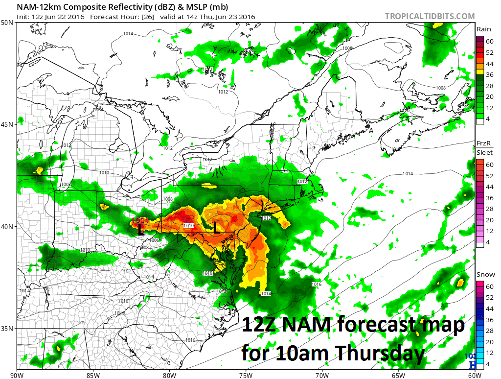
12Z NAM forecast map for tomorrow morning (10am); map courtesy tropicaltidbits.com; NOAA
Details
A news-making weather event will take place later today across the Ohio Valley and Upper Midwest with widespread damaging wind gusts, hail and perhaps even some isolated tornadoes in the area from Wisconsin/Iowa on the northwest to Ohio/West Virginia on the southeast side. Hot air is trying to advance northeastward across the Ohio Valley and Upper Midwest and this push is helping to generate an extensive area of showers and thunderstorms which is already affecting that part of the country (NEXRAD radar). While this complex of showers and thunderstorms will weaken as it moves eastward in the overnight hours, steady rain and embedded thunderstorms are likely to break out after midnight in the DC metro region and then showers should arrive in the early morning across southeastern PA, NJ and NY. Low pressure from the Ohio Valley will trek across Pennsylvania on Thursday bringing with it occasional rain and thunderstorms (NAM forecast map) with the heaviest likely south of the Mason-Dixon line. Early morning thunderstorm activity on Thursday will likely result in an “outflow boundary” which could become the focus area for re-development of thunderstorms later in the day and we'll monitor that possibility on Thursday.
Meteorologist Paul Dorian
Vencore, Inc.