11:50 AM | *Afternoon instability to produce snow showers…maybe even a heavy snow squall…”clipper” system on Tuesday to produce snow; primarily, north of PA/MD border**
Paul Dorian
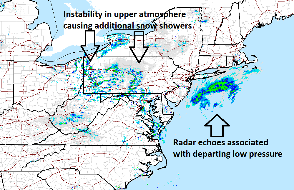
Latest radar image with instability producing snow showers in the Mid-Atlantic region; courtesy NOAA
Low pressure is pulling away from the Mid-Atlantic coastline at this time, but it is intensifying as it does, and there will be enough instability in the atmosphere behind it to produce scattered snow showers in the DC-to-Philly-to-NYC corridor over the next few hours. There can also be a heavy snow squall or two this afternoon which would quickly drop visibilities, whiten the ground, and cause slippery road conditions. By tonight, this area of instability will push off the coast and attention will turn upstream where a fast-moving system will be dropping southeastward from the Northern Plains.
Radar loop of the Northeast sector; courtesy NOAA
This “clipper” system is likely to produce snow on Tuesday; primarily, in areas north of the PA/MD border and there can even be a few inches of accumulation in and around the NYC metro region, slightly lesser amounts near Philly (coating to an inch or so), and little or no accumulation is expected in and around the DC area. Our colder weather pattern is now firmly established in the Mid-Atlantic region and it is likely to continue well into the month of February. Looking ahead to next week, there are early signals for one or two systems that could impact the Mid-Atlantic region - one around the late Sunday/early Monday time frame with some snow likely and then perhaps another threat a few days later which could feature primarily rain around here.
12Z GFS forecast map for early Tuesday afternoon of 500 mb vorticity; map courtesy tropicaltidbits.com, NOAA/EMC
Meteorologist Paul Dorian
Vencore, Inc.
vencoreweather.com
Video discussion on today’s instability and tomorrow’s “clipper”:


