11:55 AM | *Extended colder-than-normal period may bring the 30’s to many suburbs along the I-95 corridor on multiple mornings*
Paul Dorian
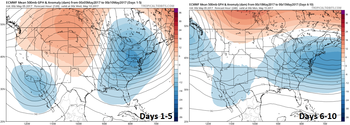
00Z Euro 5-day 500 mb height anomaly forecast maps for days 1-5 (left) and 6-10 (right); maps courtesy tropicaltidbits.com
Overview
Europe had an extended period of colder-than-normal weather in April accompanied by lots of snow and now much of the US will experience an extended period of colder-than-normal weather as we transition from early-to-mid May. This cold snap could very well result in low temperature readings in the 30’s next week on multiple mornings in many suburban locations along the I-95 corridor – and that may not be the end of it as signs point to another cold shot later in the month.

06Z GFS-parallel forecast map of Monday morning low temperatures; courtesy tropicaltidbits.com, NOAA/EMC
Details
The upper-level pattern will evolve over the next few days into an “omega”-shaped block with one deep 500 millibar low situated over the Northeast US and another along the west coast with strong high pressure ridging in between over the central Plains. This type of pattern generally results in very slow movement of surface systems so if you happen to be stuck under an upper-level low – such as will be the case in the Northeast US – there can be an extended period of colder-than-normal and unsettled weather conditions.

06Z GFS-parallel forecast map of Tuesday morning low temperatures; courtesy tropicaltidbits.com, NOAA/EMC
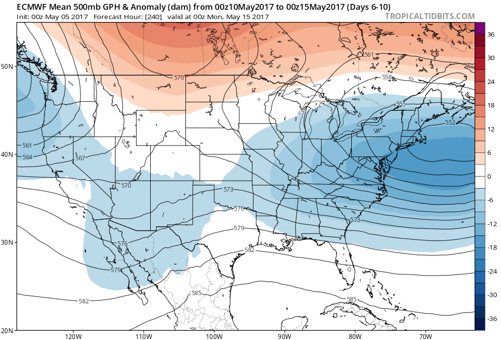
The 00Z Euro model forecast for 5-day average 500 millibar height anomalies features deep upper-level low pressure in the Northeast US for the next 5 days (blue region) and then pretty much a repeat performance for the following 5-day period. The low temperature forecast map for the Northeast US from the 06Z GFS-parallel computer model suggests widespread areas in the Northeast US will drop into the 20’s and 30’s next week and this may result in some damage to vulnerable plants and crops.

06Z GFS-parallel forecast map of Wednesday morning low temperatures; courtesy tropicaltidbits.com, NOAA/EMC
Meteorologist Paul Dorian
Vencore, Inc.
vencoreweather.com