2:45 PM | *Two tropical storms to monitor in the Atlantic Basin*
Paul Dorian

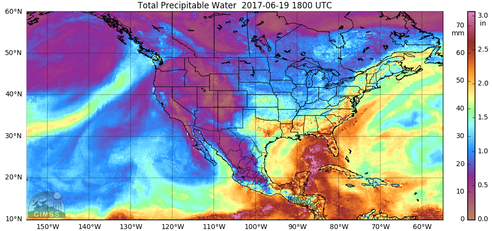
A loop of the "total precipitable water" during the last 24 hours which features tremendous flow of moisture into the central Gulf coast; courtesy University of Wisconsin/CIMSS
Overview
There are now two named tropical storms to monitor in the Atlantic Basin with one over the central Gulf of Mexico and the second over the eastern part of the Caribbean Sea. Tropical Storm Cindy has formed in the central Gulf of Mexico and is likely to turn northwest over the next couple of days perhaps making landfall by early Thursday near Galveston, Texas. Meanwhile, Tropical Storm Bret has pushed into the eastern Caribbean Sea and it will likely encounter some strong wind shear in the near term inhibiting further strengthening. It is unusual to have two named tropical storms in the Atlantic Basin during the month of June with the last couple of occurrences in 1959 and 1968. The US hasn’t had a hurricane landfall during June for over 30 years, but the US had three June hurricanes in 1886 – which was the most active hurricane year on record for the US (source).
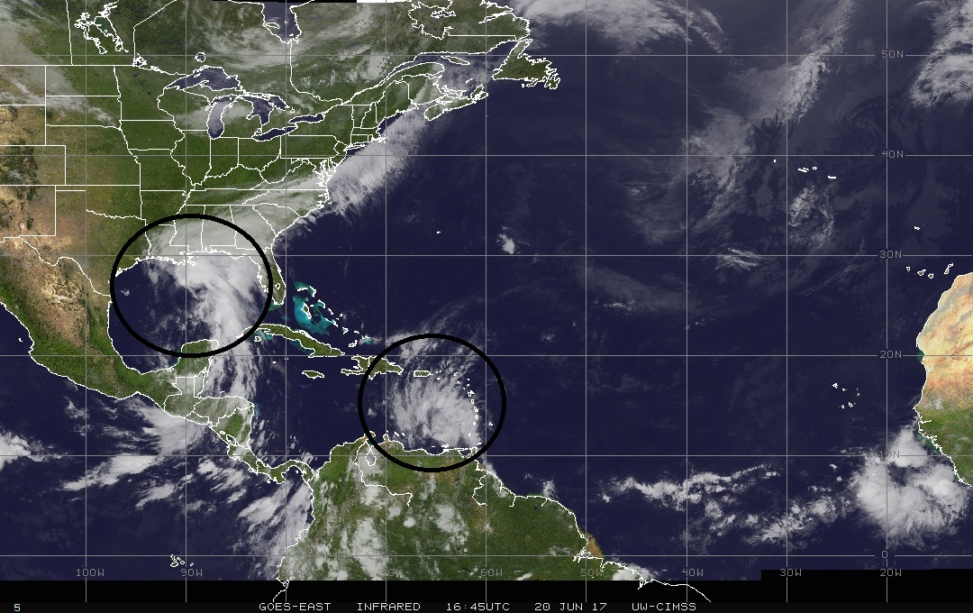
Goes-East infrared satellite image of the Atlantic Basin with Cindy over the Gulf of Mexico and Bret over the eastern Caribbean Sea; image courtesy University of Wisconsin/CIMSS
TS Cindy
Tropical Storm Cindy has been relatively stationary over the past few hours, but it is likely to resume a motion toward the northwest later today. This type of movement is likely to continue on Wednesday and this system very well could make landfall near Galveston, Texas by early Thursday morning. Cindy is likely to maintain tropical storm status, but has an outside shot at strengthening into a weak hurricane by the time it makes landfall. The biggest threat from Cindy will be heavy rainfall all along the Gulf coastal region from the western part of the Florida Panhandle to Texas.

Total rainfall amounts across the SE US during the next five days; courtesy NOAA/GFS; tropicaltidbits.com
Lots of moisture is flowing northward from the Gulf of Mexico towards the central Gulf coast and this type of low-level flow of air will continue over the next couple of days. 6-12 inches of rain can accumulate over the next couple of days over southeast Louisiana, southern Mississippi, southern Alabama and the western part of the Florida Panhandle and then 3-6 inches is possible at landfall time across southwest Louisiana and northeast Texas. Once Cindy makes landfall, it’ll likely take a turn to the northeast and move over the Tennessee Valley by the late week or early weekend. Whether the remains of Cindy ever impact the Mid-Atlantic region is still a question as a front will be pushing in from the northwest and this could suppress the moisture to just south of here.
TS Bret
TS Bret is likely to encounter some strong wind shear in the near term and this should inhibit any further strengthening. The main cause of the wind shear will be an upper-level trough over the central Caribbean Sea and this may very result in Bret’s demise over the next 24-48 hours.
Meteorologist Paul Dorian
Vencore, Inc.
vencoreweather.com