12:00 PM | *Tremendous rain already falling in the DC region…hardest hit regions from this developing storm expected to be DC metro region, Delmarva Peninsula, and southern NJ*
Paul Dorian

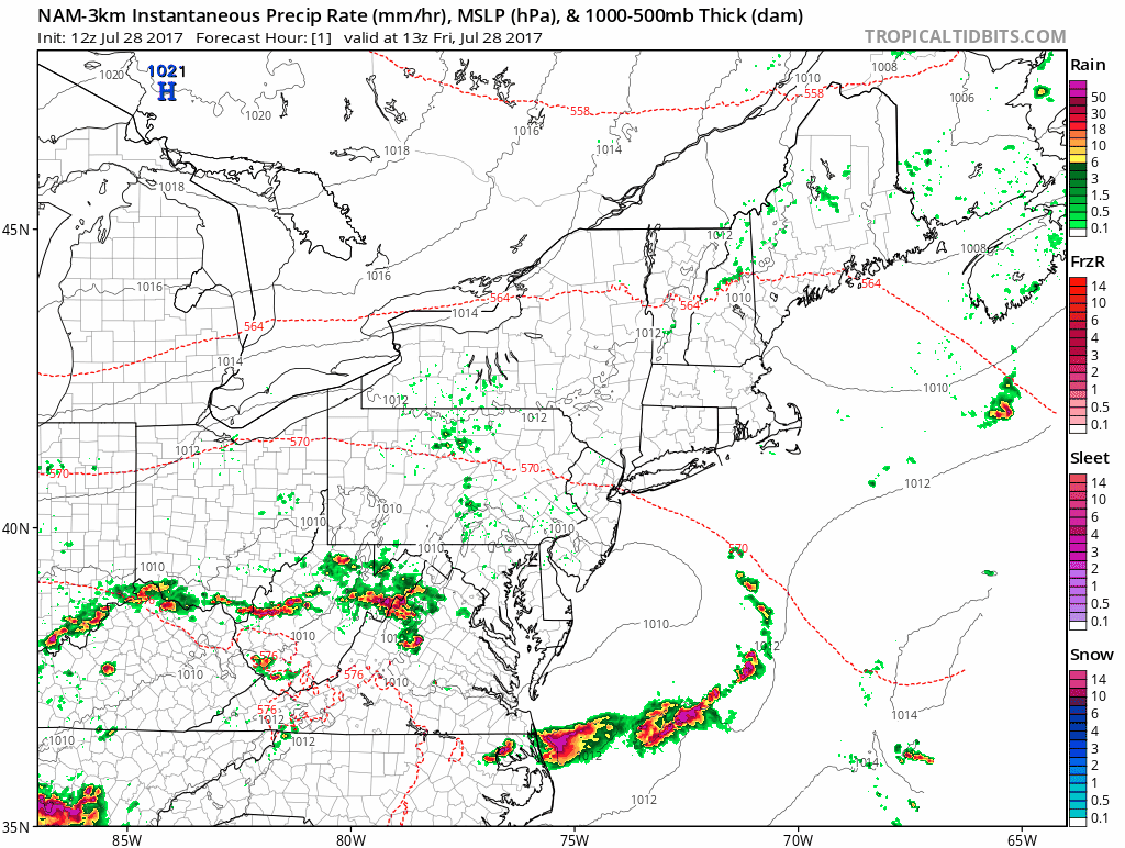
12Z high-resolution NAM (3-km) model forecast maps in hourly increments; courtesy tropicaltidbits.com, NOAA/EMC
Overview
Our late week heavy rain event is now underway in and around the DC metro region with torrential rain already falling in some areas. Low pressure is now forming along a stalled out frontal boundary zone and it will intensify as it heads towards the Mid-Atlantic coastline over the next 12 hours. The rain will gradually spread from southwest-to-northeast over the next few hours likely reaching the Philly metro region by early tonight. The heaviest rainfall amounts during this unfolding storm will likely be across in the DC-Delmarva Peninsula-southern NJ corridor where perhaps 4-7 inches can accumulate in spots by tomorrow morning. The New York City metro region will be largely spared of the heavy rainfall and there will be a sharp drop off in the total rainfall amounts from south-to-north between southern and central Pennsylvania.

Mid-day radar loop with heavy rain already in and around the DC metro region; courtesy College of DuPage, NOAA
Discussion
Vigorous energy in the upper atmosphere is sliding across the Great Lakes region and it will result in the intensification of surface low pressure in the I-95 corridor. In addition, as the colder air aloft spreads to the east, the atmosphere will destabilize and strong thunderstorms can break out this afternoon; especially, south of the PA/MD border. Temperatures this afternoon will remain fairly warm with highs not too far from 80 degrees, but as low-level NE winds develop late tonight and continue on Saturday, cooler air will push in from off of the ocean and highs tomorrow will likely be confined to the lower 70’s in most areas.

Total precipitation amounts for this storm as predicted by the 12Z NAM (3-km) computer forecast model; map courtesy tropicaltidbits.com, NOAA/EMC
The low pressure system will push away from the Mid-Atlantic coastline on Sunday and the weather should improve noticeably in the big cities. Flash flooding will be a real concern during this storm; especially, in the expected heaviest hit areas of DC, Delmarva Peninsula, and southern NJ.
Meteorologist Paul Dorian
Vencore, Inc.
vencoreweather.com
Extended video discussion: