
1:15 PM | *Fresh cold air mass one of many ingredients coming together for a significant rain event*
Paul Dorian
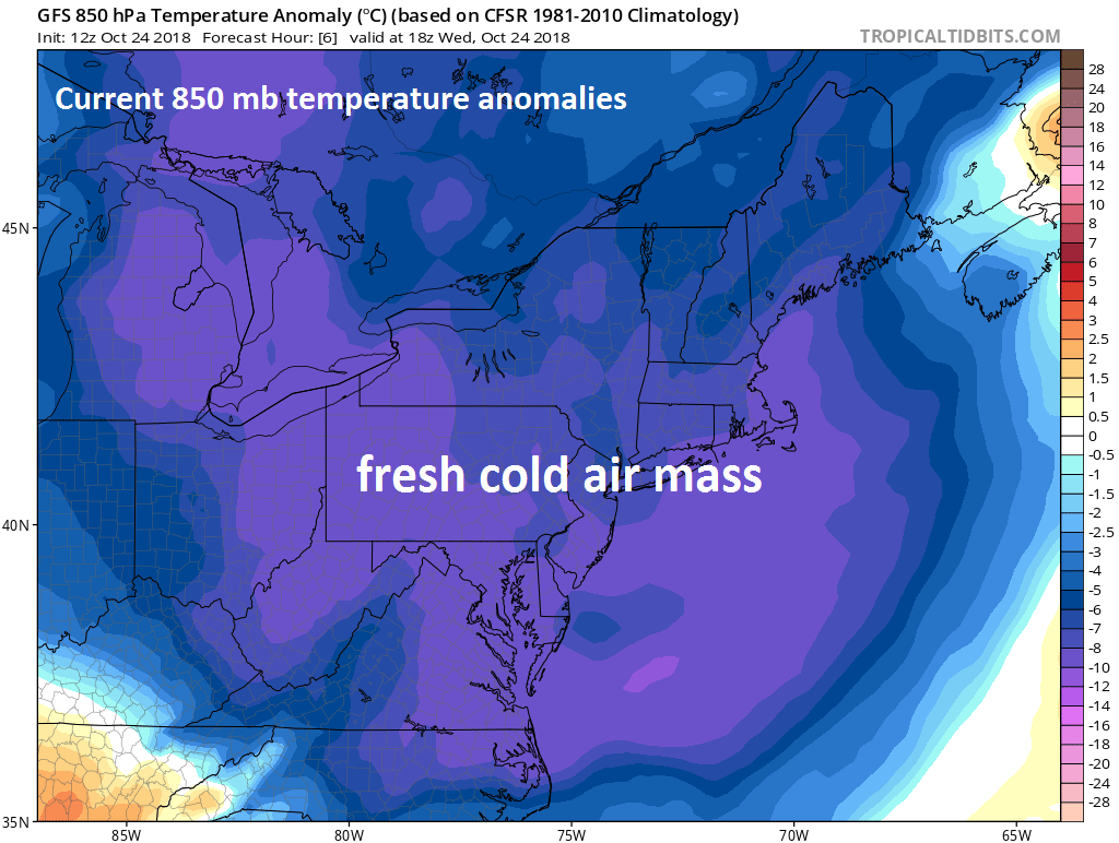
Fresh cold air is now in place across the Mid-Atlantic/Northeast US and this air mass will act as an overrunning surface at the end of the week as very moist and warm air pushes in from the Gulf of Mexico; courtesy NOAA, tropicaltidbits.com
Overview
The ingredients are falling into place for a significant rain event in the Mid-Atlantic region that should get underway later Friday as intensifying low pressure heads up along the eastern seaboard. The combination of an entrenched cold and dry air mass, copious amounts of moisture to our southwest, and vigorous upper-level energy dropping southeastward towards the eastern US will result in a soaking rain event in the DC-to-Philly-to-NYC corridor that could yield 2+ inches in some spots by early next week.

Very moist and warm air is currently in place over the Gulf of Mexico - some of which from Hurricane Willa - and this air mass will be forced up and over the dry, cold air in place across the Mid-Atlantic/Northeast US at the end of the week; courtesy NOAA, tropicaltidbits.com
Discussion
A cold front passed through the Mid-Atlantic region in the overnight hours and has ushered in a very cold and dry air mass for this time of year. High temperatures on average reach 64 degrees on this date in Philly, but noontime temperatures were stuck in the lower 50’s with NW winds gusting to 30 mph. This cold air mass will stick around into the end of the week and will act as an overrunning surface as very moist and warm air heads this way from the Gulf of Mexico. Warm, moist air is less dense than cold and dry air so when the two collide at the end of the week the warm, moist air will be forced upward and this process will result in the generation of soaking rain. Some of the moisture down in the Deep South is actually from the remnants of what was Hurricane Willa which moved (and weakened considerably) from the northeastern Pacific into central Mexico.

Two waves of energy will impact the eastern US over the next few days. The first wave will help to produce a strong low pressure system along the east coast from later Friday into late Saturday. The second system will generate additional showers in the Mid-Atlantic from late Sunday into Monday as it rotates through the large-scale upper-level trough. Courtesy NOAA, tropicaltidbits.com
In addition to this clash of air masses, vigorous energy in the upper atmosphere will drop southeastward from the Upper Midwest by the early weekend and carve out a deep trough in the Southeast US. This process will also lead to strong upward motion in the Mid-Atlantic region leading to rainfall as well. A second wave of energy in the upper-atmosphere will then rotate through the deep and broad upper-level trough and keep it chilly and unsettled around here in Sunday and Monday with additional showers likely from Sunday night into Monday. Dry and chilly weather is likely to return for Tuesday and Halloween Day (Wednesday).

Total rainfall amounts as predicted by NOAA between today and early Monday.