2:00 PM | *Significant storm to impact the region from later tomorrow into Saturday…second system produces additional showers late Sunday night/early Monday*
Paul Dorian

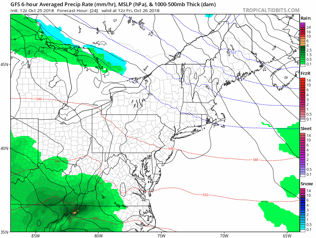
12Z GFS surface forecast maps extending from Friday morning (hour 24) to Monday evening (hour 108) featuring an initial storm near the east coast and then a second system late in the time period. Courtesy NOAA/EMC, tropicaltidbits.com
Overview
The ingredients are falling into place for a significant rain event in the Mid-Atlantic region that should get underway later tomorrow as intensifying low pressure heads up along the eastern seaboard. The combination of an entrenched cold and dry air mass, copious amounts of moisture to our southwest, and vigorous upper-level energy dropping southeastward towards the eastern US will result in a soaking rain event in the Mid-Atlantic that could yield 2+ inches in some spots by early next week. A second wave of energy in the upper atmosphere is likely to produce additional showers in the late Sunday night/early Monday time frame.
Discussion
Temperatures at 1PM were in the upper 40’s in much of the Philly metro region which is about 15 degrees below normal for this time of year and dew points were at “winter –like” levels in the upper 20’s indicative of a very dry air mass. This cold and dry air mass is anchored by strong high pressure and will stick into Friday and act as an overrunning surface for very moist and warm air heading this way from the Gulf of Mexico. Warm, moist air is less dense than cold and dry air so when the first type of air mass advances towards the second, it results in strong upward motion and eventually the generation of clouds and precipitation.

12Z GFS forecast map of 500 mb height anomalies on Sunday morning featuring “blocking” across SE Canada and two upper-level waves of energy over the eastern half of the US. Courtesy NOAA/EMC, tropicaltidbits.com
In addition to this clash of air masses, vigorous energy in the upper atmosphere will drop southeastward from the Upper Midwest and carve out a deep trough in the Southeast US by early Saturday. This feature will also lead to strong upward motion in the Mid-Atlantic region. A second wave of energy in the upper-atmosphere will then rotate through the deep and broad upper-level trough and keep it unsettled around here early next week with additional showers in the I-95 corridor from late Sunday night into early Monday. Dry and chilly weather is likely to return for Tuesday and Halloween Day (Wednesday).
Meteorologist Paul Dorian
Perspecta, Inc.
perspectaweather.com
Video discussion: