11:45 AM | *East coast storm to produce heavy rain and strong winds in the Mid-Atlantic region and frozen precipitation across interior, higher elevation locations of the Northeast US*
Paul Dorian

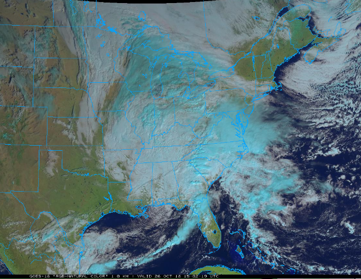
Latest satellite image features an intensifying storm system in the eastern US; courtesy NOAA/GOES-16
Overview
Low pressure will intensify near the Carolina coastline late today and then slowly push northward to a position over central New Jersey by mid-day Saturday and the result will be a soaking rain event in the DC-to-Philly-to-NYC corridor. The ingredients are in place for this significant rain event including an entrenched cold and dry air mass in the Northeast US, copious amounts of moisture to our southwest, and an intensifying upper-level trough in the eastern US. Strong winds will also become a major factor with this intensifying storm system; especially, along coastal sections where gusts past 60 mph are possible between midnight and noon on Saturday and up to 50 mph gusts are possible across interior locations. The air in place across the Northeast US will be cold enough during this upcoming event for some frozen precipitation in interior, higher elevation spots from West Virginia/western Virginia-to-northern Pennsylvania-to-northern New England.

12Z NAM (12-km version) surface forecast maps from 8 AM Friday (hour 1) to 8 PM Saturday evening (hour 36) in one-hour increments (green=moderate rain, yellow=heavy rain, blue=snow, purple/pink=freezing rain and/or sleet); courtesy NOAA/EMC< tropicaltidbits.com
Discussion
Temperatures at midday are stuck in the 40’s across much of the Mid-Atlantic region as clouds thicken with dew points generally in the 30’s – rather similar to winter-like air masses more typically seen during December or January. Meanwhile, warm and moist air is pushing northeastward from the Southeast US and is begin forced to rise up into the atmosphere resulting in clouds and precipitation. This cold and dry air mass not retreating as it is anchored in place by strong high pressure and a “blocking” pattern in the upper atmosphere across southeastern Canada. In addition to this clash of air masses, vigorous energy in the upper atmosphere is carving out a deep trough in the Southeast US and this is leading to additional upward motion in the Mid-Atlantic region. Significant rain is occurring at mid-day across central Virginia and should reach the DC metro region over the next couple of hours and then into southeastern PA by late today.
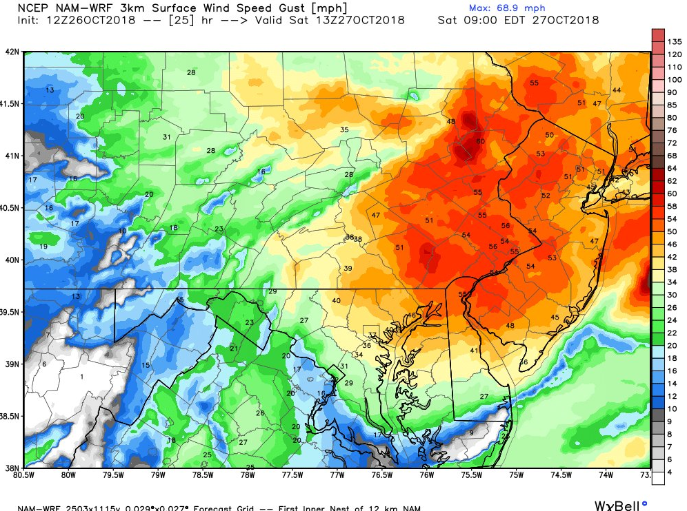
12 NAM-WRF (high-resolution) model forecast of wind gusts at 9 AM Saturday with 50+ mph extending from coastal NJ to interior PA; courtesy NOAA/Weather Bell Analytics
Low pressure across the Tennessee Valley at mid-day will translate its energy to the Carolina coastline later today and this result in a new low pressure system which will become the main player along the east coast as we head into the weekend. The Carolina coastal storm will intensify as it begins a push northward late tonight along the Mid-Atlantic coastline and reaches a position over New Jersey by mid-day Saturday. The pressure gradient between the intensifying low pressure system and departing high pressure will tighten significantly late tonight and early Saturday and the result will be wind gusts past 60 mph along coastal sections out of the east-to-northeast. In addition, winds can gust as high as 50 mph late tonight and early Saturday across interior sections of, for example, southeastern PA and central NJ. All in all the period from midnight-to-noon will be stormy indeed with heavy rain and strong winds from this powerful coastal storm. Coastal flooding will likely become a major concern at mid-morning on Saturday when high tide takes places and winds gust at their perhaps highest levels during this event.

12Z NAM forecast map of 500 mb height anomalies for Saturday evening with deep upper-level trough over the Southeast US and a second (weaker) system over the Northern Plains; courtesy NOAA/EMC, tropicaltidbits.com
A second wave of energy in the upper-atmosphere will rotate through this deep and broad upper-level trough and keep it unsettled around here as we end the weekend with additional showers likely in the I-95 corridor from late Sunday night into early Monday. Dry and chilly weather is likely to return for Tuesday and then it should turn somewhat milder on Halloween Day (Wednesday).
Meteorologist Paul Dorian
Perspecta, Inc.
perspectaweather.com
Today’s video discussion (below) focuses on this major coastal storm and the search for “upward motion” and how warm, moist air rising above cold, dry air will play an important role in this upcoming significant rain event. Numerous other video discussions can be found on our “Meteorology 101” page for a multitude of meteorological topics.