1:00 PM Wednesday | *Several hours to go with the major coastal storm and afternoon/evening hours will feature heavy snow bands*
Paul Dorian

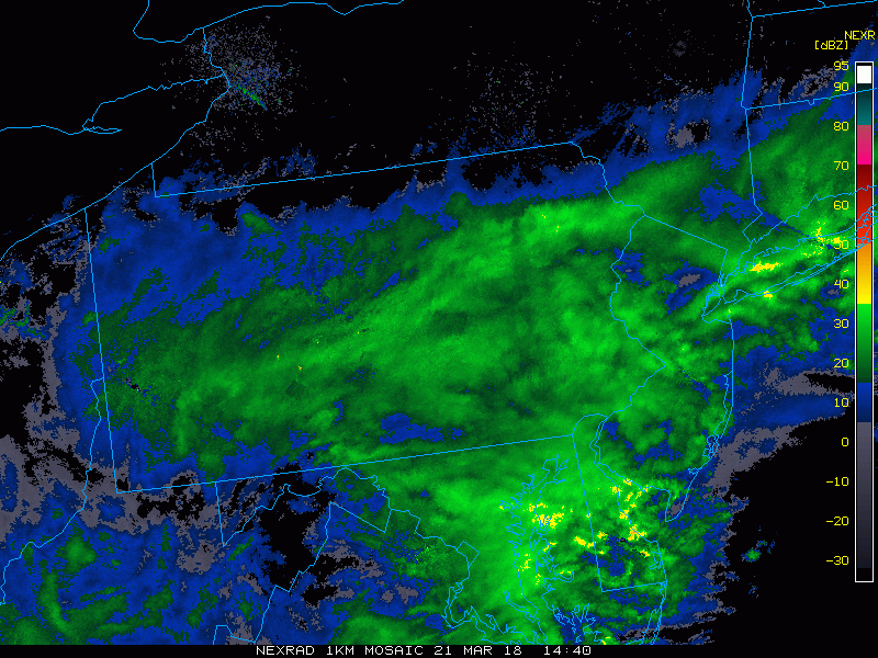
Mid-day loop of radar reflectivities and the "yellow" areas indicate heavier precipitation rates and will result in heavy snow bands in places like eastern PA and NJ over the next several hours; courtesy College of DuPage, NOAA
Low pressure continues to strengthen at mid-day off the Mid-Atlantic coastline and the snow from this system will continue well into the evening hours along the I-95 corridor. As upper-level support moves into the region with frontogenesis aloft, heavier snow bands of up to two inches per hour will form for the PM hours and they are already appearing on the latest radar loop across southeastern NJ and over the Delmarva Peninsula. These will rotate to the northwest over the next few hours and produce heavy snowfall for such places as eastern PA, northern MD, Delaware and NJ. There can even be an isolated report of “thunder snow” in some of this region.

Mid-day position of the coastal low pressure system, courtesy NOAA, EPAWA (twitter)
Temperatures will hold generally steady during the next several hours at or below freezing in most areas. Some snow accumulation reports at mid-day include 4 inches in Central Park, NY, 4 inches in Bethesda, MD, 4 inches in West Chester, PA, 5 inches in Crofton, MD, 5 inches in High Bridge, NJ, and 6 inches in Pottstown, PA.
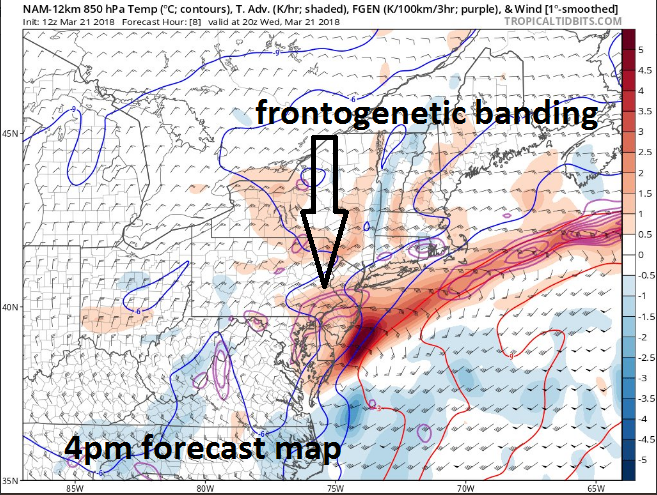
Frontogenesis in the upper atmosphere will contribute to heavy snow banding this afternoon and evening; courtesy NOAA, tropicaltidbits.com
The snow will gradually wind down later this evening as the coastal low slowly pulls to the east-northeast. As with many March snowstorms, elevation is likely to play a critical role with the difference of a couple degrees from lower spots potentially making a noticeable difference in total snowfall accumulations.

12Z NAM (3-km version) forecast map at 4pm with heavier snow indicated by the "darker blue"; courtesy NOAA/EMC, tropicaltidbits.com
Accumulation estimates remain the same from the morning forecasts with 8-14 inches in the Philly and NYC metro regions and all the way to coastal New Jersey and there will be locally higher amounts. In the immediate DC metro region, 4-8 inches of snow is likely and there will be locally higher amounts to the north, northwest and to the east of the District (e.g., Crofton, Annapolis).
Meteorologist Paul Dorian
Vencore, Inc.
vencoreweather.com