1:20 PM | ***Significant coastal storm begins very wet pattern for the eastern US***
Paul Dorian
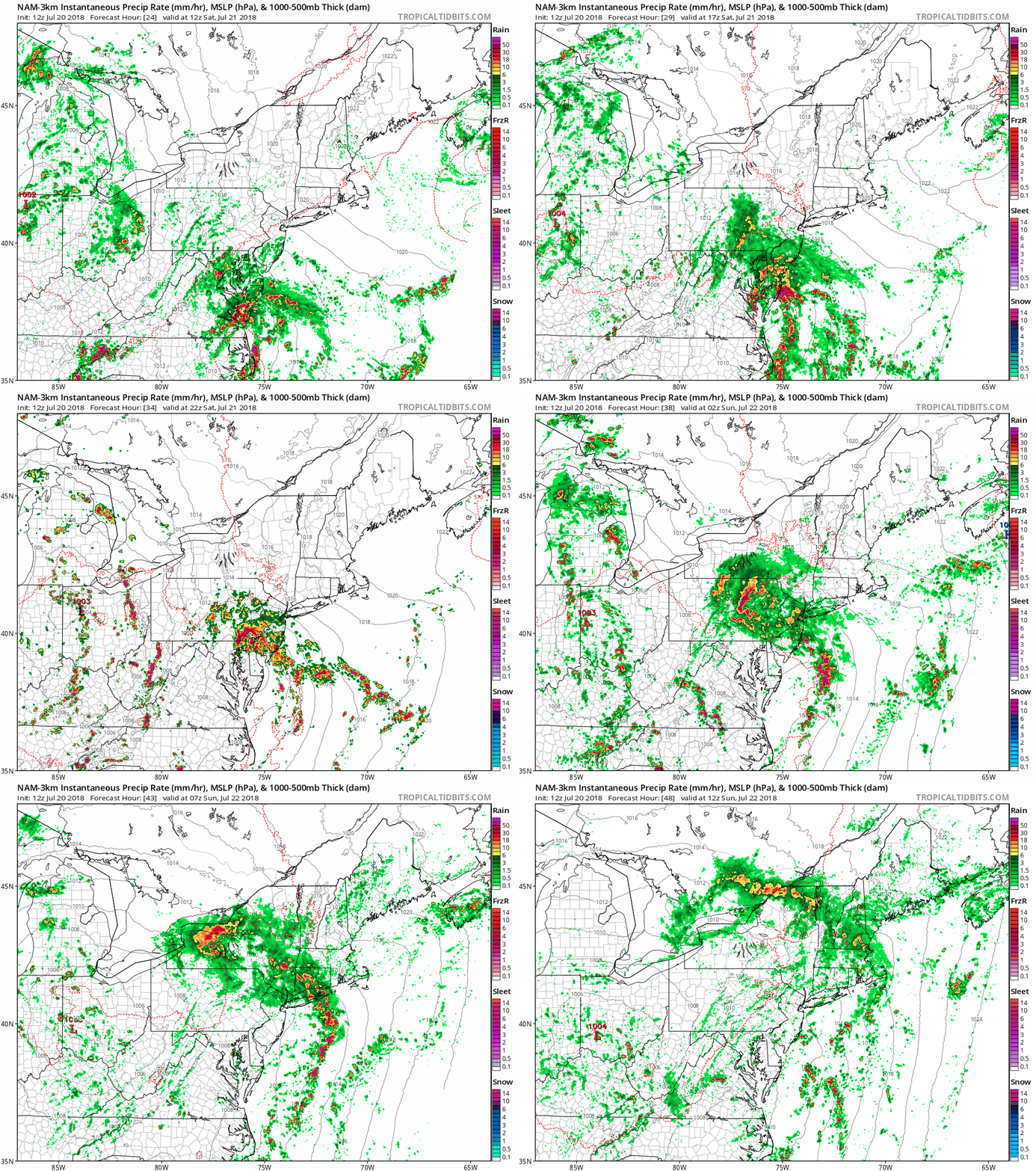
High-resolution (3-kilometer) version of NOAA's NAM computer forecast model shows the potential for heavy rain bands/embedded thunderstorms in the Mid-Atlantic region associated with the northward moving storm system (1-hour increments of instaneous precipitation rates from 8AM Saturday to 8AM Sunday); courtesy NOAA/EMC, tropicaltidbits.com
Overview
A very wet pattern is unfolding for much of the eastern third of the nation and it’ll begin this weekend with the formation of a deep “negatively-tilted” upper-level trough of low pressure over the Ohio Valley and a significant east coast storm. The upper-level system will slowly dig into the Southeast US over the next few days and ultimately contribute to an influx of moisture from the tropical Atlantic to the Mid-Atlantic. The strong coastal storm will generate heavy rain and strong winds later tomorrow and tomorrow night from the DC-to-Philly-to-NYC corridor to coastal sections from Virginia-to-Long Island.
The coastal storm will then ride northward late tomorrow night into interior sections of New England where it will weaken later Sunday. The passage of the coastal storm; however, will not end the rain threat for the Mid-Atlantic region. In fact, this significant coastal storm will just be the beginning of a very wet pattern in the eastern US for the next week or so with localized flooding potentially becoming a serious problem in many areas. By the time the latter part of next week rolls around, some spots in the eastern US may have seen the accumulation of at least half a foot of rain.
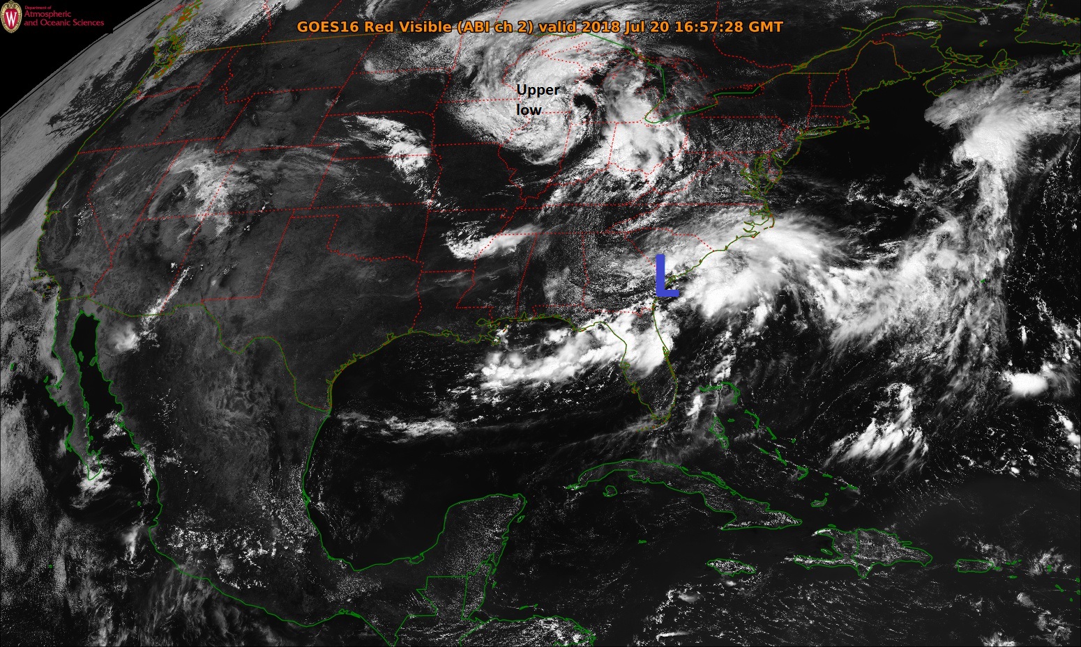
Mid-day satellite image from NOAA's GOES-East features an upper-level low over the Upper Midwest and convection along the Southeast US coastline as surface low pressure forms.
Details
An unseasonably strong “negatively-tilted” upper-level trough will form over the Ohio Valley on Saturday and the Mid-Atlantic region will be situated in the northeast quadrant of this system. As a result, vigorous upward motion will develop around here and this will aid in the intensification of a strong coastal storm by later tomorrow. This low pressure system is actually beginning to form today over the Southeast US coastline and it will slide along the Carolina coast over the next 24 hours. On Saturday, the coastal storm will push northward along the Mid-Atlantic coastline with rain and wind increasing in the region from Route I-95 to the east coast.
Deep tropical moisture will be flowing northward next week from the tropical Atlantic to the Mid-Atlantic (12Z GFS forecast map of RH (%) on Monday evening); courtesy NOAA/EMC, tropicaltidbits.com
Some of the rain later tomorrow and tomorrow night can be heavy at times and there can be some strong thunderstorm activity as well. It is not out of the question that scattered power outages develop with the expected increasing winds and potential strong thunderstorms. The low will head towards the NYC/northern New Jersey region by later tomorrow night and then northward into interior New England by early Sunday morning where it will begin a weakening phase. The passage of this storm into New England will not end the rainfall in the Mid-Atlantic region; however, as it will actually be just the beginning of a very wet stretch of weather for much of the eastern US.
NOAA's forecast map of total rainfall amounts over the next 7-days with excessive amounts in much of the eastern US
Once the upper-level low pressure system digs into the Southeast US by early next week, a flow of air from the south-to-the north along the east coast will become well established. This flow of air will pump in deep tropical moisture from the southwestern Atlantic Ocean, Caribbean Sea and Gulf of Mexico into the Mid-Atlantic region. As a result, scattered showers and thunderstorms will persist through next week and by the latter part of the week, many spots in the eastern third of the nation may have seen rainfall accumulations of several inches and the potential for some serious localized flooding will have to be closely monitored.
Meteorologist Paul Dorian
Perspecta, Inc.
perspectaweather.com
Extended video discussion on the significant weekend coastal storm and the upcoming very wet weather pattern for the eastern US:


