12:50 PM | ***Persistent influx of deep tropical moisture to keep flooding potential high through mid-week***
Paul Dorian

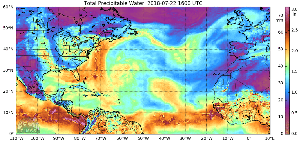
"Total precipitable water" over the past 24 hours featuring deep tropical moisture flowing northward along the US east coast; courtesy University of Wisconsin/CIMSS, NOAA
Overview
A very wet weather pattern will continue through mid-week in the Mid-Atlantic region as the combination of an upper-level trough over the Southeast US and a Bermuda High over the Atlantic pumps in deep moisture from the tropical Atlantic. There will be numerous rounds of showers and thunderstorms through Wednesday night and given the tremendous amount of available moisture in the atmosphere, any shower or storm can produce heavy rainfall amounts in a short period of time. The threat of localized flooding will remain high through mid-week as grounds are thoroughly saturated and several inches of additional rainfall are possible.

Mid-day radar loop featuring numerous showers with embedded thunderstorms...coverage will likely become more widespread over the next few hours with daytime heating adding a "boost" to the atmosphere; courtesy NOAA, College of DuPage
Details
An unseasonably strong “negatively-tilted” upper-level trough over the Southeast US is combining with high pressure over the western Atlantic to push deep moisture northward into the Mid-Atlantic from the tropical Atlantic. Latest radar shows numerous showers in the Mid-Atlantic region at mid-day with embedded thunderstorms some of which have reached strong-to-severe levels. The general movement of the showers and individual thunderstorm cells is from the southeast to the northwest – flowing along with the overall flow of air between the upper-level low to the west and high pressure to the east. The threat for showers and thunderstorms will continue on Thursday and Friday, but perhaps at slightly lower levels than what we have in store for the remainder of today, tomorrow and Wednesday.
Meteorologist Paul Dorian
Perspecta, Inc.
perspectaweather.com
Extended video discussion on the very wet weather pattern for the eastern US: