8:15 PM (Monday) | **Florence has reached category 4 status and is likely headed for the Carolina coastline…tremendous rainfall amounts to come due to an “atmospheric road block”**
Paul Dorian
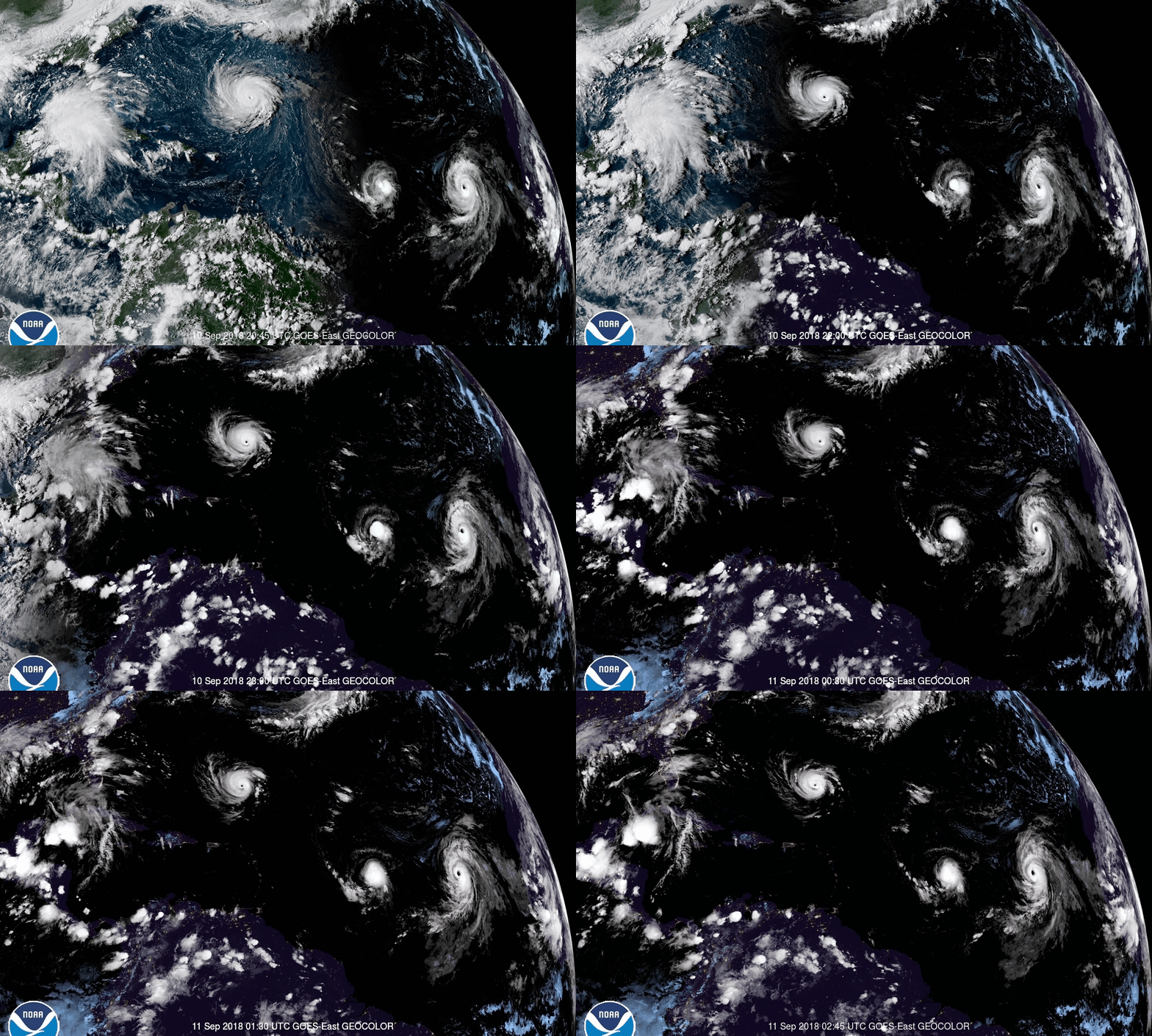
Hurricane Florence is now a category 4 storm with a well-defined eye clearly seen in this GOES-East satellite imagery loop. Florence should remain a “major” hurricane for the next couple of days before likely landfall late Thursday/early Friday along the Carolina coastline. Courtesy NOAA
Overview
Hurricane Florence has rapidly intensified today from category 2 status this morning to category 4 status this evening. As Florence moves over very warm waters over the next couple of days, it should remain as a “major” hurricane and a climb to category 5 is not out of the question. All signs continue to point to a WNW track for Florence over the next few days with a possible landfall late Thursday/early Friday near the NC/SC border region. Once Florence reaches the Carolinas, it’ll run into an “atmospheric road block” as very strong high pressure ridging is setting up to the north across the northwestern Atlantic and southeastern part of Canada. As a result of the slow down, Florence is likely to generate tremendous amounts of rainfall in the Carolinas and into at least parts of the Mid-Atlantic (e.g., Virginia) over an extended period of time.
Latest positioning of the multiple players on the tropical scene in the Atlantic Basin with an important new player in the NW Caribbean Sea. Courtesy NOAA/NHC
Florence
Florence regained major hurricane strength today and is currently rated as a category 4 with 140 mph winds and WNW movement at 13 mph. There is no reason to believe that the intensification is over; consequently, there is an outside chance of it reaching category 5 status within the next 24 hours or so. As Florence approaches the Carolina coastline, its wind field is likely to expand and this could lead to inland wind threats. The bottom line, Florence will be a large and dangerous hurricane by the time it closes in on the Carolina coastline.
12Z Euro model “spread” of storm tracks for Hurricane Florence; courtesy weathermodels.com, ECMWF
In terms of rainfall potential, history has shown us that stalled out hurricanes can dump tremendous amounts of rainfall on a given area - in some cases measured in feet and not inches. The biggest threat at this time for excessive rainfall amounts appears to be in the Carolinas and into at least parts of the Mid-Atlantic region (e.g., Virginia). Farther north, it is less certain as to how much rainfall will make into the I-95 corridor, but the potential appears to be much higher in DC as compared to NYC for significant amounts.
Three examples of stalled-out hurricanes that dumped tremendous rainfall amounts on given regions include the following: 1) Hurricane Harvey (2017) which stalled over SE Texas and flooded the Houston area, 2) Hurricane Agnes (1972) which stalled out over northern Pennsylvania and caused extensive flooding across the Commonwealth and 3) Hurricane Flora (1963) which took a loop over Cuba and generated as much as 100 inches of rain on the island.
Track of Hurricane/Tropical Storm Agnes (1972, left) and Hurricane Flora (1963, right)…both of these tropical systems stalled-out during their lifetime and generated flooding rainfall in given regions; courtesy NOAA, wikipedia
One final note, there is a potentially important new player in the overall weather pattern with a tropical disturbance now over the NW Caribbean Sea. This system adds some uncertainty to the ridge strength over the SE US and it could play a role in the eventual exit of Florence as it tries to exit from the Mid-Atlantic region after its extended visit. The rather wide model “spread” of storm tracks at 12Z (Euro) suggests there is still some uncertainty and this new tropical system may be the reason.
Stay tuned.
Tremendous rainfall amounts predicted by NOAA over the next 7-days over the Carolinas and the Mid-Atlantic. Courtesy NOAA/WPC


