12:30 PM | **Hurricane Florence closing in on the Carolinas…the “slowing down” process has begun and Florence will painfully crawl down the Carolina coastline**
Paul Dorian

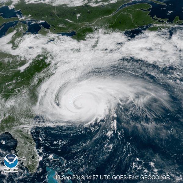
GeoColor: True Color Daytime, multispectral IR at night; courtesy NOAA
Overview
Hurricane Florence continues to close in on the Carolina coastline and it will arrive in the NC/SC border region on Friday. Hurricane Florence has weakened during the past 24 hours and is now rated as a category 2 storm. The “slowing down” process of Florence has begun and the hurricane will grind nearly to a halt when it reaches the coastline and painfully crawl along to the southwest during the next couple of days.

Current sea surface temperature anomalies with very warm water just off the coast; courtesy NOAA, tropicaltidbits.com
Details
Yesterday morning, Hurricane Florence was moving along at a pretty good clip at 17 mph, but the “slowing down” process has begun and the latest readings show a drop in movement to 10 mph in a northwesterly direction. Not only has Florence slowed down in the last 24 hours, it has weakened from category 4 (major) status yesterday morning to category 2 this morning. Hurricane Florence will continue to slow down in the next 24 hours or so as it arrives at the Carolina coastline and then painfully crawl to the southwest along the coast. This slow crawl down the coast will allow for an extended period of heavy rain and strong winds in coastal sections of the Carolinas.

The latest positions of 5 tropical systems in the Atlantic Basin; courtesy NOAA/NHC
In terms of the strength of Florence, there is a chance that it regains category 3 status over the next 24 hours as it pushes over some warmer water compared to what it is now experiencing. However, as the storm continues to slow down as it approaches the coast, it may actually generate upwelling underneath itself which tends to bring colder water from beneath to the surface and this would argue against intensification. Bottom line…perhaps a fluctuation between cats 2 and 3 during the next 24 hours.

7-day rainfall totals with 20+ inches predicted along the Carolina coastline; courtesy NOAA/WPC
Over the weekend, Florence will push inland over South Carolina in a weakened state and then begin a rather large loop that will ultimately allow it to push east and finally exit the US by the middle of next week. The loop will begin late in the weekend with a turn to the northwest and then to the northeast and eventually to the east perhaps with Florence exiting off the New Jersey coastline later Tuesday or Wednesday of next week. The heaviest rainfall from Florence for the DC-to-Philly-to-NYC corridor may actually come next Tuesday or so as it pushes eastward towards the New Jersey coastline.

Benchmark Carolina hurricanes: Hazel (1954) and Hugo (1989)
It is certainly not uncommon for the Carolinas to be hit by hurricanes and the two benchmark storms are probably Hazel (October 1954) and Hugo (September 1989) - both of which were category 4 storms at landfall. Hurricane Hazel, the strongest hurricane to make landfall in North Carolina, actually moved right near the North/South Carolina border region – perhaps quite similar to where Florence may go. It then pushed off to the north and was actually near Washington, D.C. just several hours later. It formed over the eastern Atlantic near the Cape Verde Islands on September 9, 1989.

Track of Hurricane Hazel (left) and Hurricane Hugo (right); courtesy NOAA, wikipedia
Hurricane Hugo was a “Cape Verde” type of Atlantic Basin tropical storm with its origin over Africa. It moved thousands of miles across the Atlantic Ocean, rapidly strengthening to briefly attain Category 5 hurricane strength on its journey. Hurricane Hugo slammed into South Carolina from the southeast as a category 4 storm and continued to move inland on a northwesterly track. Neither of these two benchmark hurricanes stalled out or slowed down dramatically as Florence is likely to do along the Carolina coastline.
Meteorologist Paul Dorian
Perspecta, Inc.
perspectaweather.com
Video discussion: