
11:50 AM (Friday) | **Hurricane Florence has nearly grinded to a halt**
Paul Dorian
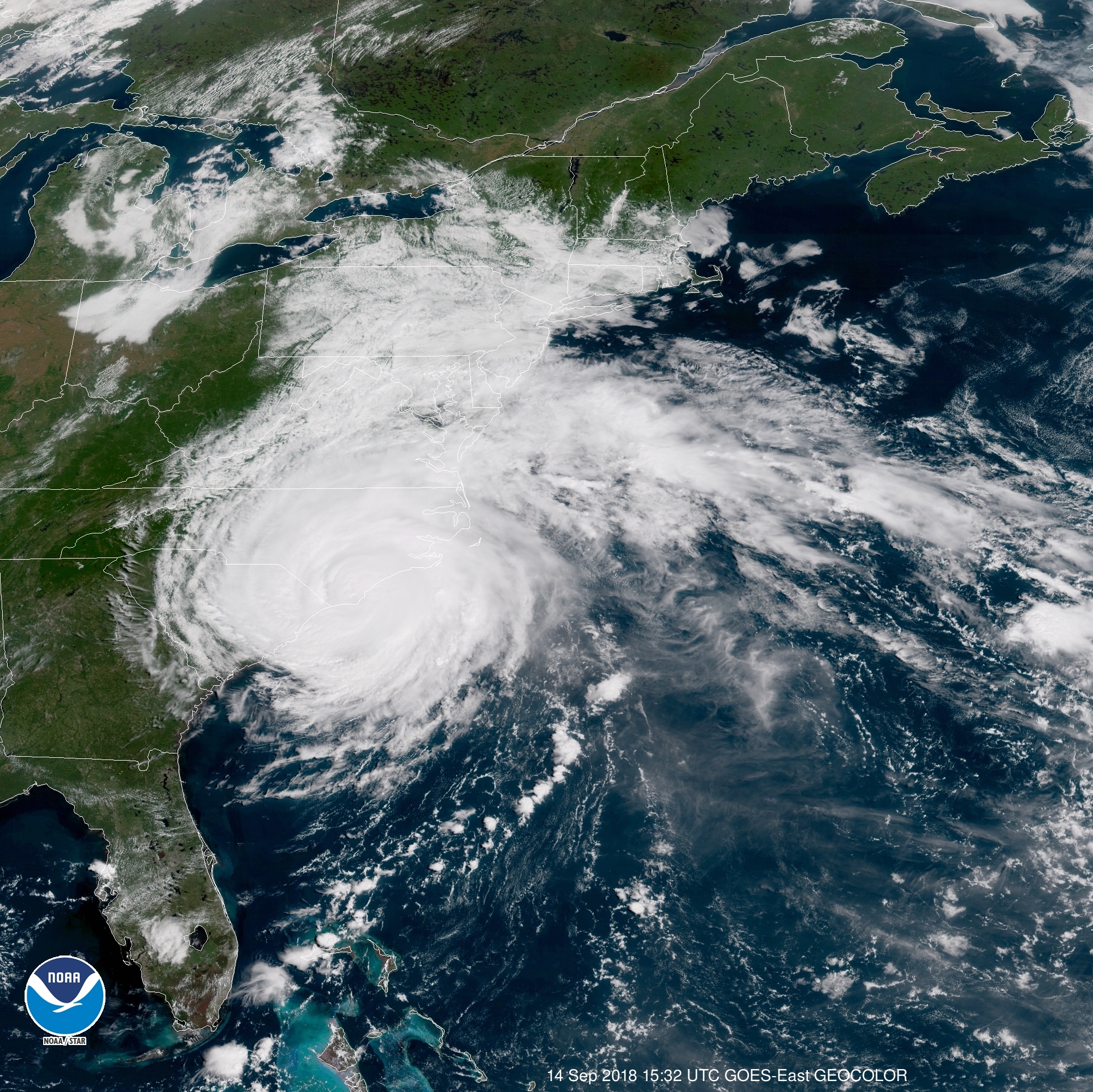
The latest satellite view of Florence which was still rated as a category 1 storm at 11am; courtesy NOAA/GOES-East GEOCOLOR
Overview
Florence made landfall earlier today near Wrightsville Beach, North Carolina as a category 1 hurricane and it has nearly grinded to a halt in recent hours with movement of only 3 mph to the west-southwest. This extremely slow movement of Florence will lead to an extended period of heavy rainfall and strong winds for coastal sections of the Carolinas and some spots will see more than two feet of rain by the time all is said and done. Florence will push inland on Saturday and cross over the state of South Carolina in a weakened state and then begin a looping process on Sunday. This looping process will begin with an acceleration to the northwest by early next week and then an even more rapid movement to the northeast on Tuesday and Wednesday. Florence will finally push off the Northeast US coastline by the middle of next week and the Atlantic Basin tropical scene may become relatively quiet for awhile. However, after this potential break in the action, the tropical scene is likely to become more active again during the latter part of September and during part of the month of October.

The track of Florence into the middle of next week as predicted by NOAA/NHC with an acceleration beginning late in the weekend and early next week.
Details
On Wednesday morning Florence was moving along at a fairly rapid clip at 17 mph, but the “slowing down” process began on Thursday with a drop in forward speed to 10 mph. The Friday 11am readings show a “painful crawl” of Florence with a movement of only 3 mph to the west-southwest. Hurricane Florence will continue to crawl along during the next 24 hours or so in a west-southwest direction and then will move inland on Saturday over South Carolina. Some sections in the coastal Carolinas are likely to end up with more than two feet of rain during this extended period of heavy rain and damaging winds.

Some sections near the Carolina coastline could see 2+ feet of rainfall from Hurricane Florence; map courtesy NOAA
Mid-Atlantic impact by Florence to include tornado threat
By the early part of next week, Florence will begin a looping process that will eventually take it to the New England coastline by mid-week. As far as the DC-to-Philly-to-NYC corridor is concerned, an impact here from the remains of Florence will likely take place in the Monday night/Tuesday time frame with some heavy rainfall and strong wind gusts. In addition, as Florence loops back around late this weekend and early next week, there can be some severe thunderstorm activity in the Mid-Atlantic region which could even produce tornadoes; primarily, if within a couple hundred miles of the storm track (on its right side). This tornado threat in the Mid-Atlantic region will likely take place in the period from late Sunday into late Tuesday as the remains of Florence accelerate to the northeast. Once Florence exits the Northeast US coastline by mid-week, the tropical Atlantic may become relatively quiet, but perhaps for just a brief time. There are signs that the tropics may become active again later this month and during at least parts of October in the Atlantic Basin.

Preliminary reports have the central pressure of Florence at 958 mb when it made landfall near Wrightsville Beach, NC earlier today. If this is confirmed, Florence would be placed in a tie for 9th on this “top ten” list. Courtesy Philip Klotzbach (Colorado State University)
Benchmark Carolina Hurricanes: Hazel (1954) and Hugo (1989)
It is certainly not uncommon for the Carolinas to be hit by hurricanes and the two benchmark storms are probably Hazel (October 1954) and Hugo (September 1989) - both of which were category 4 storms at landfall. Hurricane Hazel, the strongest hurricane to make landfall in North Carolina, actually moved right near the North/South Carolina border region – not far from where Florence made landfall. Hazel then pushed off to the north and was actually near Washington, D.C. just several hours later. It formed over the eastern Atlantic near the Cape Verde Islands on September 9, 1989.
Hurricane Hugo was a “Cape Verde” type of Atlantic Basin tropical storm with its origin over Africa. It moved thousands of miles across the Atlantic Ocean, rapidly strengthening to briefly attain Category 5 hurricane strength on its journey. Hurricane Hugo slammed into South Carolina from the southeast as a category 4 storm and continued to move inland on a northwesterly track. Neither of these two benchmark hurricanes stalled out or slowed down dramatically as Florence is doing along the Carolina coastline.
Meteorologist Paul Dorian
Perspecta, Inc.
perspectaweather.com
Video discussion: