
10:50 AM | *Powerful Great Lakes storm this weekend with blizzard conditions to bring rain to the Mid-Atlantic region and a spring tease*
Paul Dorian
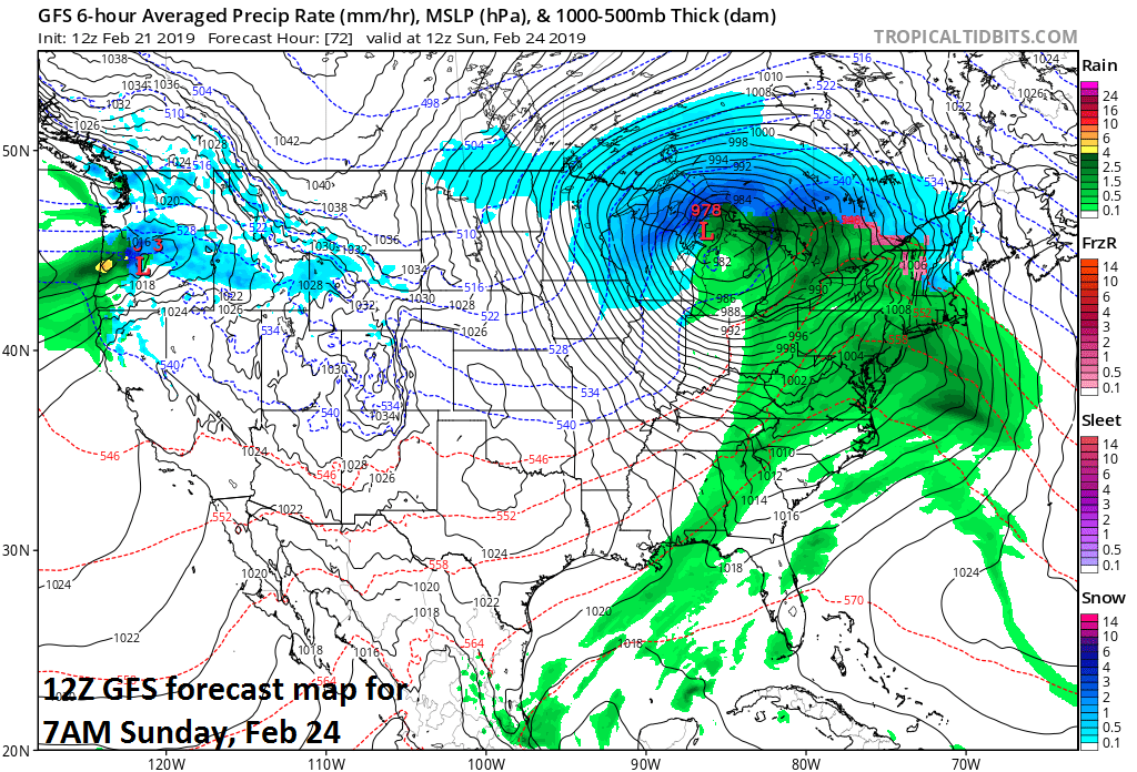
A powerful storm on Sunday morning situated over the Great Lakes; map courtesy NOAA/EMC, tropicaltidbits.com
Overview
A rapidly intensifying low pressure system will head towards the Great Lakes region this weekend from the southern Plains and it could very well become a news making event with wide ranging ramifications over a large area. This system has the potential to deepen to around 978 millibars (28.88 inches) or so by the time it reaches the Great Lakes early Sunday which may be close to monthly record low pressure values for portions of Michigan. Blizzard conditions are likely to accompany this powerful storm system this weekend over the Upper Midwest and Great Lakes. Farther east, rain will spread northeastward from the Mississippi and Tennessee Valleys and into the Mid-Atlantic region later Saturday and continue into early Sunday. Once the rain ends on Sunday, temperatures have a chance to spike to 60 degrees or higher in the DC-to-Philly-to-NYC providing us with a spring tease, but the warm up won’t last too long as colder air returns for the early part of next week.

A strong wave of energy in the upper atmosphere early Saturday will help to fuel the rapid intensification of a surface low pressure system; map courtesy NOAA/EMC, tropicaltidbits.com
Details
Low pressure will develop near the Texas Panhandle early Saturday morning with a central pressure around 996 millibars and then it’ll move northeastward towards the western Great Lakes. As strong upper-level energy moves in overhead, the surface low pressure will rapidly intensify and its central pressure may drop about 20 millibars in a 24-hour period to near 978 millibars by early Sunday morning as it reaches the western/central Great Lakes. On the warm side of the storm on Saturday, an influx of very warm and humid air from the Gulf of Mexico can result in an enhanced severe weather threat including tornadoes across Arkansas, Louisiana and Mississippi. Excessive rainfall in the Lower Mississippi, Ohio and Tennessee Valleys could result in flash flood watches and warnings. By late Saturday and early Sunday, the pressure gradient will tighten dramatically as the storm heads towards the western/central Great Lakes and the result will be blizzard conditions across the Upper Midwest and Great Lakes. Heavy snow is likely in places such as Minnesota, Wisconsin and Michigan where it has already been quite a tough winter season.
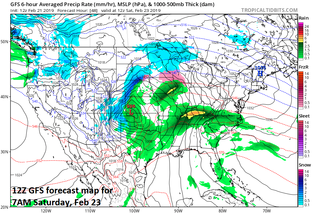
A storm on Saturday morning situated over the southern Plains will intensify rapidly on its way to the Great Lakes; map courtesy NOAA/EMC, tropicaltidbits.com
Farther east, rain is likely to overspread the Mid-Atlantic region later Saturday and it’ll be a chilly rain as temperatures in the I-95 corridor will be confined to the 40’s as we start the weekend. The rain will continue through Saturday night in the I-95 corridor and then wind down later Sunday morning. By Sunday afternoon, very mild air will be surging northward along the eastern seaboard and temperatures in the DC-to-Philly-to-NYC corridor could spike to 60+ degrees for afternoon highs as we close out the weekend. Following a cold frontal passage, colder air will pour back into the Mid-Atlantic region for the early part of next week which will be a seasonal cold although strong winds here may make it feel much colder-than-normal.
Meteorologist Paul Dorian
Perspecta, Inc.
perspectaweather.com
Video discussion: