
1:10 PM | ***Wintry mess early next week likely to include accumulating snow and ice for the Mid-Atlantic region***
Paul Dorian
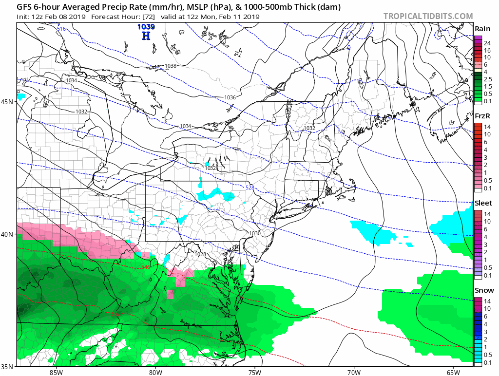
12Z GFS forecast maps between 7AM Monday (72 hour forecast) and 7AM Wednesday (120 hour forecast); courtesy NOAA/EMC, tropicaltidbits.com
Overview
An active and complex weather pattern will bring back-to-back threats to the Mid-Atlantic region early next week and there can be some accumulating snow in each event. The first system will be rather weak, but it can still generate some accumulating snow from Sunday night into early Monday in the DC-to-Philly-to-NYC corridor. The second and stronger system will have much more available moisture compared to the first and its main impact will likely take place from later Monday into Tuesday night. This second event could feature a snow-to-ice-to-rain scenario with snow and ice accumulations possible on the front end before any changeover to plain rain.
An active pattern with multiple waves of energy
The overall weather pattern is currently quite active and there will be two waves of energy traveling across the country in coming days from the western US to the Great Lakes/Northeast. The first wave will arrive in central California by early tomorrow producing coastal rains and inland heavy snows. In fact, the Sierra Nevada Mountains of eastern California are in-line for another massive snowfall with this system on top of the incredible amounts that have piled up in recent weeks. By Sunday afternoon, this system will be spreading snow across the Midwest and Ohio Valley and some of that snow should make its way into the I-95 corridor region of the Mid-Atlantic on Sunday night. The upper-level energy with this wave gets “stretched out” on its way to the Great Lakes and this will limit its impact around here, but small amounts of snow accumulation are still possible from Sunday night into early Monday from DC-to-Philly-to-NYC. The snow may mix with sleet in areas to the south of the PA/MD border during this first wintry weather event.
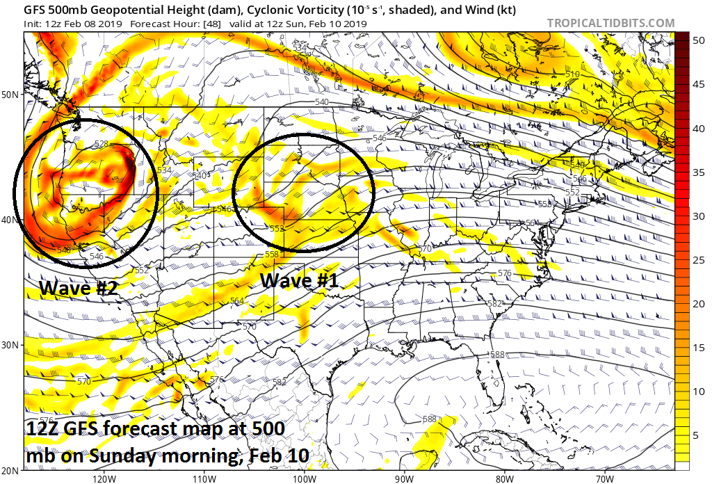
A second and stronger wave will quickly follow the first and it’ll slam into the Pacific Northwest this weekend bringing more heavy rain and snow to that part of the country including significant snow accumulations from Seattle, WA to Portland, OR. This system will then head in a general direction towards the Great Lakes from the western US by the early part of next week. At the same time, strong high pressure will build into southeastern Canada anchoring a very cold air mass for the Northeast US – a very important player in this second event early next week. On Monday afternoon, copious amounts of moisture will spread northeastward towards the Mid-Atlantic region from the Tennessee and Mississippi Valleys and it may very well be cold enough at first for snow to break out in the DC-to-Philly-to-NYC corridor by Monday evening. In fact, snow accumulations are certainly on the table in the I-95 corridor at the onset of this second storm system from later Monday into Monday night.
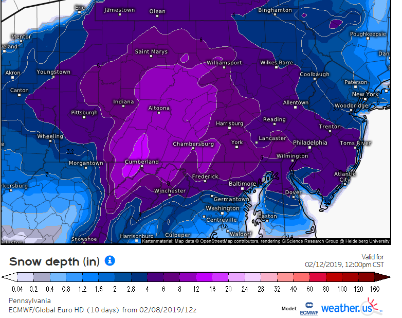
Total snowfall in the DC-to-PHilly-to-NYC corridor by noon Tuesday, February 12, as predicted by the 12Z Euro model run; courtesy ECMWF, weather.us
By early Tuesday, one area of low pressure (primary) will be heading towards the Great Lakes while a secondary surface low pressure system takes shape near the Mid-Atlantic coastline. Given this scenario, somewhat milder air should push northward along the eastern seaboard – at least in upper parts of the atmosphere – and any snow that is falling is likely to change to a period of ice (i.e., sleet and/or freezing rain) and then to plain rain. Yet another Pacific storm may slam into the western US around the middle of next week and it too can travel across the country and perhaps result in more rain and/or snow around here by the end of next week.
Stay tuned…its going to be a messy start to the new work week.
Meteorologist Paul Dorian
Perspecta, Inc.
perspectaweather.com
Video discussion: