1:30 PM (Monday) | *Strong-to-severe thunderstorms a threat in the Mid-Atlantic region from this afternoon into mid-week*
Paul Dorian

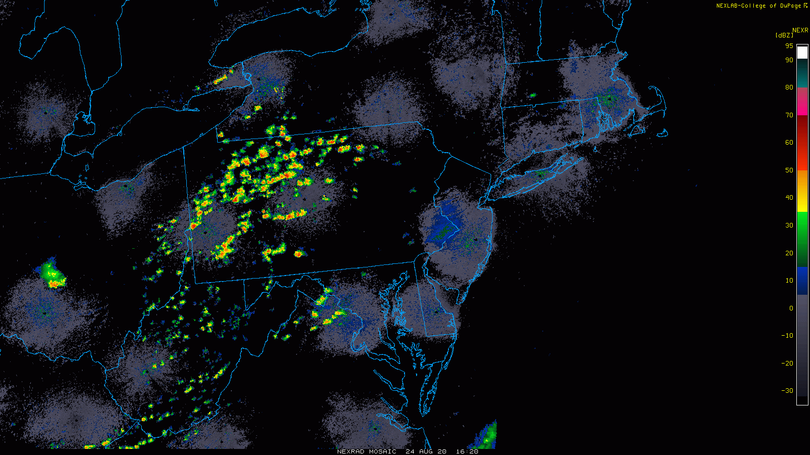
Numerous showers and thunderstorms are popping up across western portions of the Mid-Atlantic and some of these will make it into the I-95 corridor this afternoon and early tonight. NEXRAD radar images courtesy NOAA, College of DuPage
Overview
While the main focus of attention has been on tropical activity in recent days, there has been some strong-to-severe thunderstorm activity in the Mid-Atlantic region and that threat will continue from this afternoon into mid-week. A surface trough of low pressure situated in the I-95 corridor is helping to fuel the formation of numerous showers and thunderstorms across western portions of the Mid-Atlantic region and some of these will make it into the DC-to-Philly-to-NYC corridor later in the day and early tonight. A cold frontal system will then approach the I-95 corridor later Tuesday and it too can generate some strong-to-severe thunderstorm activity. As that same frontal system stalls out just to the south of here on Wednesday, there still can be some strong thunderstorm activity to monitor at mid-week.

A short-wave of energy in the upper atmosphere is closing in on the I-95 corridor and it is contributing to the formation of numerous showers and thunderstorms. Forecast map from 12Z NAM, courtesy NOAA, tropicaltidbits.com
Details
Numerous showers and thunderstorms are popping at this hour across western sections of the Mid-Atlantic from West Virginia to Pennsylvania and they are being aided by a strong trough of low pressure situated just east of the mountains in the I-95 corridor. Any one of these showers and thunderstorms can make the trek across the mountains later today and into the I-95 corridor with heavy rainfall and perhaps damaging wind gusts and small hail. The storms will tend to dissipate in the evening hours as instability drops off with the loss of the daytime heating and skies should clear later tonight.
The weather gets even more interesting on Tuesday as there will likely be a convective complex early tomorrow over the Great Lakes region and it could push to the southeast during the day. This complex of thunderstorms will be aligned with an approaching frontal system that will have energy support in the upper atmosphere. As a result, another round of showers and thunderstorms is likely to develop and some of the storms later tomorrow can be on the strong-to-severe side. Following the passage of the frontal system, Wednesday will likely start off as a rather quiet day; however, as that same front turns begins to turn around and push northward, there can be additional showers and thunderstorm activity late in the day and on Wednesday night.

The remains of Tropical Storm Laura (boxed region) could push into the Mid-Atlantic region this weekend as suggested by this Saturday afternoon forecast map of the 00Z Euro. Map courtesy WSI, Inc., ECMWF
Looking ahead, at week’s end we’ll likely be closely monitoring the movement of the remains of Tropical Storm Laura. This system is likely to reach hurricane status before making landfall late Wednesday/early Thursday in the western Gulf coastal region and then it’ll push northward into the south-central states. There is then the chance that the remains of Laura will take a turn to the east early this weekend and it could combine with the same frontal boundary zone to produce some heavy rainfall this weekend in at least parts of the Mid-Atlantic region.
Meteorologist Paul Dorian
Perspecta, Inc.
perspectaweather.com
Follow us on Facebook, Twitter, YouTube