
11:15 AM (Mon.) | *Marco weakens as it nears central Gulf coast…Laura to intensify once over the Gulf of Mexico – possibly to “major” hurricane status…likely approaches TX/LA late Wednesday*
Paul Dorian

Tropical Storm Laura is just to the south of Cuba at mid-day and it will emerge over the southeastern Gulf of Mexico on Tuesday and likely undergo rapid intensification. Images courtesy NOAA, College of DuPage
Overview
Tropical Storm Laura is a growing threat for the coastline region of Texas and Louisiana with a possible landfall late Wednesday. Tropical Storm Laura is very likely to intensify into hurricane status once out over the open warm waters of the Gulf of Mexico and it could become a “major” hurricane (i.e., category 3 or higher). Meanwhile, Tropical Storm Marco has weakened as it nears the central Gulf coastal region due to wind shear in its vicinity. The low-level circulation center of Tropical Storm Marco has been displaced from the main area of convection (thunderstorms) and it will tend to dissipate over the next few days.

The low-level circulation center of Tropical Storm Marco has been displaced by wind shear in the recent several hours from the main convection (thunderstorms) area now in the northeast quadrant. Image courtesy NOAA, College of DuPage
Tropical Storm Marco
An upper-level trough to the west of Tropical Storm Marco combined with an upper-level ridge to its east to produce south-to-southwesterly winds in its vicinity during the past several hours and this wind shear has caused a weakening of the system. As a result, the low-level circulation center has been separated from the main area of convection (thunderstorms) which has pushed off into the northeastern quadrant of the tropical system. While there will be some heavy rainfall over the next several hours from the Panhandle of Florida to southern Louisiana, the overall threat has certainly thankfully diminished for the central Gulf coastal region. The low-level circulation center will drift to the west over the next couple of days and the overall system will tend to dissipate.
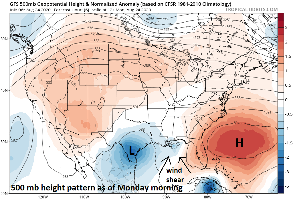
The combination of an upper-level trough to the west and ridge to the east generated enough wind shear to cause a weakening of Tropical Storm Marco as it approached the central Gulf coastal region. Map courtesy NOAA, tropicaltidbits.com
Tropical Storm Laura
Tropical Storm Laura is currently located near the southern part of Cuba and is moving WNW at 20 mph with maximum sustained winds of 60 mph. It was an ominous sign this weekend when Tropical Storm Laura interacted with the rugged terrain of Hispaniola and maintained its overall intensity level. The high terrain on Hispaniola often weakens tropical systems as it can disrupt the overall circulation pattern. In another ominous sign, much of Tropical Storm Laura is remaining out over the open water today - just to the south of Cuba - so it is maintaining much of its strength as it pushes towards the open waters of the Gulf of Mexico.

The Gulf of Mexico currently features some of the warmest water in the world and this will aid in the intensification of Laura over the next couple of days. Map courtesy NOAA, tropicaltidbits.com
Once Tropical Storm Laura reaches the southeastern Gulf of Mexico on Tuesday, it is likely to begin an intensification process as it moves over the very warm waters and encounters more favorable environmental conditions. The sea surface temperatures in the Gulf of Mexico are some of the highest seen anywhere around the world with many spots measured at > 30 degrees (C). The wind shear that has played a role in the weakening of Tropical Storm Marco is likely to diminish over the Gulf of Mexico during the next couple of days. As a result of the more favorable environmental conditions and the boost from the very high sea surface temperatures, Tropical Storm Laura is not only likely to reach hurricane status, but it could become a “major” hurricane (i.e., category 3 or higher) as it heads towards the western Gulf of Mexico.

Still somewhat of a “spread” in terms of potential landfalling region by Tropical Storm Laura with the Texas and Louisiana coastline regions both in play at this time. Map courtesy weathermodels.com, ECMWF
It is still a bit too early to pinpoint the area of landfall by Tropical Storm Laura, but signs point to the region of Texas and Louisiana– perhaps in the late Wednesday night or early Thursday time frame. The exact location of the circulation center of Tropical Storm Laura will be a bit unclear for the next 12-24 hours until it bypasses Cuba and emerges out over the open waters of the southern Gulf of Mexico. All residents from Brownsville, Texas to New Orleans, Louisiana should continue to prepare for a possible mid-week hurricane strike which could be a “major” and this threat zone includes the major metro region of Houston.
Looking ahead
The remains of Tropical Storm Laura are likely to push northward into the south-central states late this week and then may turn eastward to the Mid-Atlantic region early this weekend - potentially bringing some heavy rainfall to both of these regions. In the longer-term, the overall pattern in the tropical Atlantic should remain quite active as we turn the page to the month of September. In fact, there are some signs that the tropical threat may actually increase for the east coast of the US once we get into September– stay tuned.
Meteorologist Paul Dorian
Perspecta, Inc.
perspectaweather.com
Follow us on Facebook, Twitter, YouTube
Video discussion: