2:30 PM (Wed.) | ****Strong-to-severe thunderstorm threat later today and again later tomorrow…activity clears the way for a stretch of nice weather from Friday into early next week****
Paul Dorian

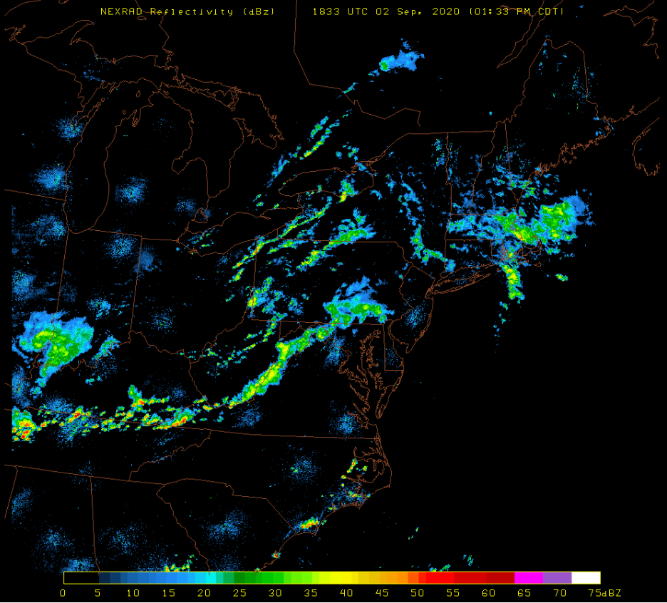
Scattered showers and thunderstorms have formed in western portions of the Mid-Atlantic region and some of these will make it into the I-95 corridor late in the day or early tonight. Perhaps the highest chance for strong thunderstorms will come in the DC metro region as the solid line now over extreme eastern West Virginia pushes to the east over the next few hours. Image courtesy University of Wisconsin, NOAA/NEXRAD
Overview
The next 24-36 hours will be an active period in the Mid-Atlantic region with the threat for strong-to-severe thunderstorms both later today and again later tomorrow. A warm front lifted northward through the region earlier today and it has resulted in an increase in overall humidity levels as well as an increase temperatures now peaking in the low-to-middle 80’s. Another frontal boundary zone will approach the I-95 corridor region later in the day and this will set off some strong-to-severe thunderstorm activity…likely in the 4 to 10 PM time period. An even stronger front will approach from the northwest late tomorrow and this too is likely to generate some strong-to-severe thunderstorm activity in the Mid-Atlantic region. The good news is that all of this activity clears out early Friday - setting the stage for a stretch of nice weather from Friday into early next week.

The high-resolution version of the NOAA NAM forecast model indicates there will be scattered strong-to-severe thunderstorms approaching the I-95 corridor region by early tonight. Map courtesy NOAA, tropicaltidbits.com
Details
Following the passage of a warm frontal system, temperatures have climbed well into the 80’s and overall humidity levels have jumped also since yesterday. As a consequence, the atmosphere is much more unstable compared to the past few days and, as a weak front approaches the region, scattered showers and thunderstorms have formed to the west of the DC-to-Philly-to-NYC corridor. Some of the thunderstorms will become strong-to-severe before they push into the I-95 corridor late in the afternoon or early tonight and generate damaging wind gusts and torrential rainfall - perhaps even a few isolated tornadoes. The activity will quiet down in the overnight hours, but another severe weather threat will return later tomorrow.

The high-resolution version of the NOAA NAM forecast model indicates there will be some strong thunderstorm activity in the Mid-Atlantic region early tomorrow night. Map courtesy NOAA, tropicaltidbits.com
On Thursday, a strong cold front will be dropping southeast across the Great Lakes/Upper Midwest and towards the Mid-Atlantic region. Once again, showers and thunderstorms are likely to form in the afternoon hours after some morning and mid-day heating destabilizes the atmosphere. Any storm that forms later tomorrow or early tomorrow night can reach severe levels with the potential of damaging wind gusts and heavy rainfall…perhaps even a few isolated tornadoes. This strong cold front should clear the east coast early Friday setting the stage for a stretch of nice weather in the Mid-Atlantic region from Friday into the early part of next week.
Meteorologist Paul Dorian
Perspecta, Inc.
perspectaweather.com
Follow us on Facebook, Twitter, YouTube
Video discussion: