
11:25 AM | ***Monster ocean storm to have a big impact on the west coast from Sunday into Monday…same system can result in an east coast storm late next week***
Paul Dorian

A powerful ocean storm will have a big impact on the west coast from Washington-to-California in the Sunday/Monday time period. Map courtesy NOAA, tropicaltidbits.com
Overview
Much of California and the rest of the western US has been experiencing “extreme” or “exceptional” drought conditions in recent weeks, but that could change in a big way in coming days. A very powerful storm will slam into the US west coast from Sunday into Monday and it could generate a foot or more of rain in the northern part of California and heavy snowfall across interior higher elevation locations of the Sierra Nevada Mountains. In addition, winds associated with this monster storm are likely to be excessive and potentially damaging in many spots along the west coast and even inland. This same system is likely to cross the country later next week and it could wind up as a significant east coast storm by week’s end.

Much of California has been experiencing “extreme” or “exceptional” drought conditions in recent weeks and this evolving wet weather pattern could certainly result in some big changes. Map courtesy NOAA/CPC
Details
There has been some rainfall across parts of central California over the past 12-24 hours or so associated with a rather weak system, but this is just the opening salvo in an overall weather pattern that is evolving into one that will become very wet for the west coast states from California-to-Washington and also British Columbia in southwestern Canada. A more organized frontal system will reach northern California later tonight and sweep southward on Friday resulting in more significant precipitation compared to the initial weak disturbance. A break in the action is then likely from later tomorrow into the early part of the weekend across the northern half of California and the rest of the west coast with no significant precipitation expected.

There is the potential for excessive rainfall amounts across the west coast next 5 days all the way from Washington-to-California. Map courtesy NOAA/CPC
By the late weekend, a monster ocean storm will begin to have an impact on the US west coast from British Columbia (Canada) to California with an “atmospheric river” heading in that direction. Some of the heaviest rainfall is likely to take place across the northern half of California from Sunday into Monday where there can be as much as a foot in some spots. Strong and potentially damaging winds are likely to accompany this storm and it is likely to also produce significant snowfall across the inland higher elevation locations of the Sierra Nevada Mountains in eastern California. If this kind of substantial rainfall does come to fruition, it certainly can help in filling the lakes and large reservoirs in northern California (Lake Shasta is ~25% full) and it would also stop any still on-going wildfire activity in its tracks. However, the down side of excessive rainfall is, of course, that there could be some serious flash flooding in localized areas.

The intense storm system that slams the west coast late this weekend/early next week could end up as a major east coast storm by the end of next week as its upper-level support crosses the country. Map courtesy NOAA, tropicaltidbits.com
After slamming California, this system will push into the Rocky Mountain States early next week with rain and snow and then arrive as a rain-maker in the central US at mid-week. With strong support aloft, this system could very well spawn a severe weather outbreak including possible tornadoes across the Mississippi and Tennessee Valleys and the Upper Midwest. By later next week, the upper-level support associated with this powerful storm will likely begin to take on a “negative tilt” (i.e., trough axis aloft orients from NW-to-SE) as it reaches the eastern US and this could, in turn, help to generate a significant east coast storm by the end of next week…stay tuned.
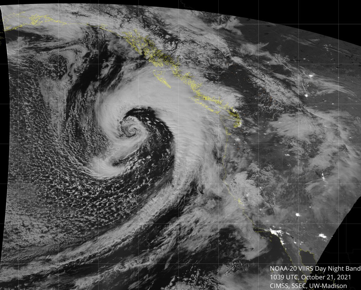
A strong storm off the Pacific NW coast is seen here in this satellite image and it will produce rainfall along the west coast from later tonight into Friday. A second and even stronger system will follow and impact the US west coast late in the weekend/early next week. Image courtesy University of Wisconsin, NOAA
Meteorologist Paul Dorian
King of Prussia, PA