12:50 PM | ****Strong, persistent E-SE winds to continue into the evening…coastal flooding a big issue…PM thunderstorms in many areas with potential damaging wind gusts and downpours****
Paul Dorian
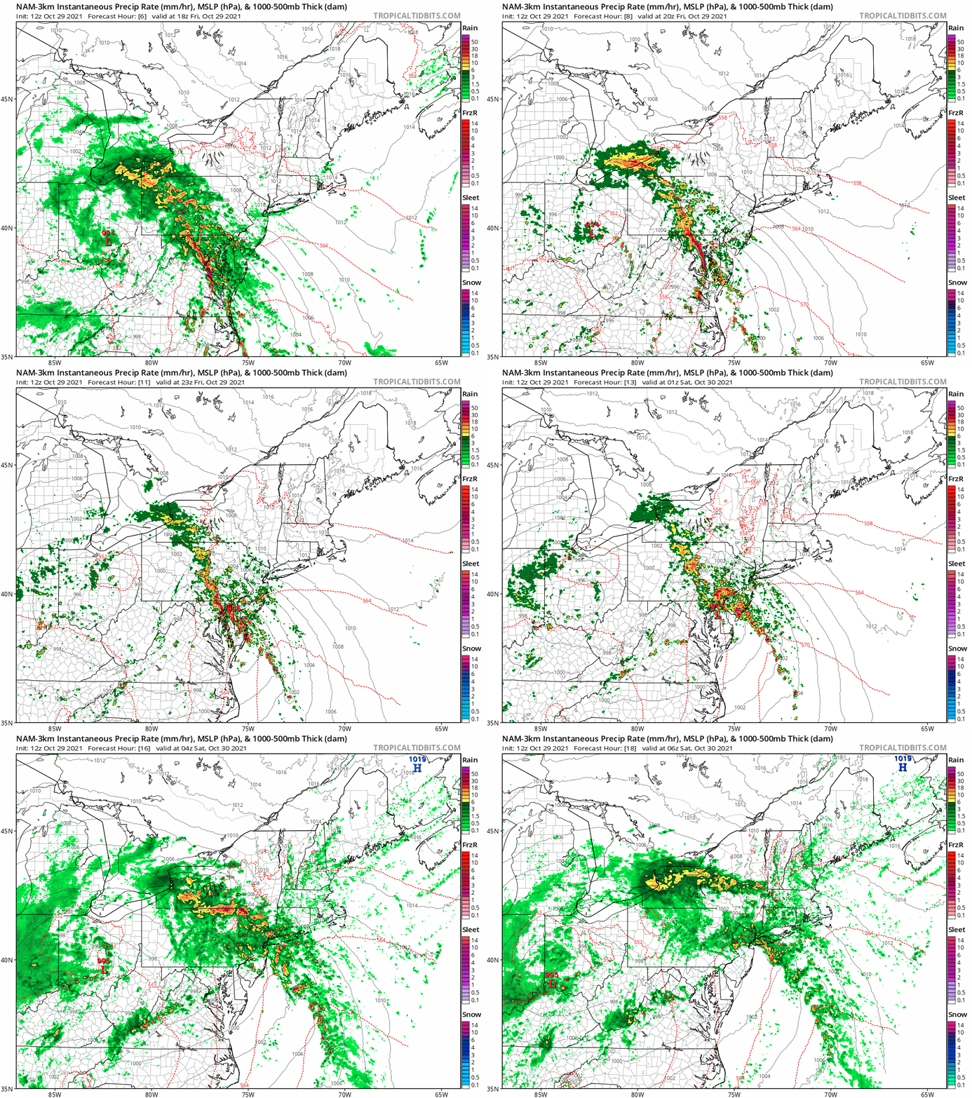
A line of strong thunderstorms will push from southwest-to-northeast this afternoon and evening and it could result in damaging wind gusts. maps courtesy NOAA, tropicatidbits.com
Overview
Today’s storm in the Mid-Atlantic region is living up to its potential with strong, persistent E-SE winds, some serious coastal flooding, and occasional heavy rainfall that will produce 1-3 inches and isolated higher amounts. The added twist this afternoon and evening will be the likelihood for some strong thunderstorms which should rotate from the southwest-to-northeast and could include damaging wind gusts along with downpours.
Very strong winds in the lower levels of the atmosphere (at 850 mb) can be tapped into during any PM thunderstorm activity potentially resulting in broken limbs or downed trees. Maps courtesy NOAA, tropicaltidbits.com
Details
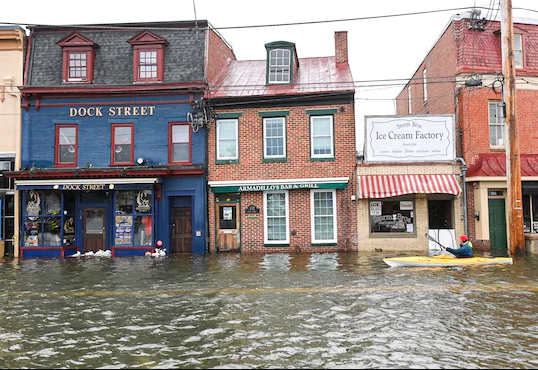
Winds have gusted to the 40-50 mph range in the parts of the Mid-Atlantic region from an east-to-southeast direction and they will continue to be strong and persistent this afternoon and evening. Given the well saturated grounds, some of the stronger gusts have resulted in downed trees and there have been some reports already of scattered power outages. In addition, the persistent and strong onshore flow is increasing concerns for coastal flooding in the normally vulnerable locations of the Mid-Atlantic. These vulnerable areas not only include coastal sections along the Atlantic Ocean, but also those areas near the Chesapeake and Delaware Bays and also the Potomac and Delaware Rivers. The biggest threat of coastal flooding in the Mid-Atlantic region will likely take place during the nighttime high tide – after many hours of this strong and persistent onshore flow.
A photograph of Annapolis, MD as of early afternoon on Friday…the nighttime high tide is especially worrisome. Courtesy Washington Post/Capital Weather Gang (Twitter)
In terms of thunderstorm activity, a strong line of storms is likely to push from southwest-to-northeast in the Mid-Atlantic region from this afternoon into the evening. This line will likely reach northeastern Maryland during the late afternoon hours and then southeastern Pennsylvania later in the evening. Given such strong winds in the lower levels of the atmosphere (e.g., low-level jet streak at 850 millibars), any thunderstorm can tap into this and produce damaging wind gusts at surface (ground) levels.
The upper-level low associated with this storm system will linger in the Mid-Atlantic/NE US on Saturday making for a cloudy day and quite likely one with numerous residual showers. It’ll settle down a bit on Sunday, Halloween Day; however, clouds are likely to limit any sunshine as we close out the weekend and a shower or two cannot be ruled out. Looking ahead to next week, a big pattern change to colder will take place across the Great Lakes/Mid-Atlantic/NE US with a cold air mass pushing in by mid-week from northwest-to-southeast.
Meteorologist Paul Dorian
King of Prussia, PA
Video discussion:


