12:00 PM | ***A look ahead to Thanksgiving week…a potential colder and stormy pattern with a quick start to winter***
Paul Dorian
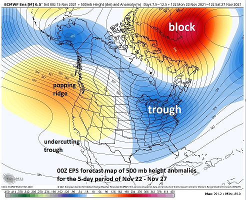
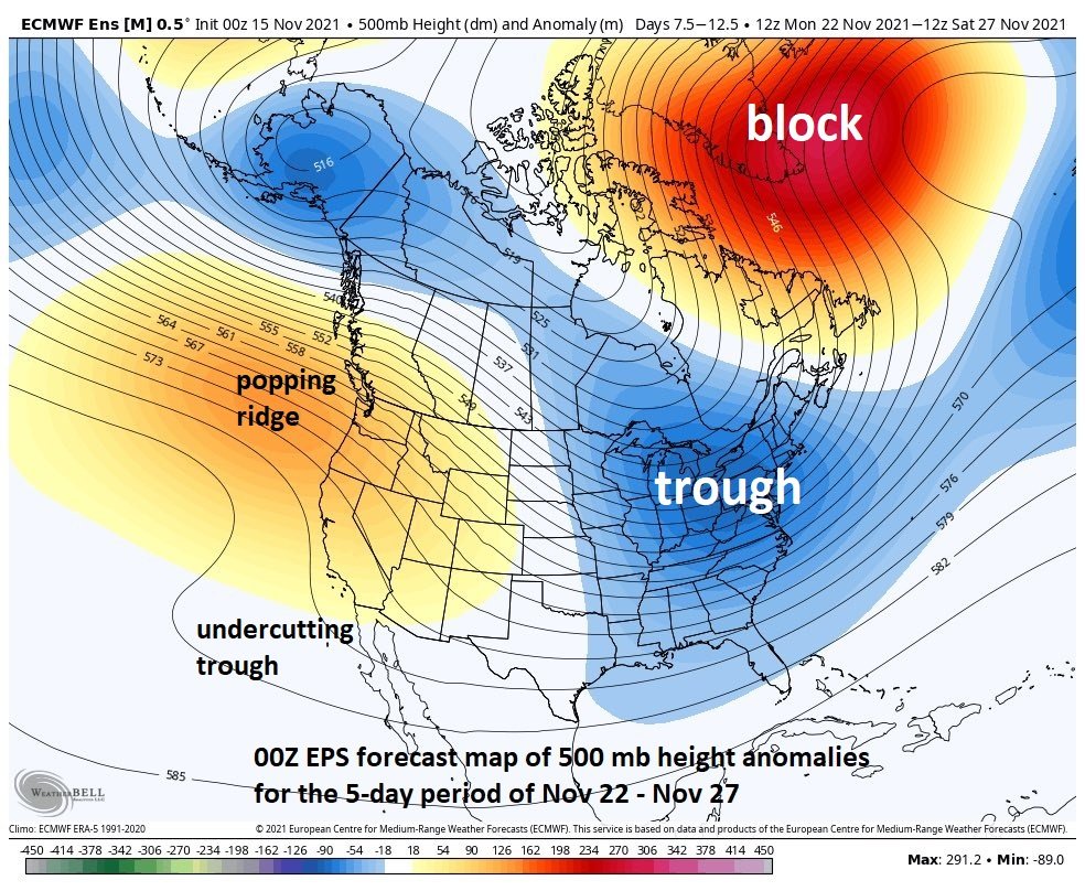
The upper air pattern could evolve into one next week that features high-latitude blocking, an upper low over the eastern US and a popping ridge near the US/Canadian west coasts. Map courtesy Weather Bell Analytics, ECMWF
Overview
One of the highlights of the Winter Outlook issued last month was the signal that there could be a quick start to winter in the Mid-Atlantic/Northeast US during the latter part of November and in of December. We have now reached the mid-point of November and there are some near-term signals that support the idea of a quick start to winter in the Mid-Atlantic/Northeast US. After a couple of chilly days to start this week, it’ll turn noticeably milder on Wednesday and Thursday, but then a strong cold front will usher in another colder-than-normal air mass for the end of the week and first half of the weekend. Looking ahead, there is the potential for Thanksgiving week to become cold and stormy perhaps leading to that quick start to the winter season in this part of the nation.
Details
The first half of November has ranged anywhere from near normal-to-slightly colder-than-normal in the I-95 corridor (PHL: -0.2 degrees, DCA -1.3 degrees, NYC: -0.4 degrees), but the evolving weather pattern suggests the second half of the month could be more clearly in the below-normal zone for temperature anomalies. In addition, there are some signs that the colder pattern could become stormy as we progress through the second half of the month. In the near term, this week begins with a colder-than-normal air mass riding into the DC, Philly and New Yok City metro regions on brisk W-NW winds. After another chilly day on Tuesday, a noticeable warm up will begin on Wednesday and then peak on Thursday afternoon with highs likely well up in the 60’s - quite a bit above-normal for this time of year. That two-day warm-up will, however, come to an abrupt end by Friday after the passage of the next strong cold front and the end of the weekend and much of the weekend will be on the chilly side.
The teleconnection indices known as the Arctic Oscillation (AO, left) and North Atlantic Oscillation (NAO, right) tend to slide into negative territory next week. Plots courtesy NOAA, Weather Bell Analytics
Looking ahead to next week, teleconnection indices suggest there is the potential for a cold and stormy weather pattern to form in the Mid-Atlantic/Northeast US. Two such indices known as the North Atlantic Oscillation (NAO) and its closely-related cousin Arctic Oscillation (AO) tend to drop into negative territory which is often correlated with an increasing chance of cold air outbreaks into the Mid-Atlantic/Northeast US. In addition, the Pacific/North American (PNA) teleconnection index tends to slide into positive territory as we get into next week. A positive PNA regime is often correlated with western US/Canada ridging aloft and an upper-level trough in the eastern states. This type of ridging/troughing upper-level pattern can result in “cross-polar” flow and cold air outbreaks into the Mid-Atlantic/Northeast US from the northwestern part of Canada.
The teleconnection index known as the Pacific/North American (PNA) tends to slide into positive territory next week. Plot courtesy NOAA, Weather Bell Analytics
Multiple computer forecast models show the overall upper air pattern evolving next week into one with high-latitude blocking over Greenland at the same time an upper-level trough forms in the eastern states and an upper-level ridge pops up near the west coasts of Canada and the US. This kind of an overall pattern could allow for additional (and increasingly) cold outbreaks into the Mid-Atlantic/Northeast US from the northern part of Canada and it could also favor some storminess near the east coast as early as the first half of next week.
Stay tuned in coming days to see if, in fact, we get a quick start to the winter season in this part of the nation.
Meteorologist Paul Dorian
Valley Forge, PA
Video discussion:


