12:30 PM (Wednesday) | *Multiple cold air outbreaks on the way for the Mid-Atlantic/Northeast US…”high-latitude blocking” pattern to set up next week*
Paul Dorian

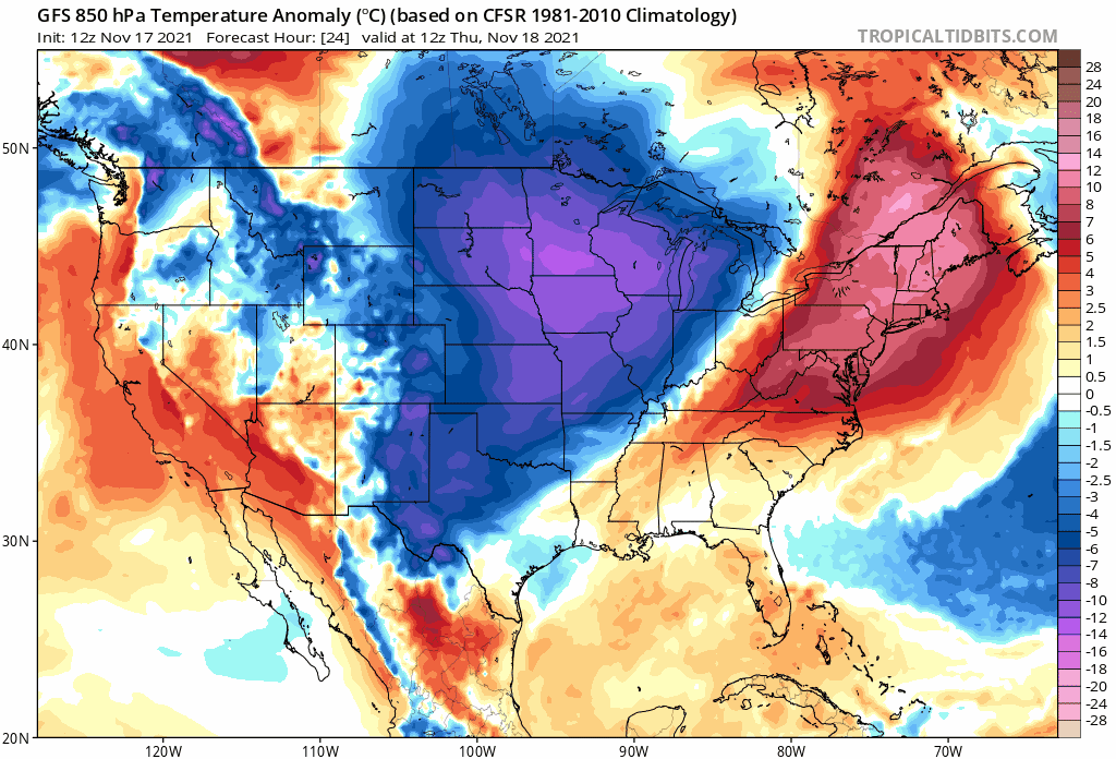
While it’ll be mild today and tomorrow in the northeastern part of the nation, multiple cold air outbreaks are on the way during the next week or so. Maps courtesy NOAA, tropicaltidbits.com
Overview
Milder air is pushing into the Mid-Atlantic/Northeast US today on the backside of high pressure over the western Atlantic and this warm up will peak on Thursday afternoon with high temperatures not far from the 70 degree mark in the DC-to-Philly-to-NYC corridor. The warm up will be rather short-lived, however, as a strong cold front moves through the region on Thursday night with some rain shower activity and Friday promises to be a windy and cold day with gusts past 30 mph. After a cold, dry start to the weekend, it’ll turn a bit milder on Sunday in the Mid-Atlantic/Northeast US, but then another strong cold front will arrive early next week and this system will usher in the coldest air of the season so far. By Tuesday, temperatures will be way below-normal and winds will be quite strong to go along with the possibility of some snow shower activity. After a couple of quieter days on Wednesday and Thursday (Turkey Day), yet another cold shot should work its way into the northeastern quadrant of the country as “high-latitude blocking” sets up to our north.
Details
Low-level winds are turning to a southerly direction at mid-day on the back side of high pressure centered over the western Atlantic and this is allowing milder air to push into the Mid-Atlantic/Northeast US from our southwest. Temperatures this afternoon will top out at noticeably milder levels well up in the 50’s along the I-95 corridor and then the warm up intensifies on Thursday just ahead of the next cold front. In fact, temperatures on Thursday afternoon are likely to reach 70+ degrees in some of the DC-to-Philly-to-NYC corridor which is well above the normal highs for this time of year (Philly: 55 degrees, DCA: 58 degrees, NYC: 54 degrees). A strong cold front arrives tomorrow night with some shower activity and the work week will end with much colder conditions on Friday and a stiff wind making it feel even colder than the actual air temperatures.
The weekend is likely to start off with some of the coldest temperature readings so far this season in the I-95 corridor (mid-to-upper 20’s for overnight lows) and the day as a whole will remain well-below-normal, but the wind will be less of a factor compared to Friday. It turns a bit milder on Sunday with highs likely back up into the low-to-mid 50’s, but clouds will increase ahead of the next strong cold front and showers will be possible on Sunday night and Monday. This early week cold frontal passage will usher in the coldest air of the season so far for the Mid-Atlantic/Northeast US and winds will become a very noticeable factor by Tuesday. The upper air will feature a deep low pressure system in the eastern states and this atmospheric instability could cause some snow shower activity on Monday night and Tuesday to go along with the windy and cold conditions.

“High-latitude blocking” pattern sets up next week across Greenland/NE Canada and this will play a role in a cold and active stretch of weather across the eastern states. Map courtesy NOAA, tropicaltidbits.com
The weather will tend to get quieter again next Wednesday and Thursday in the Mid-Atlantic/Northeast US which is a good thing for Thanksgiving Day travelers in this part of the nation. By the middle of next week, strong “high-latitude blocking” will set up to our north over places like Greenland and northeastern Canada and this will help to continue to allow for cold air masses to drop from northern Canada into the central and eastern US. As such, another strong cold front is liable to reach the Mid-Atlantic region from the northwest by late next week paving the way for more below-normal conditions in the area.
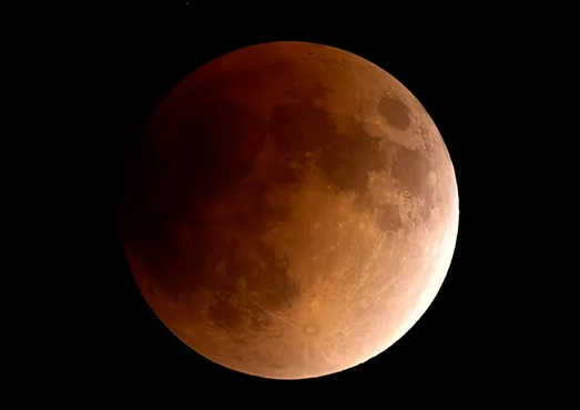
One final note, there will be a partial eclipse of the moon (actually almost total at 97%) early Friday morning from 2:18 AM (EST) to 5:47 AM (EST) (with peak around 4:02 AM (EST)). This is actually going to be the longest partial lunar eclipse in nearly 600 years. It’ll be a close call with respect to the sky cover in the Mid-Atlantic region as clouds should gradually clear after midnight following the passage of the initial strong cold front, but it’ll be cold and windy with temperatures dropping sharply.
Meteorologist Paul Dorian
Video discussion: