10:30 AM | ****Quick burst of heavy snow on Monday can generate rapid accumulations before a changeover to plain rain****
Paul Dorian
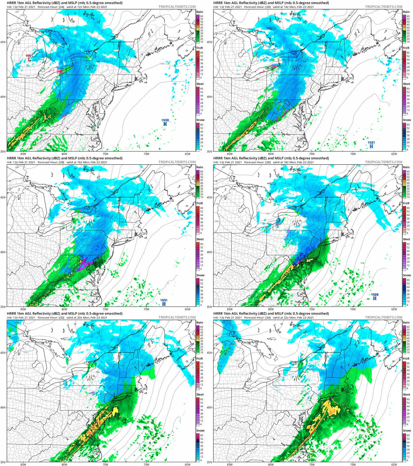
High-resolution model forecast maps for Monday, February 22nd with some snow and sleet in the I-95 corridor. Maps courtesy NOAA, tropicaltidbits.com
Overview
The new work week will begin with a bit of a tricky situation as there is likely to be a quick burst of heavy snow in the DC-to-Philly-to-NYC corridor possibly mixed with sleet at times - all as a strong cold frontal system slides to the east. Snow, possibly mixed with sleet, should arrive by the mid-morning hours on Monday in DC and in the mid-to-late morning hours across the Philly and NYC metro regions. Rapid accumulations are likely before a changeover to plain rain takes place later in the afternoon.
12Z NAM forecast map of 2-meter temperatures at mid-morning on Monday with most areas still at or below freezing along the I-95 corridor. Map courtesy NOAA, tropicaltidbits.com
Details
An active frontal system will slide eastward across the I-95 corridor on Monday and it can be just cold enough at the onset for snow possibly mixed with sleet. In fact, there can be some rapid accumulations of the snow in the I-95 corridor region before milder pushes in from the south later in the afternoon and results in a changeover to plain rain in most areas. A coating to an inch or two is possible in the DC metro region; especially, on the northern and western sides of the District and it is likely to arrive just after the morning commute time comes to an end.
In the Philly metro region, the snow should arrive during the mid-to-late morning hours and there can be a quick 1-3 inches of accumulation before an afternoon changeover to rain and isolated higher amounts are possible. Snow arrives in New York City during the late morning and it can accumulate from a coating to an inch or two before a changeover there to rain in the afternoon. Temperatures later tomorrow will climb above freezing in all areas along the I-95 corridor with lower 40’s possible for highs in DC and the mid-to-upper 30’s in Philly and NYC. Watch out for very hazardous road conditions as heavy snow will quickly accumulate despite falling during the daytime hours.
Meteorologist Paul Dorian
Perspecta, Inc.
perspectaweather.com
Follow us on Facebook, Twitter, YouTube


