10:15 AM (Tuesday) | *Much warmer weather arrives at mid-week in the Mid-Atlantic region and then back door cool fronts will need to be monitored*
Paul Dorian

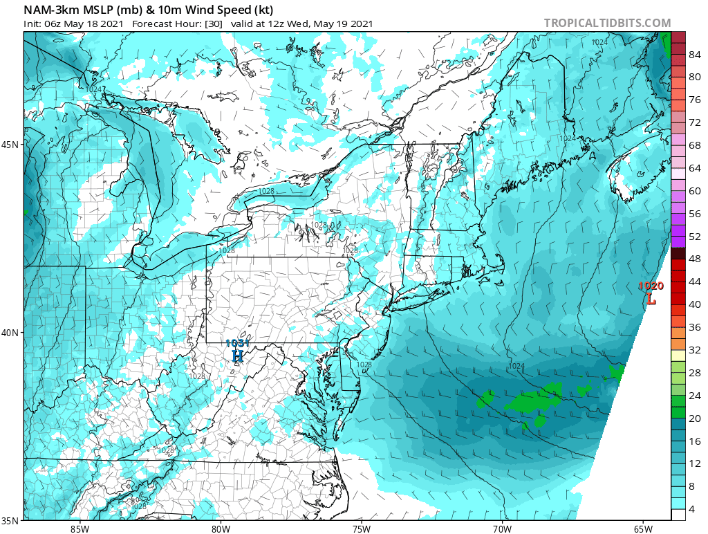
Winds will shift from westerly on Wednesday along the east coast to easterly by later Thursday which could result in a drop in temperatures across New Jersey and New York City. Maps courtesy NOAA, tropicaltidbits.com
Overview
A surge in temperatures is about to take place in the Mid-Atlantic region with temperatures climbing well into the 80’s at mid-week along the I-95 corridor. Temperatures have yet to reach the 90 degree mark officially this spring in the I-95 corridor, but they have a pretty decent shot this week in the Washington, D.C. metro region and an outside shot in Philly and New York City. One wrench in the unseasonably warm outlook is the possibility that a back door cool front could knock off several degrees later in the week; especially, in the New York City metro region and coastal New Jersey.

High pressure ridging aloft centered over the Great Lakes will dominate the scene for the next several days. Map courtesy NOAA, tropicaltidbits.com
Discussion
Sprawling high pressure currently dominates the scene across the eastern third of the nation and it will continue to do so for the next several days. This system will result in a surge of temperatures at mid-week in the Mid-Atlantic region resulting in afternoon highs on Wednesday well up in the 80’s in many spots. The overall very warm weather pattern will continue into Thursday, but a shift of winds off the east coast to an easterly direction will be a signal that a back door cool front could play an important role in the temperature pattern by later Thursday and into Friday – at least across eastern sections of the Mid-Atlantic such as New York City and New Jersey. If, in fact, the back door cool front sweeps inland on Thursday, it could drop temperatures from their highs on Wednesday afternoon well up in the 80’s to the 70’s by later Thursday and Friday in those coastal regions of New Jersey and New York City. A back door cool front like this will typically have less impact on temperatures in places farther away from the coast like Washington, D.C. where temperatures are more likely to flirt with the 90 degree mark for afternoon highs on Thursday and Friday.

Temperatures will surge in coming days across the northeastern quadrant of the nation. Map courtesy NOAA, tropicaltidbits.com
On Friday and during the upcoming weekend, there will be several waves of energy moving across the area as upper-level ridging shifts to the west. This will open the door for some shower and thunderstorm activity and also allow for another back cool front to potentially impact the region later in the weekend which could bring cooler temperatures – at least on a temporary basis – by early next week.

A classic look at the Brood X cicada with its familiar red eyes…photo taken this past weekend in Crofton, MD.
One final note, given the expected big warm up in the Mid-Atlantic region in coming days, the emergence of the “Brood X” cicada population should really jump. The cicadas have been very noticeable in recent days across the DC metro region, but not so much to the north of there. Cicadas generally emerge when soil temperatures reach about 64 degrees (F) and this will be no problem during the upcoming warm stretch of weather.
Meteorologist Paul Dorian
Peraton
peratonweather.com