
1:45 PM (Monday) | ***Late day and evening thunderstorms can be on the strong-to-severe side in the I-95 corridor with heavy rainfall, frequent lightning and damaging wind gusts***
Paul Dorian
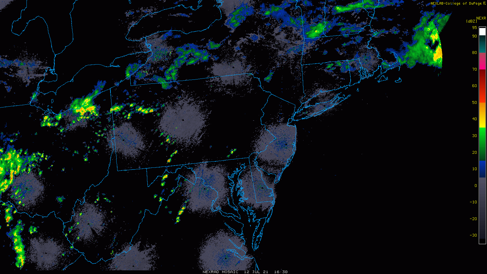
Thunderstorms are firing up at this hour across the interior Mid-Atlantic and can impact the DC-to-Philly-to-NYC corridor later today and tonight. Images courtesy College of DuPage, NOAA
Overview
We have certainly heard this warning multiple times this spring and summer…”the potential exists for strong-to-severe thunderstorm activity in the DC-to-Philly-to-NYC corridor and any storm can produce heavy rainfall, frequent lightning and damaging wind gusts”. In fact, the overall weather pattern will remain on the wet side through the remainder of the week across the eastern half of the nation including in the DC, Philly and NYC metro regions with multiple chances of additional showers and thunderstorms.
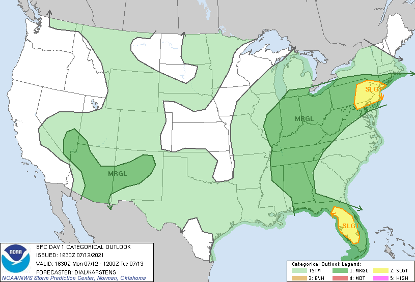
Severe weather is possible later today and tonight in much of the Mid-Atlantic region; especially, to the north of the PA/MD border. The severe weather threat includes damaging wind gusts and torrential rainfall. Map courtesy NOAA/SPC
Details
Dew points are in the 70’s in the I-95 corridor this afternoon and when combined with temperatures near the 90 degree mark, it is making for quite uncomfortable conditions. In addition, the high dew points are indicative of a very moist environment and any thunderstorm that forms later in the day and early tonight can easily tap into the excessive humidity and produce some heavy rainfall. A nearly stationary frontal system is adding to the instability to go along with the hot and humid air mass and it’ll remain quite unsettled for the remainder of the week in the eastern half of the nation.
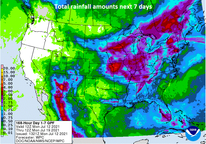
Unsettled weather will continue through the week in much of the eastern half of the nation with a continuous influx of warm and humid air on the backside of a western Atlantic high pressure system. Map courtesy NOAA/WPC
The most likely timetable for the strong-to-severe thunderstorm activity in the DC-to-Philly-to-NYC corridor is 2-10 PM and it is an extended period as multiple rounds of storms are possible. Heavy rainfall of up to a few inches in a short period of time can certainly cause localized flooding later tonight and tonight; especially, in poor drainage areas. Damaging wind gusts are also a threat with this pending thunderstorm activity with the greatest chance likely being from northeast Maryland to all areas north of the Mason-Dixon Line.

Quite an unstable atmosphere exists at mid-afternoon in the Mid-Atlantic region; especially, across SE PA, southern NJ where “Convective Available Potential Energy (CAPE)” is high (right plot). In addition, precipitable water amounts (left plot) are quite high all along the I-95 corridor which is a red flag that any storm later today and tonight can produce heavy rainfall amounts in a short period of time. Maps courtesy NOAA
Meteorologist Paul Dorian
Peraton
peratonweather.com