
12:15 PM | *July has been a nearly normal month for temperatures in the Mid-Atlantic...transition into August will feature additional comfortable air masses...coastal storm next week?*
Paul Dorian

An upper-level low is likely to push into the eastern states next week and it could help spawn low pressure near the east coast. Map courtesy NOAA, tropicaltidbits.com
Overview
While much of the nation from the Northern Plains to the Pacific Northwest has experienced hotter-than-normal weather this month, the Mid-Atlantic region has enjoyed a nearly normal month in terms of overall temperatures. In fact, it appears the last couple of days of July can include some below-normal temperatures in much of the Mid-Atlantic region and the first week of August could turn out to be cooler-than-normal in much of the eastern US. In addition to the potential for cooler-than-normal temperatures in the Mid-Atlantic region next week, we’ll have to watch out for the possibility of a coastal storm.

Cooler-than-normal conditions are likely next week across much of the eastern half of the nation. Map courtesy Weather Bell Analytics (Joe Bastardi), NOAA
Details
So far in the month of July, temperatures have averaged slightly below-normal in Central Park (New York City) at -1.2 degrees and nearly normal in Philly (+0.4 degrees) and Washington, D.C. (-0.1 degrees). While the next few days are likely to stay quite warm; especially, in areas to the south of the PA/MD border such as the DC metro area, more comfortable air is likely to arrive for the last couple days of July (i.e., Friday and Saturday) following the passage of a cold frontal system. Looking ahead, a second cold frontal system is likely to push through the Mid-Atlantic region early next week and this system is likely to usher in another comfortable air mass for the first week of August that may actually extend all the way from the Midwest-to-northern New England.
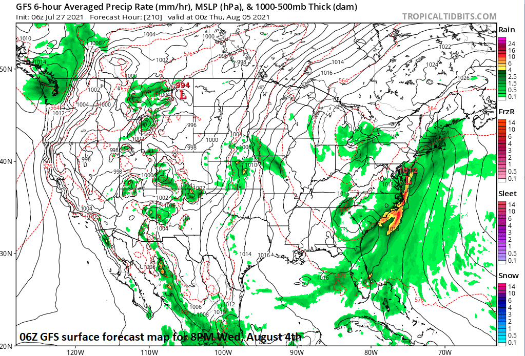
Low pressure could form near the east coast by the middle of next week as an upper-level low slides into the eastern states. Map courtesy NOAA, tropicaltidbits.com
In addition to the potential of comfortable temperatures to start to the month of August in the eastern US, there are signs that the overall pattern could become pretty wet; especially, along the eastern seaboard. As an upper-level low builds into the eastern states, surface low pressure may form near the east coast by the middle part of next week and, if this were too materialize, it could actually become cool and damp for at least parts of the Mid-Atlantic region.
Meteorologist Paul Dorian
Peraton
peratonweather.com