2:40 PM | ***"Elsa" near hurricane strength just off Florida's west coast…an impact in the Mid-Atl./NE US later in the week…in the short-term, severe thunderstorms for parts of the Mid-Atlantic***
Paul Dorian

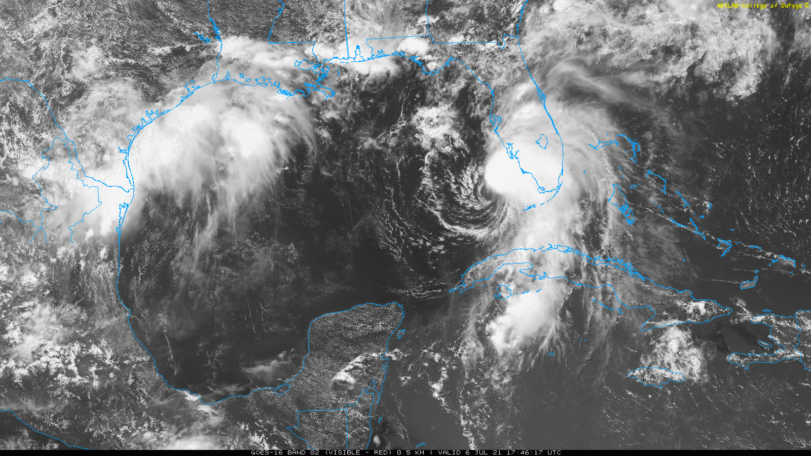
“Elsa” is a strong tropical storm and is likely to reach hurricane status shortly as it pushes slowly northward just off Florida’s west coast. Images courtesy College of DuPage, NOAA
Overview
“Elsa” is a strong tropical storm that is on the verge of reaching hurricane status as it pushes slowly northward just off Florida’s southwest coastline. It is having significant impact in the state of Florida and is likely to have an impact later in the week all the way up into the Mid-Atlantic and Northeast US. In the short-term, a very unstable atmosphere could bring severe thunderstorms to the northern Mid-Atlantic later today and tonight in this hot and humid air mass.

“Elsa”
“Elsa” is strengthening and is on the verge of reaching hurricane status as it pushes slowly northward just off the southwest coast of Florida. This system was trucking along at a good speed over the weekend, but has since slowed down to a northward movement of only 9 mph and this is helping its cause for intensification over the very warm waters of the eastern Gulf of Mexico. Bands of heavy rain are rotating around the developing center of “Elsa” through the southwestern part of Florida and these will push to the north and east during the next several hours impacting all the way to the east coast of the state. The tropical system is likely to make landfall as a hurricane late tonight or early Wednesday along Florida’s west coast and to the north of Tampa. It will then move across the northern part of Florida later tomorrow and likely reach the southeastern part of Georgia by tomorrow night.
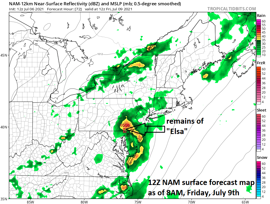
NOAA’s 12Z NAM mode forecast map for early Friday features the remains of “Elsa” over the southeastern part of PA. The likely impact period in the I-95 corridor will be from later Thursday into early Friday. Map courtesy NOAA
After that, “Elsa” will turn to the northeast and push up along the eastern seaboard reaching the southeastern part of Virginia by later Thursday. From there, the remains of “Elsa” could move over the Delmarva Peninsula and to a position over southern New Jersey by Thursday night or early Friday – enhancing the chances for heavy rainfall along the I-95 corridor.

A very unstable atmosphere raises the chances for severe weather in much of the Mid-Atlantic region alter today/tonight. Map courtesy NOAA
Severe weather threat later today/tonight for parts of the Mid-Atlantic
In the short-term, the northern Mid-Atlantic region may have to deal with severe thunderstorm activity; primarily, from northeastern Maryland/Delaware and points to the north and east (DC metro may escape without a storm tonight). A very unstable atmosphere has developed with these hot and humid conditions and this will pave the way for strong-to-severe thunderstorm activity later today into the late evening. One measure of atmospheric stability is known as Convective Available Potential Energy (CAPE) and it is indicating very strong instability across northeastern MD, southeastern PA and much of New Jersey. The likely timetable for the storms in the I-95 corridor region of the northern Mid-Atlantic will be 4pm-to-10pm.
Meteorologist Paul Dorian
Peraton
peratonweather.com
Follow us on Facebook, Twitter, YouTube
Video discussion: