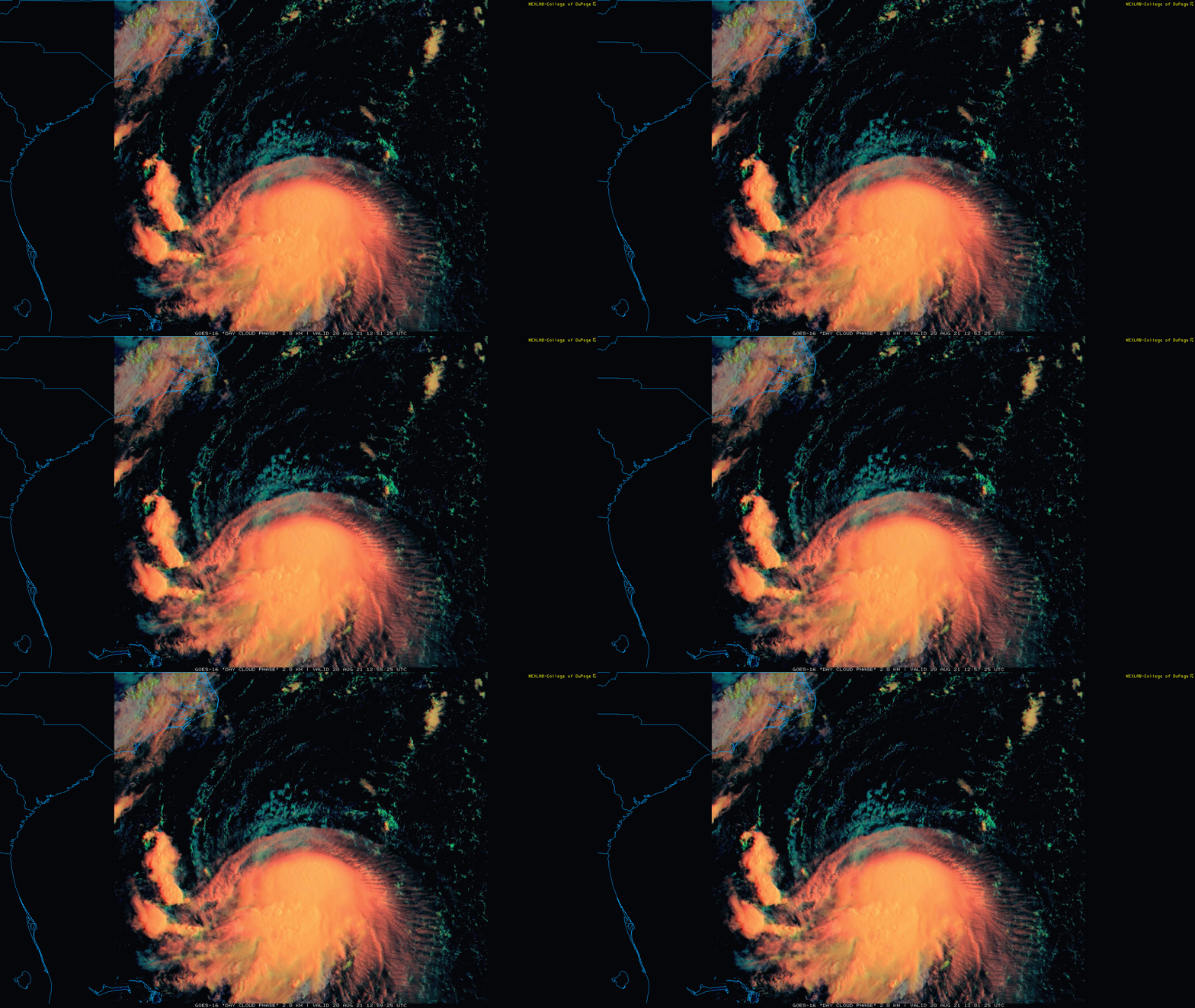
11:00 AM (Friday) | ****TS Henri to turn to the north and intensify into hurricane status...direct impact possible by later Sunday in the region from Long Island to southern New England****
Paul Dorian
TS Henri is classified as a strong tropical storm this morning with max sustained winds of 65 mph. Improving environmental conditions should allow it to attain hurricane status this weekend. Images courtesy College of DuPage, NOAA
Overview
Tropical Storm Henri remains a threat to Long Island and New England where it could make a direct impact as a strong tropical storm or weak hurricane late in the upcoming weekend. This system will become influenced by expanding high pressure over southeastern Canada and a developing upper-level trough over the Appalachian Mountains causing it to make a sharp right turn in the near-term. In addition, more favorable environmental conditions will allow for intensification of Henri this weekend from the current tropical storm status to hurricane levels and it could very well be closing in on Long Island and southern New England as a strong tropical storm or weak hurricane by late in the day on Sunday. All residents from the northern Mid-Atlantic to northern New England should closely monitor the movement of Tropical Storm Henri.
A variety of computer forecast models feature a storm track of TS Henri that will bring it to the region from Long Island to southern New England by the latter part of the weekend (using 06Z 8/20 model runs). Map courtesy tropicaltidbits.com (Levi Cowan)
Details
At 11 AM, Tropical Storm Henri is moving to the NW at 7 mph with maximum sustained winds at 65 mph – just under the threshold used for hurricane classification. Increasingly favorable environmental conditions, however, should allow it to reach hurricane status within the next day or so. It is currently sitting nearly underneath a strong high pressure ridge in the upper part of the atmosphere and the overall wind field remains weak and this is resulting in its continued rather slow movement.
Sea surface temperatures may play a key role in the ultimate intensity level of TS Henri as it potentially closes in on the Long Island or southern New England coastline. Water temperatures in the western Atlantic drop off pretty sharply from the Gulf Stream region to the southern New England coastline. This chill down in the water off the New England coastline can result in a weakening of the system in the hours before the potential landfall late Sunday. Map courtesy NOAA, tropicaltidbits.com
Key players in the upper atmosphere include a strong high pressure ridge over the western Atlantic which will tend to retreat northward and an upper-level trough that is sliding into the Mid-Atlantic region. This combination is often a typical one for New England hurricanes and it will allow for a shift in the movement of Henri to the north in the near-term and potentially to right near the coastline of Long Island or southern New England by the latter part of the weekend.
A 500 mb composite map of landfalling New England hurricanes has many similarities to what is expected aloft this weekend with an upper-level low over the Mid-Atlantic and high pressure ridging over southeastern Canada. Maps courtesy tropicaltidbits.com, NOAA (left); Eric Webb (Twitter, right)
In addition to the upper air pattern, water temperatures off the coast of New England may play a key role in the upcoming situation. The initial trek of Henri over the ocean this weekend will be over some pretty very warm water, but as it gets closer to the Northeast US coastline, sea surface temperatures will drop off noticeably and this could have an impact on its intensity as it approaches land with weakening possible in those last few hours.
The bottom line is that all coastal residents from the northern Mid-Atlantic to northern New England should continue to closely monitor this tropical storm in coming days. In addition, don’t just be focused on the possible landfall location of Long Island or southern New England as there can be heavy rain bands that “swing around” the storm center all the way down to Southeast PA, southern NJ and the Delmarva Peninsula.
Meteorologist Paul Dorian
Peraton
peratonweather.com
Follow us on Facebook, Twitter, YouTube
Video discussion:


