11:30 AM | ***Accumulating snow from later tonight into Friday in the Mid-Atlantic/NE US…watch out for mesoscale heavier snow bands…next cold blast arrives early next week***
Paul Dorian

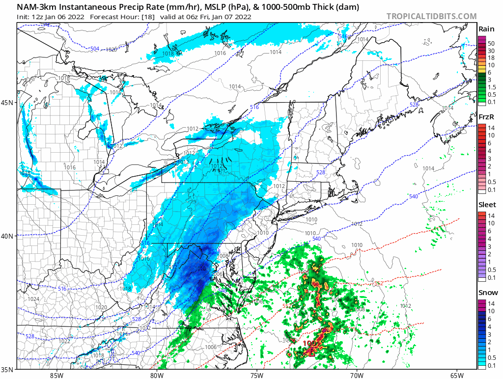
Small-scale heavier snow bands are likely to form late tonight/early Friday (shown here in dark blue) as low pressure intensifies off the Mid-Atlantic coastline. Maps courtesy NOAA/NAM (high-resolution version), tropicaltidbits.com
Overview
An upper-level disturbance is helping to generate surface low pressure in the southeastern states at mid-day and this system will intensify over the next 24 hours as it moves rather quickly to the northeast - likely reaching the waters off of eastern Maine by mid-day on Friday. Accumulating snow will spread across the DC-to-Philly-to-NYC corridor later tonight and it’ll wind down on Friday morning from southwest-to-northeast. There are likely to be small-scale heavier snow bands that develop later tonight/early Friday associated with mid-level “frontogenetic forcing” and these will produce localized higher accumulation amounts. It’ll be quite cold during and after the storm and another very impressive cold air blast will arrive in the Mid-Atlantic/Northeast US early next week.

Low-level strong “frontogenesis” with this system is likely to help generate small-scale heavier snow bands late tonight/early Friday. Map courtesy NOAA/NAM (high-resolution version), tropicaltidbits.com
Details
An upper-level disturbance that is currently moving southeastward across the Mississippi Valley is helping to spin off a surface low pressure system in the Southeast US. This low pressure system will intensify as it heads northeastward over the next 24 hours to a position off the Mid-Atlantic coastline by early tomorrow and then to a location off the east coast of Maine by mid-day Friday.

12Z NAM (high-resolution version) forecast map of the 500 mb vorticity field late tonight associated with the developing low pressure system. Map courtesy NOAA, tropicaltidbits.com
Accumulating snow will develop in the DC-to-Philly-to-NYC corridor later this evening and, given the fairly rapid movement of the low pressure system, it is likely to wind down in the morning hours on Friday from southwest-to-northeast – perhaps a 6-10 hour event in a given spot. While the duration of the snowfall may be somewhat limited, there are likely to be heavier “mesoscale” (aka small-scale) snow bands that develop late tonight/early Friday and these may feature 1-2” snowfall rates and lead to localized higher accumulations. The likelihood for these heavy snow bands is the result of some strong “frontogenetic forcing” that develops in lower and middle levels of the atmosphere during this event. Average accumulations in the DC-to-Philly-to-NYC corridor are likely to end up in the 3-6 inch range, but given the expectation of small-scale heavy snow bands, isolated higher amounts are likely; especially, across New Jersey and the NYC metro region where the “forcing” will be quite strong early Friday. Farther up the east coast, snow accumulations may increase into the 6-12 inch range in places like eastern New England where the off-shore storm will be at its most intense level on Friday.
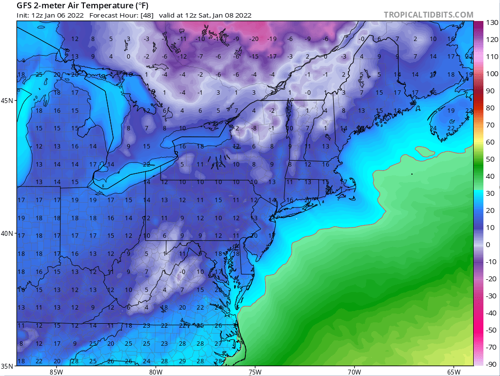
12Z GFS forecast map of 2-meter temperatures as of 7AM, Saturday, January 8th with very cold conditions all along the I-95 corridor. Map courtesy NOAA, tropicaltidbits.com
Given the nature of the cold (and dry) air mass that will be in place during this upcoming event, the snow-to-liquid ratios are likely to be rather high resulting a drier, lighter texture to the snow as compared with the heavier, wet snow that fell earlier this week in the southern half of the Mid-Atlantic region. Following the passage of the low pressure system, temperatures are likely to drop well down into the teens on Friday night/Saturday morning all along the I-95 corridor from DC-to-Philly-to-NYC. It’ll start off the day on Saturday at very cold levels and stay well below-normal for the rest of the day. Milder air will, however, push in for a brief time on Sunday and the initial push can result in some rain, ice and/or snow shower activity, but temperatures ultimately should climb into the 40’s in DC, Philly and NYC – just ahead of the next cold front.

A cold air mass is already in place across the Mid-Atlantic region and Northeast US - in time for the upcoming storm - and another impressive cold shot comes early next week. Map courtesy NOAA, tropicaltidbits.com
The passage of the late weekend cold frontal system will usher in another very impressive cold air mass for the Mid-Atlantic and Northeast US that had its origins in western Canada and Alaska. We’ll likely be dealing with low temperatures in the teens on Monday night and again Tuesday night in the DC-to-Philly-to-NYC corridor, single digits and sub-zero lows are likely across interior locations and in northern New England. As an example as to how cold the source region has been, low temperatures yesterday morning officially bottomed out at 60 degrees (F) below zero in the small village of “Chicken” situated in the eastern, interior part of the 49th state. These cold air outbreaks into the central and eastern US look like they’ll continue into the middle part of the month and the overall evolving upper air pattern could result in more storms as well.
Meteorologist Paul Dorian
Arcfield
arcfieldweather.com
Follow us on Facebook, Twitter, YouTube
Video discussion: