
11:35 AM | **Meandering low pressure to impact the Mid-Atlantic region into mid-week…coastal flooding, chilly, windy, periods of rain**
Paul Dorian
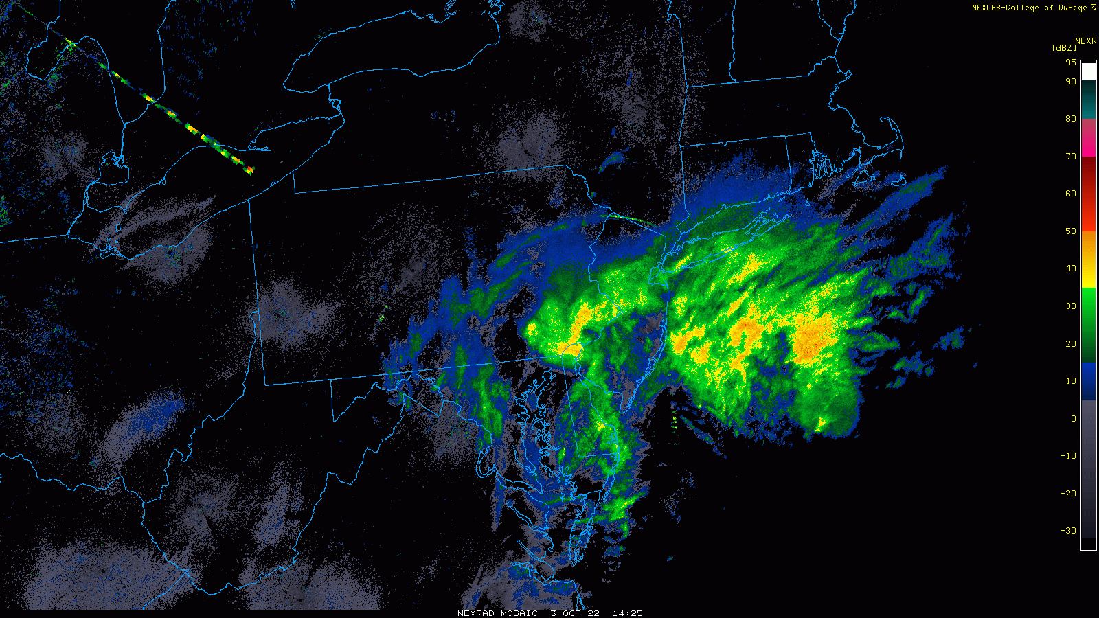
Latest radar echoes feature a swirl of rain rotating around low pressure in a counter-clockwise fashion and this pattern will remain into mid-week. Images courtesy College, of DuPage, NOAA
Overview
Low pressure off the Mid-Atlantic coastline will continue to impact the Mid-Atlantic region into the middle part of the week with rain, wind and chilly conditions along with coastal flooding. This system which is connected to a post-tropical Ian will tend to drift away from the coast later today only to return on Tuesday and this will extend the nasty weather into early Wednesday. An upper-level trough to our northwest will then be able to finally kick this system out-to-sea by Thursday ahead of the next cool front that ushers in another cool air mass for the weekend.

Low pressure off the Mid-Atlantic coastline will meander around until mid-week creating additional windy, chilly and wet conditions for the region. In addition, coastal flooding will be a problem at high tides over the next 48 hours from Long Island/NYC to the Delmarva Peninsula. Images courtesytropicaltidbits.com, NOAA
Discussion
The effects of Ian just won’t go away in the Mid-Atlantic region as surface low pressure will spin around off the coast into mid-week causing additional rain, wind and chilly conditions. In addition, with an extended period of onshore flow (NE winds), coastal flooding will be a big problem at periods of high tide during the next couple of days from Long Island/NYC-to-New Jersey-to-Delmarva Peninsula. Rain will not be constant during the next 48 hours in the Mid-Atlantic, but it will be heavy at times. Temperatures will remain far below-normal for the early part of October with highs confined to the 50’s on Monday and Tuesday in the I-95 corridor as compared with the climatological average in the lower 70’s.
At mid-week, an upper-level trough will drop southeast from south-central Canada towards the Great Lakes and this system will be the “kicker” for the low pressure meandering off the east coast. As this system approaches, it’ll be able to “kick” the low pressure out-to-sea, and the weather will improve later Wednesday and turn out pretty nice on Thursday. A surface cold front tied in with the late week upper-level trough system should pass through by the weekend and this will usher in another cool mass for the Mid-Atlantic region.
Meteorologist Paul Dorian
Arcfield
arcfieldweather.com
Follow us on Facebook, Twitter, YouTube
Video discussion: