
1:00 PM | ***An active early weekend Arctic frontal passage in the Mid-Atlantic region with “pre-frontal” rain/possible strong storms…”post-frontal” high winds, interior snows***
Paul Dorian

Two upper-level systems will phase together early this weekend and the result will be a rapidly intensifying surface low pressure along an Arctic frontal boundary zone. One system aloft will be riding along the northern branch of the jet stream and a second in the southern branch. Map courtesy NOAA, Pivotal Weather
Overview
After today’s mix of snow and rain in areas to the north of the PA/MD border and cold rain to its south, the Mid-Atlantic will enjoy relatively tranquil conditions on Thursday and Friday as high pressure builds across the region. It will, however, turn quite active again as we begin the upcoming weekend with an Arctic cold front advancing into the eastern states. This cold frontal system will have a lots of support in the upper atmosphere which will help to contribute to the formation of surface low pressure along the frontal boundary zone and this system will intensify rapidly as it pushes northeastward.
Rain is likely ahead of the Arctic front in the Mid-Atlantic region from Friday night into early Saturday and some of it can be heavy at times and a strong thunderstorm is also possible. On the back side of the front, temperatures will drop sharply, the rain will change over to accumulating snow across interior sections of the Mid-Atlantic and perhaps all the way into the I-95 corridor. In addition, high winds are likely to develop from later Saturday into Saturday night as a strong pressure gradient forms between the departing storm system and a strong high pressure in the southern states.

By Saturday night, the two upper-level systems will phase together resulting in a vigorous upper-level low positioned right on top of the Mid-Atlantic region. Map courtesy ECMWF, Pivotal Weather
Details
After a couple of fairly tranquil days on Thursday and Friday, the weather turns much more active at week’s end and going into the early part of the upcoming weekend. Another strong Arctic cold front will sweep eastward and its passage on Saturday in the Mid-Atlantic region will become quite a weather-maker. The Arctic cold front will be supported by vigorous upper-air energy as a system in the northern branch of the jet stream phases together with a southern branch system by later Saturday. The result of this phasing together will be the development of a strong surface low pressure along the Arctic frontal boundary zone and this system will intensify rapidly as it pushes in a northeasterly direction.
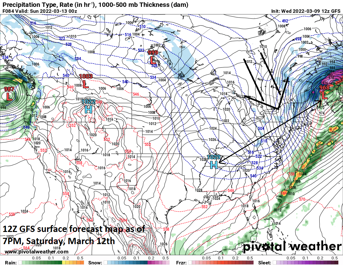
A strong pressure gradient will form on Saturday between the departing strong and still intensifying surface low pressure system and high pressure over the Tennessee Valley. High winds are quite likely to follow the passage of the Arctic cold front in the Mid-Atlantic from later Saturday into Saturday night. Map courtesy NOAA, Pivotal Weather
There will be some “pre-frontal” rains from Friday night into early Saturday in the Mid-Atlantic region – some of which can be heavy at times - and perhaps even some strong-to-severe thunderstorm activity. Behind the front, temperatures will drop sharply later Saturday after early morning highs and the rain will change to accumulating snow across interior sections of the Mid-Atlantic (e.g., central PA, western MD, western VA). In fact, there is a chance for a changeover to snow all the way into the I-95 corridor later in the day on Saturday with some accumulations on the table in suburban areas to the north and west of the big cities along the DC-to-Philly-to-NYC corridor. Given the expected sharp drop in temperatures, we’ll have to watch out for the possibility of a quick freeze up after the “pre-frontal” rainfall.
In addition to the threat for some snow on Saturday, a big concern is the likelihood for high winds following the passage of the strong Arctic cold front. A tremendous pressure gradient will develop between the departing strong and still intensifying low pressure system over northern New England by later Saturday and a strong high pressure system that will build over the southern states. The result of this gradient could be wind gusts in the 50-60 mph range from later Saturday into Saturday night and this kind of intensity can certainly raise the possibility of some downed tree limbs and power outages. The atmosphere calms down some by later Sunday in the Mid-Atlantic, but temperatures will remain well below-normal for this time of year as we close out the upcoming weekend with highs generally confined to the 30’s.
Meteorologist Paul Dorian
Arcfield
arcfieldweather.com
Follow us on Facebook, Twitter, YouTube
Video discussion: