
9:30 AM | *Much colder air mass arrives in time for Easter Sunday...interesting possibilities on Monday/Monday night from coastal storm*
Paul Dorian

A cold front arrives in the I-95 corridor later this afternoon and it can be accompanied by some strong-to-severe thunderstorm activity. Following the passage of the cold front, the work week will end on a cooler note with highs on Friday generally in the 60’s following the 80’s of today and yesterday. Map courtesy NOAA, tropicaltidbits.com
Overview
Temperatures soared into the 80’s on Wednesday in much of the Mid-Atlantic and in many spots this was the first reading this season at those levels. A repeat performance is in store for today with afternoon highs again likely to be in the 80’s across much of the region, but this time, showers and strong thunderstorms will accompany the warmth. A cold front is sliding this was from the Ohio Valley and an even stronger cold front will arrive late Saturday with more showers and possible thunderstorms. That mid-weekend frontal passage will usher in a colder air mass for Sunday and much of next week will be on the cool side across the northern US. A coastal storm will form early next week and it is likely to result in accumulating snow for the interior sections of the Mid-Atlantic and Northeast US.
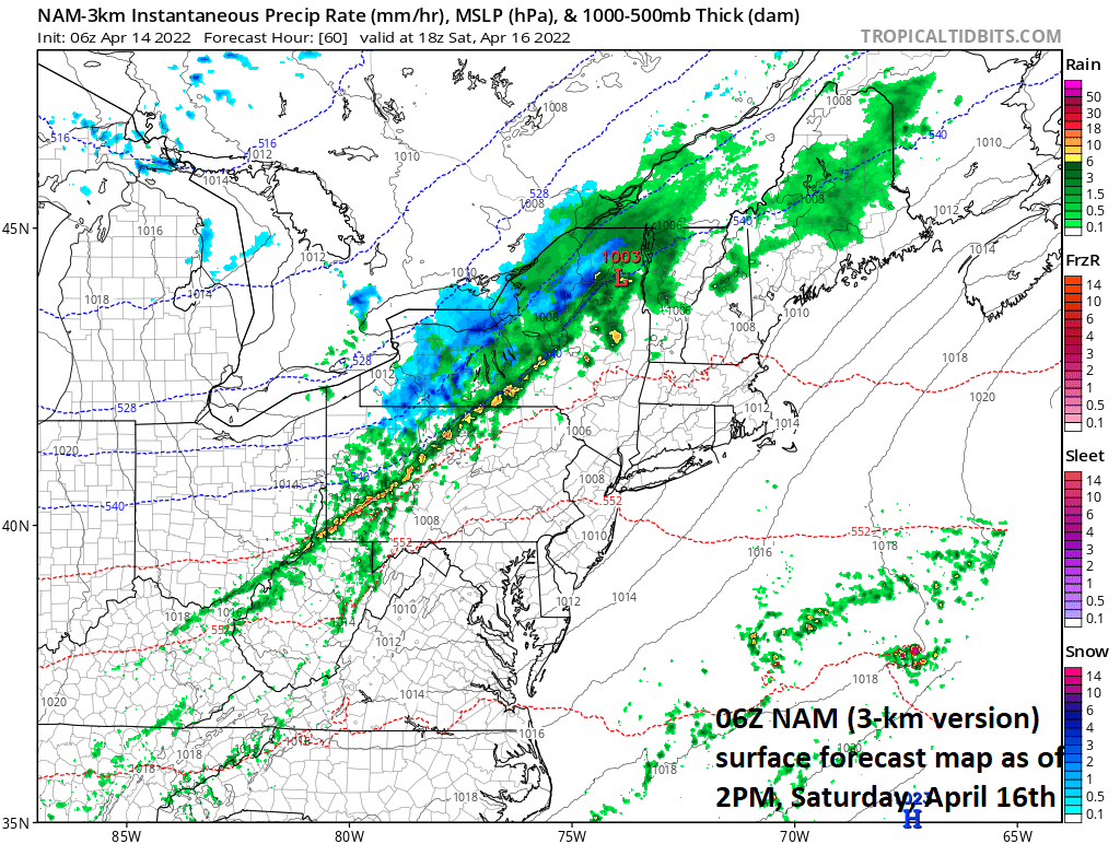
The next cold front coming this way will arrive here late Saturday and it could be accompanied by showers and perhaps a few strong thunderstorms. Following the passage of the cold front, much colder air will push in on Sunday limiting highs to the 50’s in the DC-to-Philly-to-NYC corridor despite plenty of sunshine. Map courtesy NOAA, tropicaltidbits.com
Details
A strong cold front moved from west-to-east on Wednesday across the Mississippi and Tennessee Valleys and helped to generate numerous severe thunderstorms and damaging wind reports. This same front has lost a bit of its punch; however, it reaches the eastern seaboard later today and it remains strong enough to generate some strong-to-severe thunderstorm activity from later this afternoon into the early evening. Temperatures ahead of the front will climb into the 80’s and it’ll turn noticeably cooler on Friday following the passage of the front, but still pretty decent for this time of year.

Sunrise on Easter Sunday will be quite cold across the Mid-Atlantic region with temperatures primarily in the 30’s. Map courtesy NOAA, tropicaltidbits.com
Another cold front will push this way on Saturday and this front will be the leading edge of an even colder air mass that has worked its way from west-to-east in recent days across the northern US. Showers can accompany this weekend frontal system on Saturday and perhaps a strong thunderstorm or two will be mixed in with temperatures likely in the 60’s. Following the passage of the cold front, the colder air mass will arrive in time for sunrise on Sunday and temperatures are likely to start off the day in the 30’s across much of the Mid-Atlantic region. Despite plenty of sunshine on Sunday, afternoon highs are likely to be confined to the 50’s in the DC-to-Philly-to-NYC corridor – a far cry from the 80’s of today and yesterday. The weather could turn pretty interesting on Monday and Monday night as a storm organizes near the Mid-Atlantic coastline. There will be enough cold air still around early next week to raise the possibility of accumulating snow across interior sections of the Mid-Atlantic/NE US later Monday into Monday night.

Next week is looking quite a bit colder-than-normal across the northern US while at the same time, the southern states enjoys generally warmer-than-normal conditions. Map courtesy NOAA, tropicaltidbits.com
Looking ahead to later next week, this next shot of cold air for the second half of the weekend will not be the last. Additional cold air outbreaks will drop to the south and east from Canada continuing to inhibit the chances of sustained warmth for the northern half of the nation.
Meteorologist Paul Dorian
Arcfield
arcfieldweather.com
Follow us on Facebook, Twitter, YouTube
Video discussion: