1:45 PM | ***Significant storm to bring some heavy rain to the I-95 corridor, strong winds to coastal sections, and accumulating snow to the interior Mid-Atlantic/Northeast US***
Paul Dorian

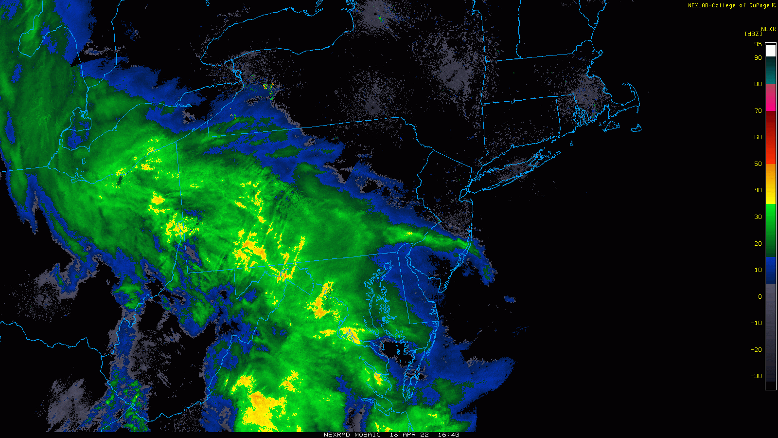
This unfolding late season coastal storm is going to bring some heavy rain to DC, Philly and NYC likely resulting in 1-2 inches by early Tuesday. Radar images courtesy NOAA, College of DuPage
Overview
A late season coastal storm will bring heavy rain to the DC-to-Philly-to-NYC corridor from later today through tonight, strong winds and potential flooding to coastal sections and accumulating to snow to interior, higher elevation locations of the Mid-Atlantic/Northeast US. In fact, it is not out of the question that some of the northern and western suburbs of the big cities along I-95 see ice pellets or even snow mixed in at times during this unfolding coast storm. An unusually chilly air mass is in place across the northeastern part of the nation, jet streaks will form at multiple levels of the atmosphere, and a vigorous disturbance aloft will all contribute to the formation of a significant storm that will have a variety of impacts over the northeastern quadrant of the nation. Cold air outbreaks from Canada into the central and eastern states have continued unabated in recent weeks and it looks like they will continue into late April and likely the early part of May.

A late season coastal storm will bring accumulating snow to interior, higher-elevation locations of the Mid-Atlantic/Northeast US as depicted here by the 12Z GFS computer forecast model run. Map courtesy NOAA, tropicatidbits.com
Details
Ingredients are coming together for a significant storm to develop near the east coast and it will have a wide-ranging impact on the Mid-Atlantic/Northeast US during the next 12-24 hours. In the DC-to-Philly-to-NYC corridor, heavy rain is likely to develop from later today into late tonight with 1-2 inches on the table by early Tuesday. There can be a few thunderstorms mixed into the picture; especially, in areas to the south of the PA/MD border. An intensifying jet streak in the lower levels of the atmosphere will combine with intensifying surface low pressure to generate powerful wind gusts along coastal sections at the height of this storm up to 50 mph or so. In addition, coastal flooding is a threat in Delaware and New Jersey at times of high tide given the persistent onshore flow of air that is expected during this storm.

Coastal sections of New Jersey, Delaware, southeastern NY and New England will experience powerful wind gusts during the height of this storm and coastal flooding is on the table at times of high tide. Map courtesy NOAA, tropicaltidbits.com
Meanwhile, on the cold side of this developing storm system, accumulating snow is likely to fall in the interior, higher-elevation locations of the Mid-Atlantic/NE US extending from West Virginia, western Virginia/Maryland to western/central/northeastern PA to upstate New York and interior New England with many of these areas likely to receive 6+ inches by early tomorrow. These kinds of snow accumulations are certainly not all that common in this part of the nation during the second half of April, but it follows a pattern set last week. It is not out of the question that some ice pellets or even snow mix in at times in some of the northern and western suburbs along the I-95 corridor during this unfolding coastal storm. Just last week, snow fell all the way from the west coast of the Pacific Northwest to the Dakotas in an unusual late season blizzard. In fact, an inch of snow was recorded in Portland, Oregon which was the latest ever recorded and 20+ inches of snow fell in last week’s storm across portions of North Dakota.
The overall weather pattern that has featured the continuation of cold air outbreaks from Canada into the US in recent weeks does not look like it will end just yet. There are signs that additional cold air outbreaks are destined to reach the central and eastern states as late as during the end of April and perhaps even into early May. In fact, it is not out of the question that the same parts of the northeastern part of the nation that receive snowfall in this unfolding storm, may be threatened with snow again as April winds down and May gets underway.
Meteorologist Paul Dorian
Arcfield
arcfieldweather.com
Follow us on Facebook, Twitter, YouTube
Video discussion: