11:45 AM | ***Severe thunderstorm threat this afternoon and evening throughout the Mid-Atlantic region***
Paul Dorian
One of the ingredients for the severe weather threat today in the Mid-Atlantic region is a negatively-tilted upper-level trough which will add instability into the atmosphere. Map courtesy NOAA, tropicaltidbits.com
Overview
There is a severe thunderstorm threat in the Mid-Atlantic region for this afternoon and evening as a combination of ingredients will come together including the arrival of a strong cold front, high humidity and a vigorous disturbance in the upper atmosphere. The threat of severe weather includes the possibility of damaging wind gusts, hail and even isolated tornadoes from mid-day into the evening. Following the passage of the strong cold front, a much different air mass will push into the Mid-Atlantic for Tuesday and Wednesday with noticeably lower humidity and comfortable temperatures.
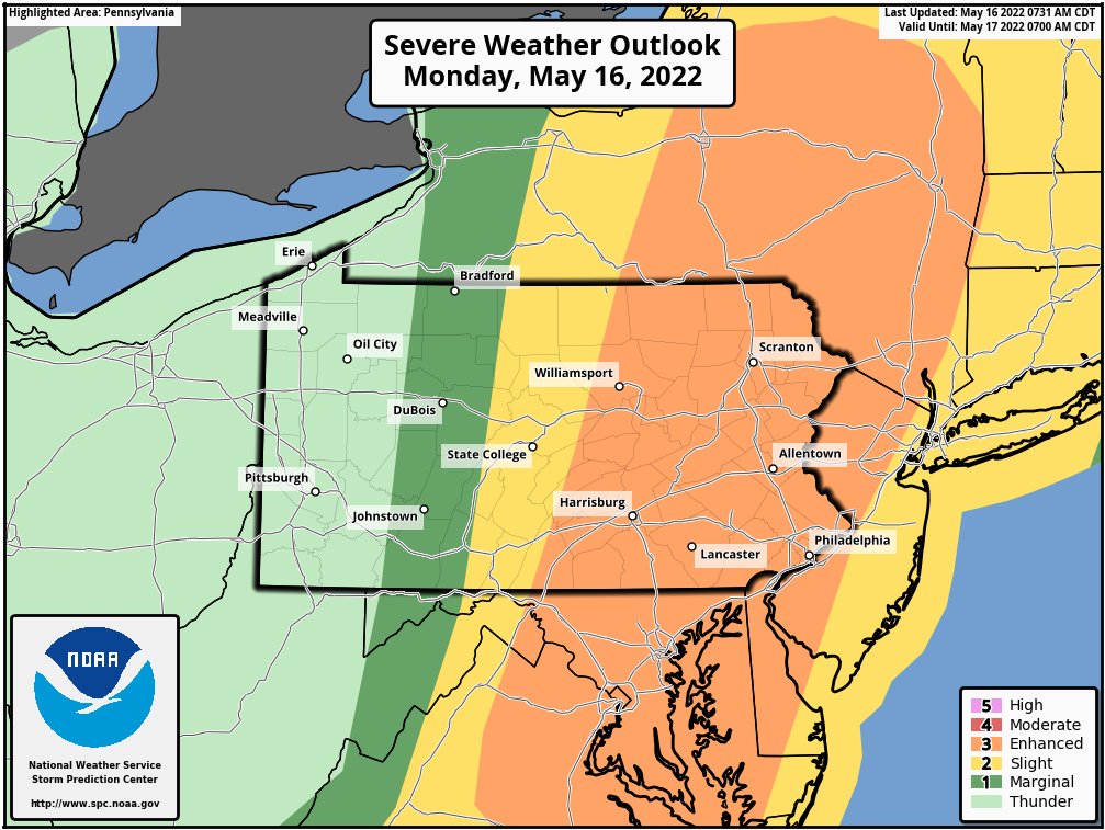
NOAA’s Storm Prediction Center has placed an “enhanced” threat of severe weather in the Mid-Atlantic region for later today and early tonight.
Details
The combination of a strong surface cold front, high humidity, and a negatively-tilted trough in the upper part of the atmosphere will raise the chance of severe weather in the Mid-Atlantic from early this afternoon into the evening. Dew points climbed into the 60’s during the overnight hours - reflective of a humid air mass - and it’ll stay very moist in lower levels right through passage time of the cold frontal system and this will be a contributing factor to atmospheric instability. Thunderstorms have already broken out in portions of the Mid-Atlantic region in such areas as central PA and the DC metro region and there will be multiple cells/lines forming later in the day. An initial batch of showers and possible embedded scattered storms can come through the DC/Philly metro regions in the early and mid afternoon hours, and a follow-up batch looks likely for the late afternoon/early evening hours…this later batch has more potential for strong-to-severe weather activity.
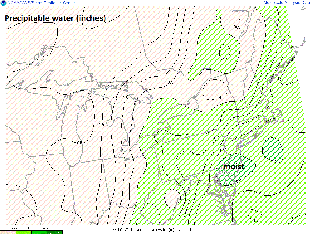
Humidity climbed noticeably this past weekend and the high moisture content in the low-levels of the atmosphere will aid in instability later today and tonight as a strong cold front pushes into the Mid-Atlantic. Precipitable water levels as shown on this map are quite high in the I-95 corridor - reflective of the high moisture content in the lower part of the atmosphere. Map courtesy NOAA/WPC
In terms of specific severe weather threats, damaging straight line winds of 60+ mph are possible given expected low-level wind shear and isolated tornadoes cannot be ruled out. Also, given the increasingly unstable atmosphere, there will be support for the generation of large hail in some areas. Furthermore, the high moisture content will lead to the possibility of flash-flooding type of rainfall during any thunderstorms; especially, in those areas that get hit more than once.
Thunderstorms have broken out across portions of the Mid-Atlantic and the threat of severe weather will exist all afternoon and into the evening. Images courtesy NOAA, College of DuPage
Following the passage of the cold front, a much different air mass will push into the Mid-Atlantic region on Tuesday with much lower humidity and pleasant temperatures. There will be a stiff NW breeze on Tuesday as well and there should be plenty of sunshine. The comfortable weather conditions will continue on Wednesday and then a big-time warm up may take place at the end of the work week and beginning of the upcoming weekend.
Meteorologist Paul Dorian
Arcfield
arcfieldweather.com
Follow us on Facebook, Twitter, YouTube
Video discussion:


