
2:00 PM | *Back door cool front brings dramatic relief today to Boston…brings much relief to NYC and New Jersey on Wednesday...little relief in Philly and virtually none in DC*
Paul Dorian
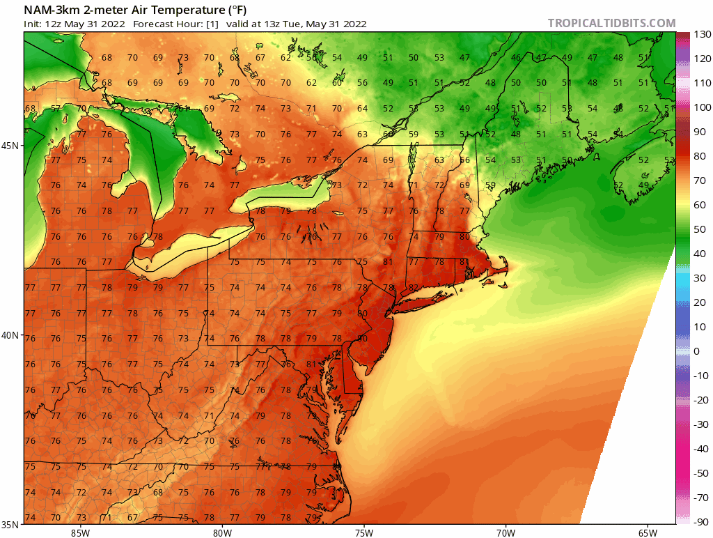
A back door cool front is moving from northeast-to-southwest in the Northeast US resulting in much relief across eastern Massachusetts. This system will usher in cooler Atlantic Ocean air for New York City and New Jersey in the overnight hours. Maps courtesy NOAA, tropicaltidbits.com
Overview
Hot weather dominated the scene today across the Mid-Atlantic and Northeast US and one of the ways to get relief is from a “conventional” cool frontal system that passes from west-to-east. However, long-time residents of the Mid-Atlantic and Northeast US know that one other way to get a break in the heat is for a back door cool front to slide from northwest-to-southwest which can produce dramatic temperature changes in a short period of time. That is exactly what happened today in Boston with a temperature drop of nearly 20 degrees in about 10 minutes and a big change is in store on Wednesday for New York City and New Jersey.
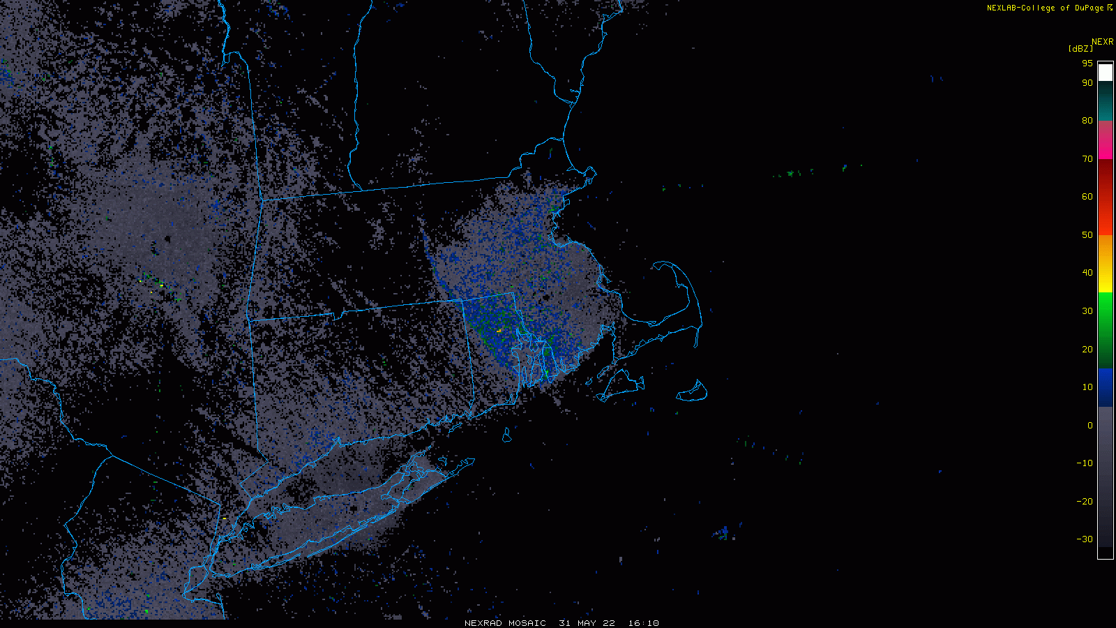
A back door cool front can be detected in this early afternoon radar loop of the Northeast US moving in a northeast-to-southwest direction. Maps courtesy NOAA, College of DuPsge
Details
It is now down to 60 degrees in Boston following a sharp drop in temperatures earlier today from the 80’s into the 60’s following the passage of a back door cool front. The passage of this system brought about a low-level wind change to a east/northeast direction and the air over the relatively cool western Atlantic Ocean caused a quick drop in temperatures in eastern Massachusetts. Ahead of the back door cool front, temperatures early this afternoon are still near 90 degrees in places like Hartford, CT, but the heat will soon be displaced there by cooler Atlantic Ocean air.
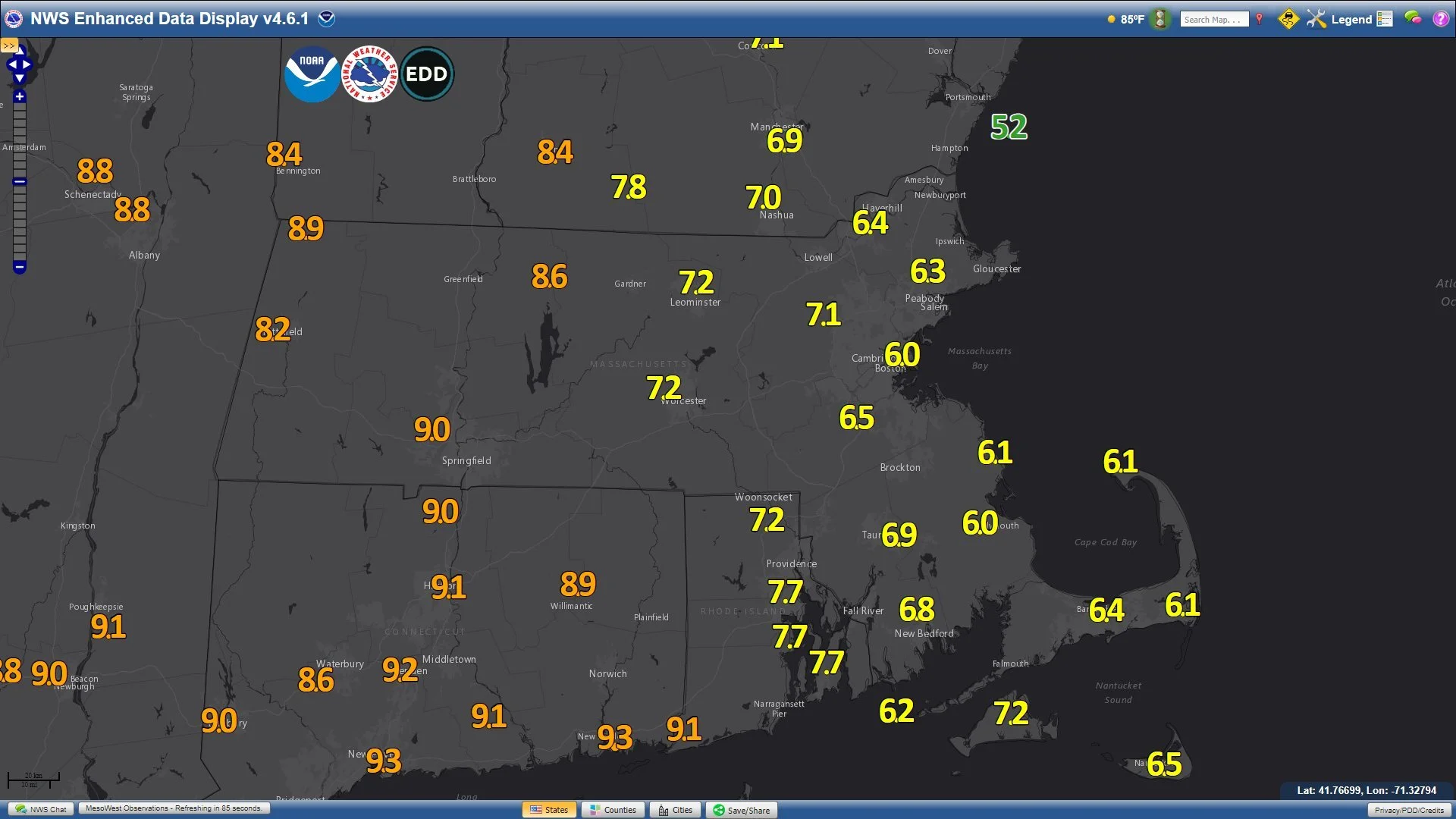
A surface map of southern New England in the early afternoon show temperatures on the cooler side of the back door cool front (in yellow) and on the warmer side (in orange).
On Wednesday, New York City and New Jersey will experience much relief as the back door front will slide through these areas later tonight and cause a low-level wind shift to an onshore direction. Temperatures today have peaked in the middle 90’s across the NYC metro area and will likely be confined to the middle 70’s on Wednesday in that location as well as throughout the state of New Jersey. As the back door front pushes farther to the southwest, its impact becomes more and more limited. While there will be some relief on Wednesday in Philly, there will be virtually no relief at all in the DC metro region from this back door cool front and ocean air mass. Relief comes to all of the Mid-Atlantic region later in the week with the passage of a conventional west-to-east moving cold frontal system.
Meteorologist Paul Dorian
Arcfield
arcfieldweather.com
Follow us on Facebook, Twitter, YouTube
Today’s video discussion: