10:00 AM | *Heat wave to break today with arrival of front…more comfortable conditions on Tuesday...another comfortable air mass is coming for the upcoming weekend…a recap of the weekend temperatures*
Paul Dorian
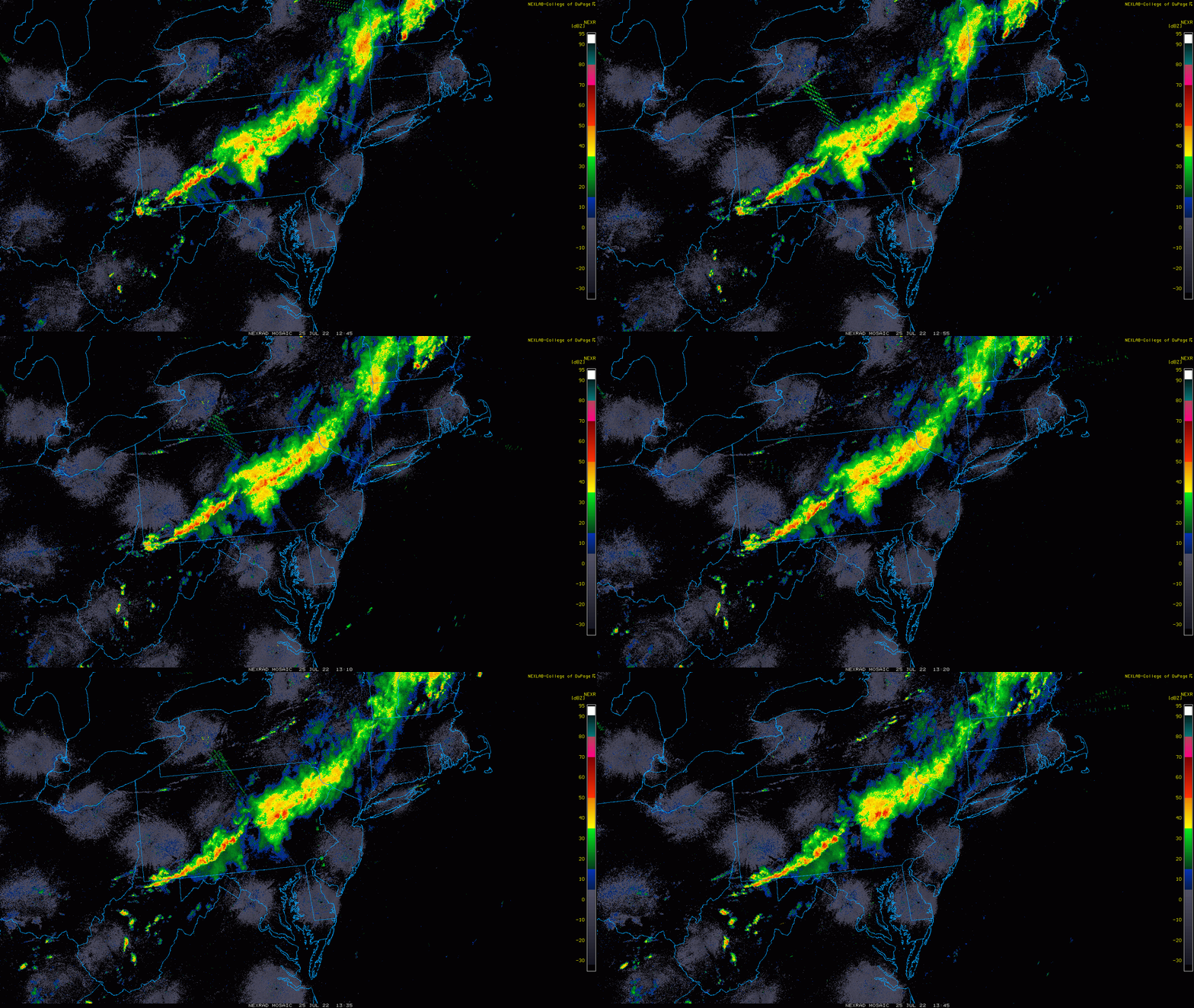
Showers and embedded thunderstorms are cutting across Pennsylvania during the late morning hours. Showers and strong-to-severe thunderstorms are a threat for DC, Philly and NYC from early-to-mid afternoon through the evening hours. Images courtesy College of DuPage, NOAA
Overview
The first extended heat wave of the summer in the Mid-Atlantic/Northeast US will break today with the arrival of a frontal system that is currently producing showers and embedded thunderstorms in upstate Pennsylvania. The chance of showers will increase in the I-95 corridor by the early-to-mid afternoon and while not every location will get hit, a strong-to-severe thunderstorm is possible right into the late evening hours. Much more comfortable conditions will take place on Tuesday with below-normal temperatures and another cooler-than-normal air mass is destined to come this way for the upcoming weekend. The past weekend featured some excessive heat in the DC-to-Philly-to-NYC corridor with a run to the 100 degree mark on both days.
The front that breaks the back of the heat wave will encounter a general west-to-east flow of air aloft over the next 24 hours and this will result in a stalling-out of the boundary zone across the southern Mid-Atlantic. Its close proximity will keep it unsettled in much of the region during the remainder of the work week with the next chance of showers and thunderstorms coming on Tuesday night. Map courtesy NOAA, tropicaltidbits.com
Details
The first extended heat wave of the summer in the Mid-Atlantic/Northeast US will break today upon the arrival of a frontal system that is currently generating showers and embedded thunderstorms. While temperatures today can reach 90+ degrees in the I-95 corridor, it won’t be the excessive heat of the past couple of days and there will be quite a stiff breeze and lots of cloud cover to help reduce the discomfort levels. While not every location will get hit, showers and strong-to-severe thunderstorms can impact the DC-to-Philly-to-NYC corridor anytime from the early-to-mid afternoon hours to the late evening as the frontal system inches its way across the area from northwest-to-southeast.
It becomes much more comfortable on Tuesday in the Mid-Atlantic/NE US and another comfortable air mass is destined to arrive here the for the upcoming weekend. Map courtesy NOAA, tropicaltidbits.com
On Tuesday, temperatures should actually stay below-normal in many portions of the Mid-Atlantic/NE US with afternoon highs, for example, confined to the low-to-mid 80’s in Philly where normal highs are about 88 degrees (at PHL). Given the general west-to-east air flow in the upper part of the atmosphere, this front will have difficulty pushing too far to the south and east over the next 24 hours or so and is likely to stall out later tomorrow in the southern Mid-Atlantic region. As such, it’ll stay unsettled around here for the remainder of the work week with additional chances for showers and thunderstorms to go along with overall seasonal temperatures. In fact, the next chance of showers and thunderstorms is likely to come on Tuesday night in at least parts of the Mid-Atlantic. Another cool front will head this way late in the week and all signs point to this next one having more “push” behind it and a comfortable air mass is likely to follow its passage for the upcoming weekend.
As far as the past weekend goes, temperatures did indeed make a run to 100 degrees on both days in the I-95 corridor. In Philly, the official high temperatures on Saturday and Sunday were 98 and 99 degrees respectively. In Washington, D.C., Reagan National Airport (DCA) surged to 96 degrees on Saturday and 94 degrees on Sunday. In NYC, highs were 95 degrees in Central Park and 96 degrees at JFK Airport on each weekend day. The airport at Newark, New Jersey (EWR) - which often runs a few degrees hotter than nearby airports (urban heat island) – actually did reach triple digits with readings of 101 degrees on Saturday and 102 degrees on Sunday.
Meteorologist Paul Dorian
Arcfield
arcfieldweather.com
Follow us on Facebook, Twitter, YouTube
Video discussion:


