1:50 PM | **Showers/storms are popping in the Mid-Atlantic region and there can be some heavy rainfall in the DC-to-Philly-to-NYC corridor**
Paul Dorian
Overview
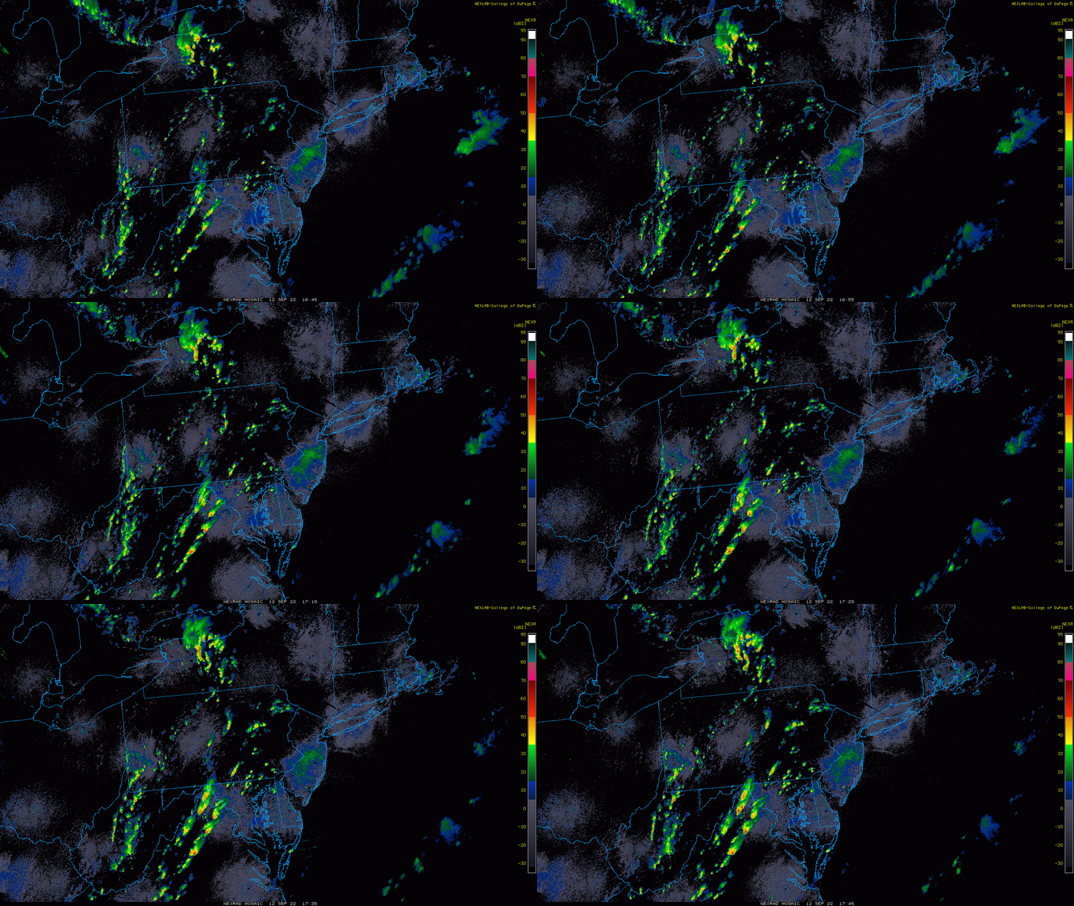
The combination of a vigorous upper-level trough of low pressure and an approaching cold front is setting off the development of numerous showers and thunderstorms in the Mid-Atlantic region and some of these can result in heavy rainfall from this afternoon into later tonight. The showers and storms can reach the DC and Philly metro regions anytime after 2 pm and then during the late afternoon hours in the NYC metro region and the threat in all places will continue into late evening. The front pushes through the region later tomorrow setting the stage for some nice weather on Wednesday, Thursday and Friday.
Details
A warm front pushed northward through the Mid-Atlantic region this morning and warm and humid air has followed with clouds breaking for partial sunshine. With the daytime heating, the atmosphere has become more and more destabilized with contributions to the instability being made by an approaching vigorous upper-level low pressure system. Showers and thunderstorms have broken out and are now advancing towards the DC and Philly metro regions and can reach NYC later in the day and continue and the threat can continue in all places until late evening. As has been the case in recent weeks, the showers and thunderstorms will be of the “hit or miss” variety and not every location will get hit. However, heavy rain is a possibility just about anywhere in the I-95 corridor and with the recent heavy rainfall, watch out for the possibility of localized flash flooding in some spots.
The cold front passes through the Mid-Atlantic region later tomorrow and morning clouds should give way to afternoon sunshine and an incoming refreshing air mass will become quite noticeable tomorrow night as cooler, less humid conditions develop. High pressure and a secondary cool front at mid-week will result in a stretch of very nice weather from Wednesday through Friday and it could very well last right through the upcoming weekend.
Meteorologist Paul Dorian
Arcfield
arcfieldweather.com
Follow us on Facebook, Twitter, YouTube
Video discussion:


