1:10 PM (Monday) | ***Severe thunderstorms a threat again for later today/early tonight in the Mid-Atlantic region…a somewhat similar repeat performance expected on Tuesday, Independence Day***
Paul Dorian

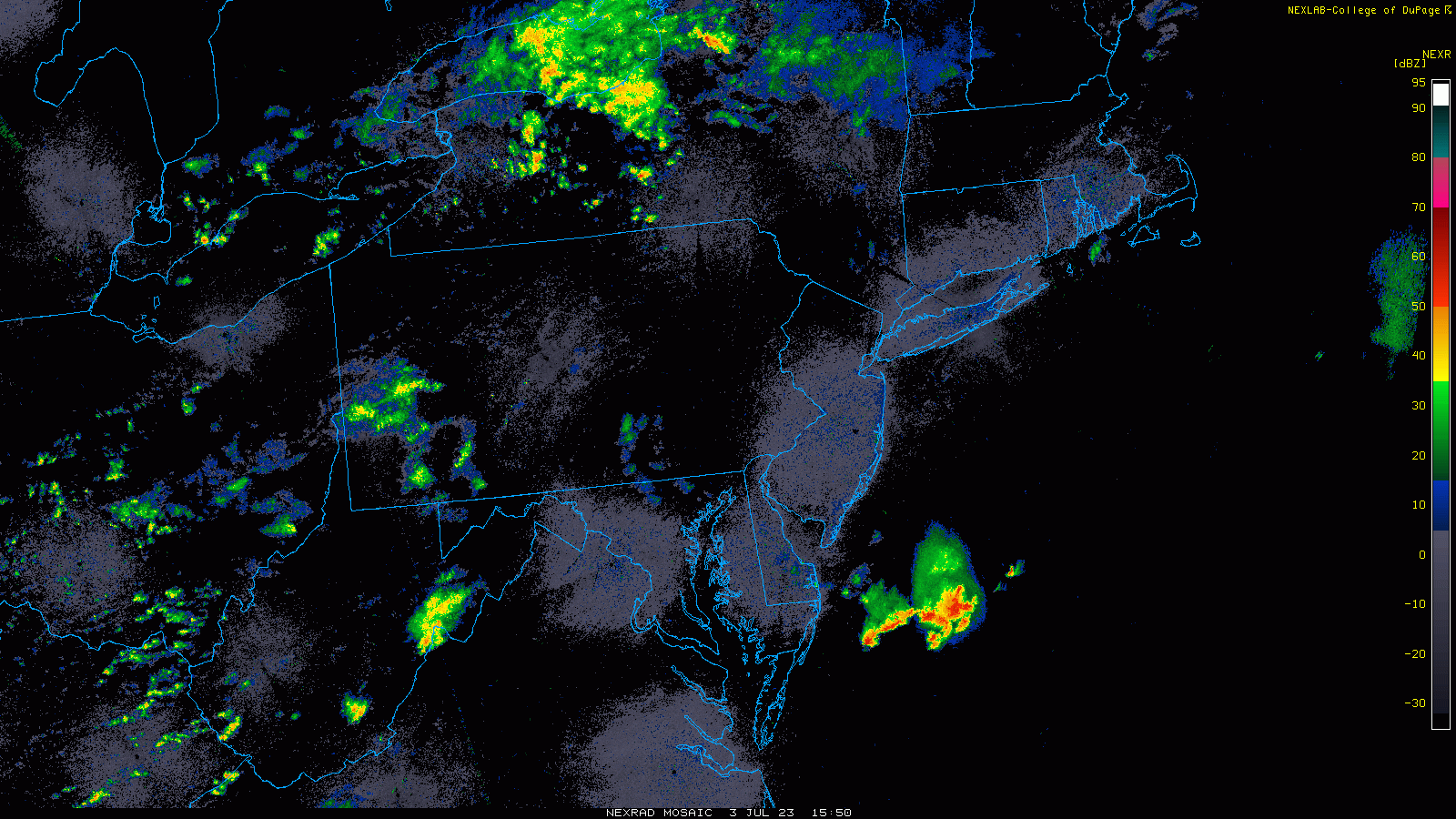
Radar echoes are expanding in coverage this afternoon across the western part of the Mid-Atlantic region. The threat of showers and thunderstorms will increase in the eastern Mid-Atlantic region during the mid and late afternoon hours and continue into the evening. Images courtesy College of DuPage, NOAA
Overview
The combination of an upper-level trough, high moisture content in the lower atmosphere, and a weak frontal boundary zone will be enough to result in very unstable atmospheric conditions in the Mid-Atlantic region from later today into early tonight enhancing the chance for severe thunderstorm activity. A somewhat similar setup will continue the chance of showers and thunderstorms on Tuesday, the 4th of July, with the greatest chance once again coming during the afternoon and early evening hours. Not all areas will get hit during this next 36 hours, but any thunderstorm that does form can contain torrential downpours, damaging wind gusts, hail and even an isolated tornado or two. The overall unsettled weather pattern that began in late June may relax a bit on Wednesday and Thursday; however, it should resume in full force by the end of the shortened work week and continue through the upcoming weekend.

The threat for severe thunderstorms later today/early tonight is “enhanced” is the southern Mid-Atlantic and slight in the northern Mid-Atlantic according to NOAA’s Storm Prediction Center.
Details
The atmosphere will become increasingly unstable this afternoon as a combination of ingredients comes together in the Mid-Atlantic region. The end result will be the increasing chance for showers and thunderstorms as we go through the afternoon hours and into the early evening. Any thunderstorm that forms later today can reach severe status and generate heavy rainfall, damaging wind gusts, hail, and even an isolated tornado or two.

Several ingredients are coming together today in the Mid-Atlantic region to create unstable conditions and one of them is an upper-level trough of low pressure moving east from the Ohio Valley. Map courtesy NOAA, tropicaltidbits.com
The main factors involved in the generation of unstable conditions include an upper-level trough that is pushing eastward from the Ohio Valley to the Mid-Atlantic, a weak surface frontal system, and plenty of low-level moisture in the Mid-Atlantic region with dew points near 70 degrees in many spots. Throw some daytime heating into this mix with the partly sunny skies and the atmosphere will become quite primed for the development and intensification of shower and thunderstorm activity as we go through the afternoon hours and into the early evening.
Unfortunately, the Independence Day holiday on Tuesday may not be much different than today in terms of the prospects for showers and thunderstorms. The aforementioned frontal system will stick around the area on Tuesday and low-level moisture content will remain high enough to be supportive of additional showers and thunderstorms on the holiday. The highest chance of showers and thunderstorms on Tuesday will come during the afternoon and early evening hours and likely along and to the northwest of Route I-95 where terrain can become a focus area for convection initiation. There is some hope that dry conditions will develop by later in the evening for the usual timing of fireworks displays (i..e., 9:30 pm or so).
This same frontal system will tend to fall apart at mid-week and the chance for showers and thunderstorms will be somewhat diminished as a result on Wednesday and Thursday; however, isolated activity cannot be completely ruled out on either day. With the approach of another frontal system on Friday, the unsettled weather pattern should resume in full force and it’ll continue through the weekend with a daily shot at showers and thunderstorms.

The month of June ended with cooler-than-normal conditions in much of the eastern US and Southwest US with above-normal conditions across the Northern Plains and Texas/Louisiana. Data courtesy NOAA, Prism (Oregon State University), Dr. Ryan Maue (Twitter)
One final note, if you thought June was on the cool side of normal in the Mid-Atlantic region, you were correct. The month of June ended up 2.9 degrees below-normal in Philadelphia, 2.2 degrees below-normal in D.C., and 2.0 degrees cooler-than-normal in Central Park (NY). Temperatures reached the 90 degree mark for highs only once during the entire month in both Philadelphia and New York City and only four times in Washington, D.C. The month of May was also cooler-than-normal in all three Mid-Atlantic locations.
Meteorologist Paul Dorian
Arcfield
arcfieldweather.com
Follow us on Facebook, Twitter, YouTube
Video discussion: