**Low pressure to bring beneficial rainfall to much of the Mid-Atlantic region...some locations will see all snow for awhile or a mixture of snow and rain**
Paul Dorian

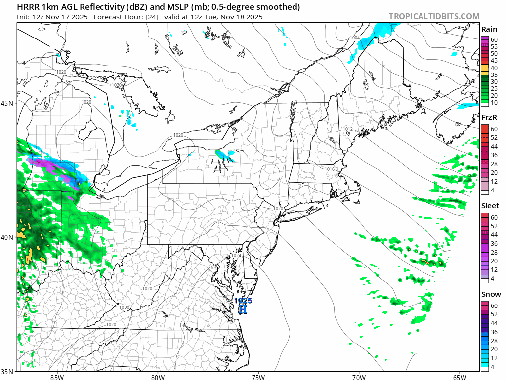
Low pressure will move eastward on Tuesday from the Midwest to the Mid-Atlantic region bringing with it some much needed rainfall and, in some areas, snowflakes will mix in at times. Maps courtesy NOAA (12Z HRRR)
Overview
It has been quite dry in the Mid-Atlantic region during the past several weeks with below-normal rainfall so far during November, and this dry spell followed drier-than-normal months of September and October. While not expecting a heavy rain event, low pressure will bring some welcomed rainfall to portions of the Mid-Atlantic region from later Tuesday into Tuesday night with the highest totals likely along and south of the PA/MD border. And, with a cold, dry air mass in place, the rain could be mixed with snow at times in some of the suburbs north and west of the big cities along the I-95 corridor. Farther inland, there can even be some minor accumulation amounts of an inch or two in, for example, the region between State College and Scranton in upstate Pennsylvania.

While not a heavy rain event, some beneficial rainfall is coming to the Mid-Atlantic region with highest amounts likely along and south of the PA/MD border. Map courtesy NOAA, tropicaltidbits.com
Details
Colder-than-normal air pushed into the Mid-Atlantic region on Sunday following the passage of a strong cold front and it was ushered in on strong northwesterly winds that gusted to 50 mph or so. These same northwest winds will be a noticeable factor throughout the rest of today, and then they’ll die down later tonight with high pressure building into the area. On Tuesday, temperatures will remain below normal for this time of year and - just as important in terms of prospects for any frozen precipitation - dew points will be quite low as well, indicative of a very dry air mass. After a clear start to the day, clouds will thicken during the late morning hours as low pressure starts to head in this direction from the Midwest.
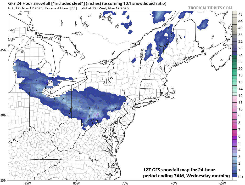
With a cold, dry air mass in place, some of the rain that heads into the Mid-Atlantic region later Tuesday and Tuesday night could be mixed with snow at times; especially, in those higher elevation areas north of the PA/MD border. Map courtesy NOAA, tropicaltidbits.com
On Tuesday afternoon, the leading edge of the precipitation shield will make inroads into the Mid-Atlantic region with rain possible from central PA to north-central MD. This rain shield will tend to be confined to near the PA/MD border for a few hours, and then as upper-level support moves in overhead, the precipitation shield will likely expand noticeably in coverage by the late evening hours on Tuesday. In fact, precipitation is likely to encompass much of the Mid-Atlantic region by the late evening on Tuesday and it could last all the way to daybreak on Wednesday in many areas.

In terms of precipitation type, while certainly not a significant snow event, there can be some snowflakes mixing in at times from late Tuesday into the early morning hours on Wednesday in those higher elevation locations to the northwest of the big cities. Farther inland, there can even be some minor accumulation amounts on the order of an inch or two in, for example, the region from State College to Scranton in upstate PA.
Meteorologist Paul Dorian
Arcfield
arcfieldweather.com
Follow us on Facebook, Twitter, YouTube
Video discussion: