
**A cold Turkey Day on the way...powerful winds to set up by Thursday night and Friday…Great Lakes snow machine gets turned on during this Arctic outbreak...weekend storm Upper Midwest/GL/OV**
Paul Dorian
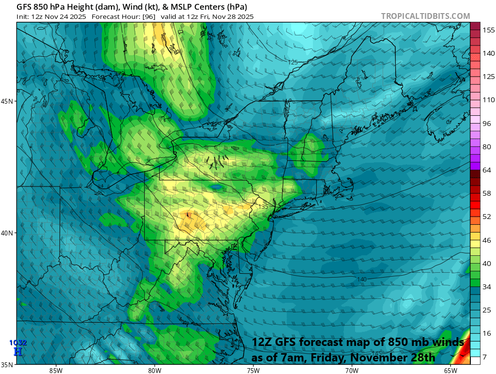
Powerful winds are likely to accompany this Arctic air outbreak from late Thursday through Friday across the northeastern states. Map courtesy NOAA, tropicaltidbits.com
Overview
It is looking like a cold Turkey Day across the Mid-Atlantic region with well below-normal temperatures following the mid-week passage of a strong cold front. A secondary cold front arrives later Thursday, and winds will increase markedly on Thursday night and Friday behind this second frontal passage to go along with the colder-than-normal conditions. The chill will stick around right into the upcoming weekend throughout the northeastern part of the country. In terms of snow, this late week Arctic air outbreak will be the catalyst for another Great Lakes snow event in those areas just downstream of the still relatively warm waters and, in some cases, it may be intense with substantial lake-effect snow accumulations. Looking to the weekend, a new storm system could bring significant snowfall to portions of the Upper Midwest, Ohio Valley and again the Great Lakes region.

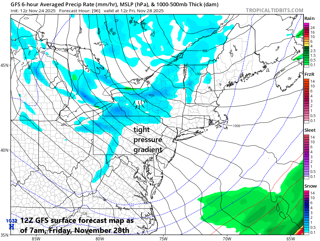
The Great Lakes snow machine will get turned on full throttle with this late week Arctic air outbreak and, in some spots, this can result in substantial snowfall amounts. Map courtesy NOAA, weathermodels.com
Details
As a strong cold front approaches the northeastern part of the nation, the overall pattern will evolve into a wet one from later Tuesday into late Tuesday night with beneficial rainfall coming to the Mid-Atlantic region. As the front closes in on Wednesday, there can be scattered shower activity and temperatures are likely to surge into the 60’s in much of the Mid-Atlantic region as a southwesterly flow of milder air will intensify on the front side of the cold frontal system. On the heels of the frontal passage, a much colder air mass will arrive in time to result in a cold Turkey Day in the DC-to-Philly-to-NYC corridor with daytime highs likely confined to the low-to-mid 40’s…well below normal for this stage of November.
In addition to the threat of intense snow bands just downstream of the Great Lakes, this late week Arctic air outbreak will likely be accompanied by powerful winds over a large part of the northeastern states. map courtesy NOAA, tropicalttidbits.com
A secondary cold front will then pass through later Thursday, and this will usher in even colder air leading to strong cold air advection. Also, an incoming area of high pressure from the west will combine with the departing low pressure system over Canada to set up a tight pressure gradient in the Mid-Atlantic region. The result will be a very windy period from Thursday night though Friday to go along with the much colder-than-normal air temperatures. The high-pressure system will slide close by from Friday night into Saturday which will help to relax the winds. Temperatures will, however, remain on the cold side of normal through the first half of the weekend and then there may be slight moderation on Sunday.
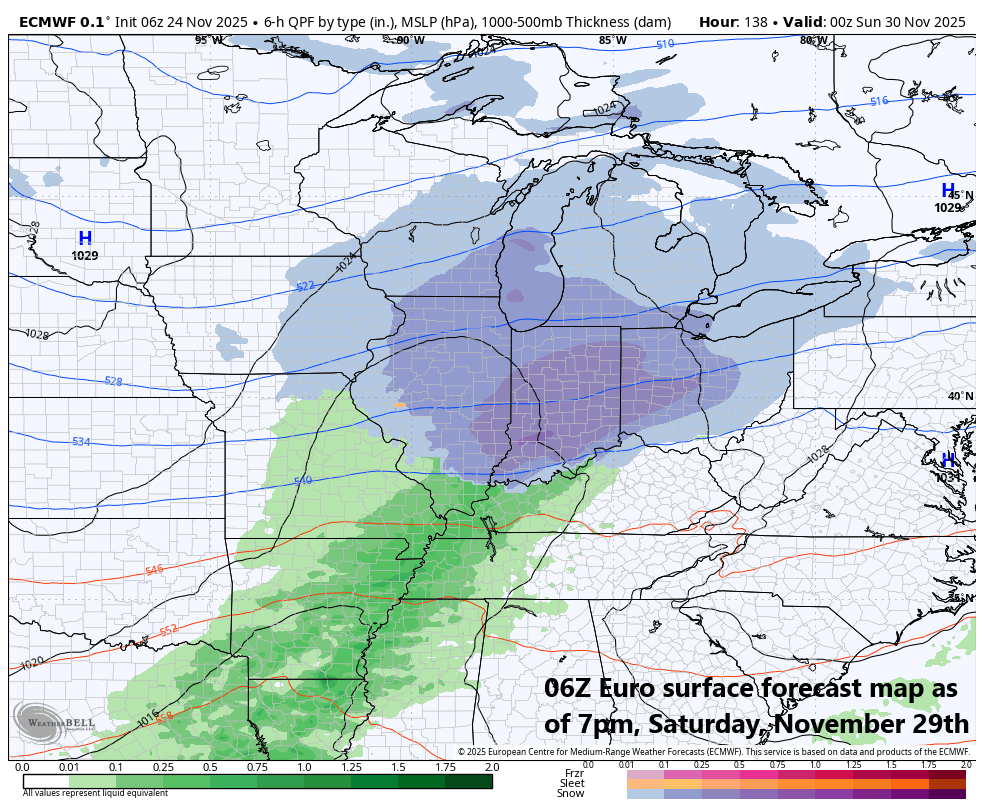
A new storm system can bring significant snowfall this weekend to the Upper Midwest, Ohio Valley and Great Lakes. Map courtesy ECMWF, Weather Bell Analytics
In terms of snow, this late week Arctic air outbreak is likely to result in an intense Great Lakes snow event with numerous snow bands impacting those areas just downstream of the lakes. The combination of Arctic air flowing over the still relatively warm waters of the Great Lakes will destabilize the atmosphere in a significant way and this could lead to substantial snow amounts in some areas just downstream of the lakes. As an example, the Upper Peninsula region of Michigan could see a foot or more of snow and places like Buffalo and Watertown in New York State can experience very heavy snow bands as well. The combination of heavy snow bands and powerful winds could certainly wreak havoc on travel late this week for many spots in the Great Lakes region. Farther south and east, it is certainly possible that some snow showers make their way into the immediate I-95 corridor between late Thursday and Friday night to go along with the strong winds and Arctic chill. Looking ahead to the weekend, a new storm system could bring substantial snowfall to the Upper Midwest, Ohio Valley and once again, to portions of the Great Lakes.
Meteorologist Paul Dorian
Arcfield
arcfieldweather.com
Follow us on Facebook, Twitter, YouTube
Video discussion: