
***Strong cold front barrels through the area early Friday...brings heavy rain, powerful winds, and maybe even a gusty thunderstorm...temperatures rise later tonight and then drop sharply on Friday***
Paul Dorian

The powerful cold front is likely to arrive in the DC-to-Philly-to-NYC corridor between 6 and 9 am and it can produce downpours and maybe even a gusty thunderstorms. Temperatures will climb to very mild levels ahead of the front late tonight and then drop sharply behind it during the mid-day and afternoon hours on Friday. Map courtesy NOAA, Weather Bell Analytics
Overview
A strong cold front will barrel through the region early Friday morning, and this system will bring us heavy rain, powerful winds, and maybe even a gusty thunderstorm. Winds will be strong ahead of the front from late tonight into early Friday, gusting up to 45 mph or so from a southwesterly direction, and then they’ll shift to northwesterly following the frontal passage. After a brief lull in the winds immediately surrounding the frontal passage, they’ll pick up markedly during the mid-day and afternoon hours...potentially gusting to 50+ mph. Temperatures will act in a topsy-turvy fashion during the next 24 hours in that they’ll rise into the 50’s later tonight in most areas and then drop sharply into the 30’s during the day on Friday on the heels of the frontal passage. Snow showers are very likely to develop on Friday across some of the higher elevation interior locations and one or two of these can make their way all the way into the I-95 corridor. The weather will settle down for the weekend with dry conditions expected on both days and a moderate chill in the air and another colder-than-normal air mass will arrive for the start of next week.
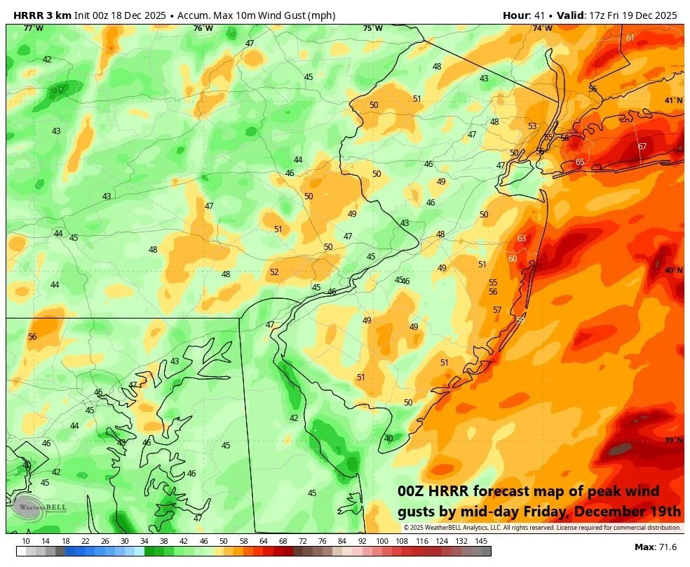
Winds will be quite strong both ahead of the incoming cold front and on the heels of its passage. On the front side, southwesterly winds can gust to 45 mph or so in the Mid-Atlantic region and on the back side, they can gusts to 50+ mph from a northwesterly direction. Map courtesy NOAA, Weather Bell Analytics
Details
Temperatures actually climbed to seasonal levels on Wednesday - for the first time since before Thanksgiving Day in many areas - and they’ll return to relatively mild levels this afternoon as any sun that is around will give way to increasing clouds. Rain is likely to break out in the DC-to-Philly-to-NYC corridor later this evening, and it will become heavy at times during the overnight hours with a gusty thunderstorm possible. Winds will increase in intensity later tonight from a southwesterly direction ahead of the cold front and can gust to 45 mph or so. Temperatures will rise in the overnight hours reaching very mild levels in the 50’s before daybreak on Friday.

The upcoming rain event associated with an incoming strong cold front will be a soaker in much of the Mid-Atlantic region with more than inch likely to fall from the overnight hours into Friday morning. Map courtesy NOAA, Weather Bell Analytics
The strong cold front will likely barrel through the DC-to-Philly-to-NYC corridor in the 6-9 AM period...just in time for the AM commute in many areas. A line of heavy showers and embedded gusty thunderstorms is likely to accompany the front and this certainly can have an impact on travel conditions during the morning hours on Friday. After a brief lull in the winds surrounding the frontal passage, NW winds will intensify noticeably during the mid-day and afternoon hours and can gust to 50+ mph in the Mid-Atlantic region. Temperatures will drop sharply behind the front, likely into the 30’s in most areas from their very mild levels in the 50’s at the start of the day.
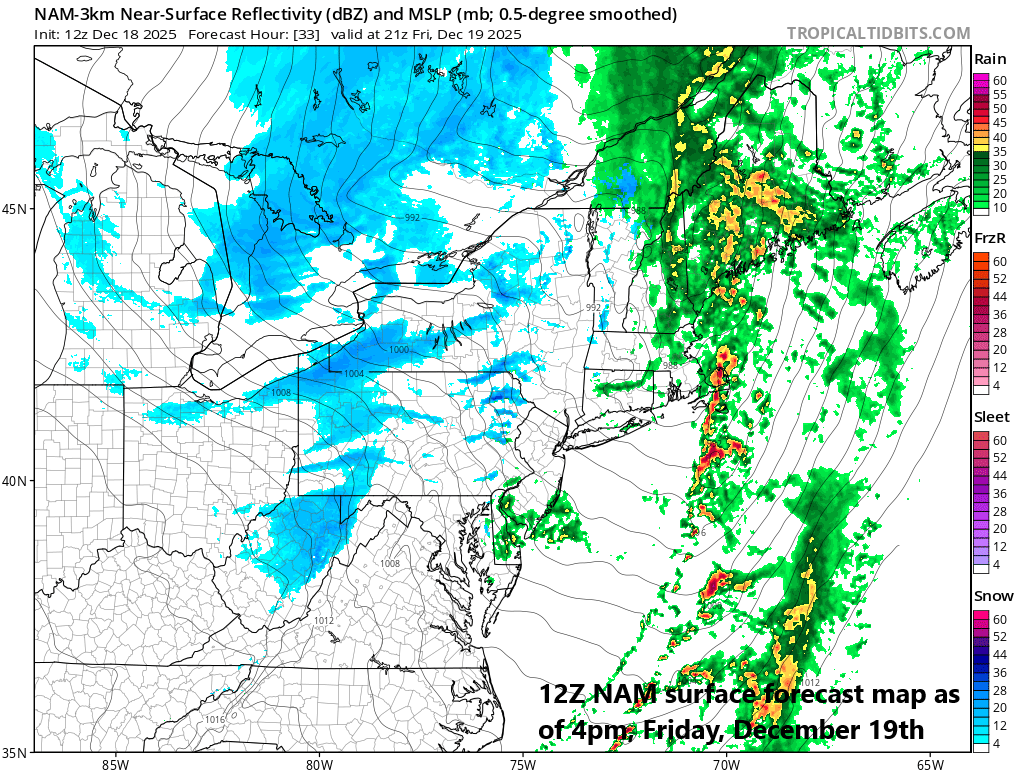
Snow showers will form on Friday just downstream of Lakes Erie and Ontario (shown in blue) as cold air flows over the still relatively warm waters. A few of these snow showers can make their way all the way into the immediate I-95 corridor by later in the day. Map courtesy NOAA, tropicaltidbits.com
Meanwhile, just downstream of the Great Lakes, snow showers will develop on Friday morning across the interior higher elevation locations of the Mid-Atlantic region. A few of these snow showers may even make it all the way into the immediate I-95 corridor during the mid-day or afternoon hours. Winds will remain strong on Friday evening but then diminish in the wee hours of Saturday morning as high pressure edges closer to the Mid-Atlantic region. The weekend will be relatively quiet with dry conditions, moderate chill, and light winds. Another cold front pushes through the Mid-Atlantic region late on Sunday and it’ll usher in another colder-than-normal air mass for the beginning of next week.
Meteorologist Paul Dorian
Arcfield
arcfieldweather.com
Follow us on Facebook, Twitter, YouTube
Video discussion: