
*Big-time relief comes by Friday, August 1st...transition from the high heat to colder-than-normal weather comes with heavy rainfall/possible flash flooding Thursday PM...a spectacular weekend*
Paul Dorian

The “transition” from today’s high heat and humidity to the much cooler conditions expected on Friday will come with some heavy rainfall and localized flash flooding is on the table. Map courtesy ECMWF, Pivotal Weather
Overview
Temperatures on Tuesday afternoon peaked at 98 degrees in Philadelphia - tying a record for the date from 2002 – and most other sections in the Mid-Atlantic region experienced high heat and humidity. Today will also be a day of high heat and humidity, but big-time relief is coming by Friday and it’s not out of the question that jackets may be required as we close out the work week (and begin the new month of August). A slow-moving cold frontal system will approach the area later tonight from the north and west, but then only be able to inch its way through the Mid-Atlantic region from tomorrow into tomorrow night as low pressure forms along its boundary zone.
Showers and thunderstorms are likely to be somewhat limited in coverage later today and tonight and then they should become more numerous and widespread on Thursday afternoon and night. Some of the rain will be heavy at times during the PM hours on Thursday, some of the storms can be strong-to-severe, and localized flash flooding is on the table. Showers may linger on Friday – the first day of August - and the day will feature a stiff east-to-northeast wind with low pressure pulling away from the east coast. Clearing skies will set in late Friday night and the first weekend of August may turn out to be the nicest weekend of the entire summer season with comfortable temperatures and low humidity levels.
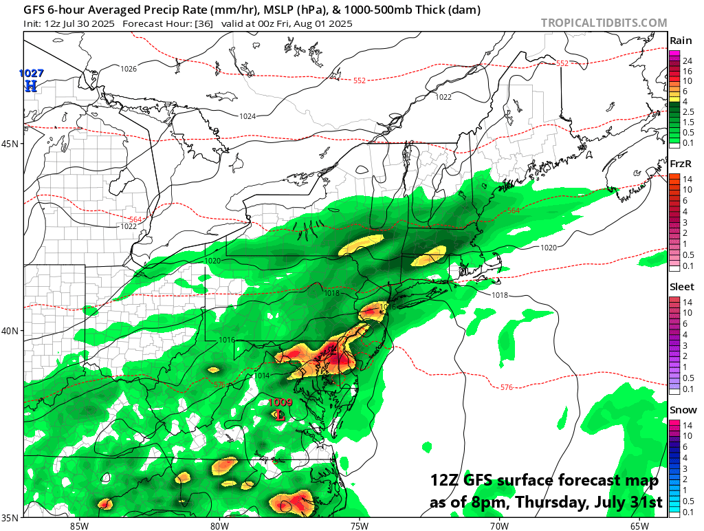
Low pressure will form along a frontal boundary zone on Thursday and enhance rainfall amounts…an east-to-northeast flow of air will develop by tomorrow night for much of the Mid-Atlantic region and continue on Friday, August 1st. Map courtesy NOAA, tropicaltidbits.com
Details
Temperatures will reach well up into the 90’s again this afternoon in most of the Mid-Atlantic region, but big-time relief is on the horizon...in fact, jackets may be required as we end the work week on Friday (and begin the month of August). A slow-moving cold frontal system - backed up by strong “Canadian-borne” high pressure - will push south and east across the Great Lakes today and will approach the Mid-Atlantic/Northeast US by later tonight. This frontal system will take its time in its advancement to the south and east on Thursday and Thursday night as low pressure forms along its boundary zone.

High temperatures on Friday will be some fifteen degrees below-normal in the Mid-Atlantic/NE US for the first day of August. Map courtesy NOAA, weathermodels.com
Showers and thunderstorms will form later today and tonight across the Mid-Atlantic region, but likely only on an “isolated-to-scattered” basis. More numerous and widespread showers and thunderstorms are likely from tomorrow afternoon through tomorrow night as the front grinds its way through the region. Some of the rain on Thursday afternoon and night is likely to be heavy at times, some of the storms can be strong-to-severe, and localized flash flooding is on the table. The likely general rainfall amount during this “transition” weather event is 1-2 inches; however, there is the potential of as much as 3-5 inches in some spots.

The month of August will get off to a cooler-than-normal start across much of the nation (shown in blue). Map courtesy ECMWF, Weather Bell Analytics
On Friday, low pressure will slowly pull away from the east coast and there will be mostly cloudy skies and lingering showers in much of the I-95 corridor and especially along coastal sections. In addition, the first day of the new month will feature well below-normal temperatures and a stiff east-to-northeast wind that will develop in a counter-clockwise fashion around the departing low pressure system. Clearing skies should develop by late Friday night and the weekend is likely to turn out to be one of the nicest of the entire summer season with comfortable temperatures and low humidity levels.
Meteorologist Paul Dorian
Arcfield
arcfieldweather.com