
Tuesday PM - ****Strong-to-severe thunderstorms later today/early tonight...tropical downpours with possible flash flooding...similar scenario likely later tomorrow****
Paul Dorian

Thunderstorms have formed across the central Mid-Atlantic region and will head east into an unstable atmosphere all along the I-95 corridor. Radar image courtesy NOAA, College of DuPage
Overview
The combination of an upper-level trough, a slow-moving surface frontal system, and an extremely humid air mass will result in strong-to-severe thunderstorms later today and early tonight and there can be a repeat performance later tomorrow. Any shower or thunderstorm in this tropical air mass can produce flooding rainfall given the well saturated nature of the grounds in the Mid-Atlantic region. Temperatures today have soared to 90+ degrees all along the DC-to-Philly-to-NYC corridor and the high humidity is making for a very uncomfortable day. The unsettled weather pattern continues from Thursday into Sunday with a daily shot at showers and thunderstorms.
The atmosphere has destabilized significantly during the past few hours leading to a high risk of strong-to-severe thunderstorms in DC, Philly and NYC from later today into tonight. Map courtesy NOAA/SPC
Details
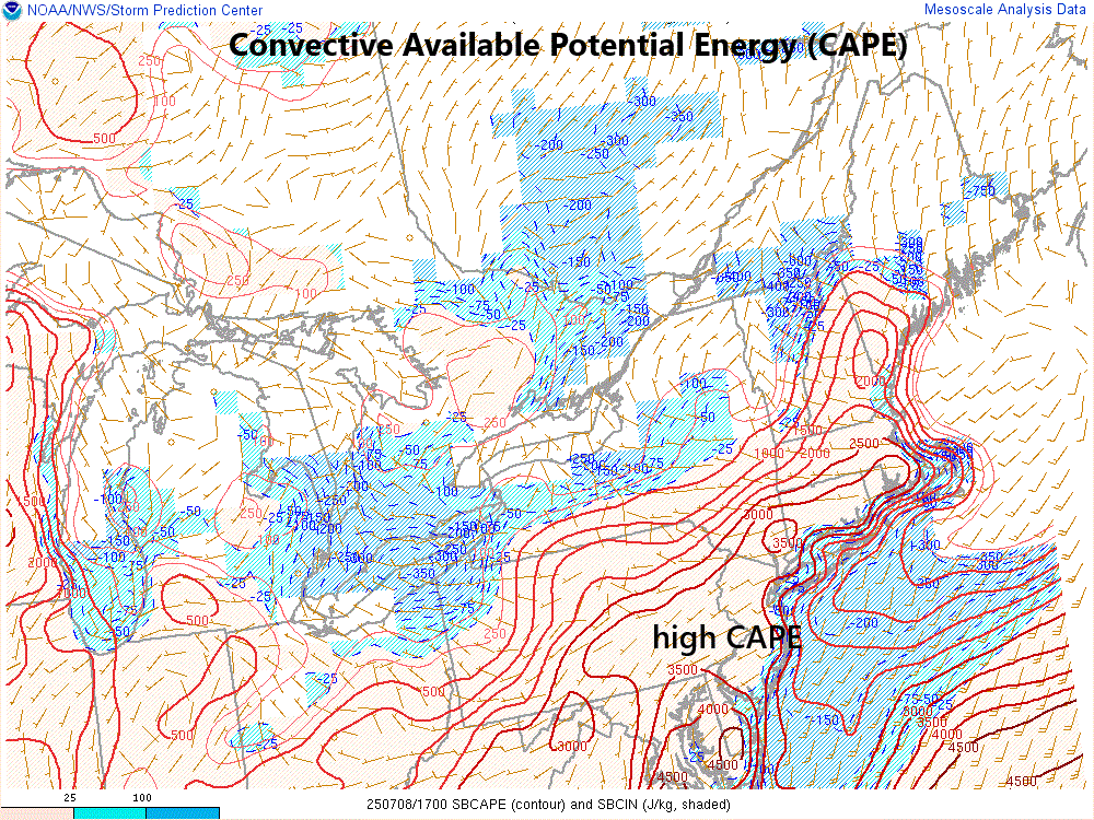
Thunderstorms are intensifying at this hour and widening in coverage across the central Mid-Atlantic region and these cells are heading east towards the I-95 corridor with a likely arrival timetable of 3-9pm. The atmosphere is quickly destabilizing as strong surface heating is combining with a very moist boundary layer that features dewpoints way up middle 70’s. One metric used to assess stability in the lower atmosphere is called “Convective Available Potential Energy (CAPE)” and it has increased dramatically during the past few hours with the strengthening of upward motion.
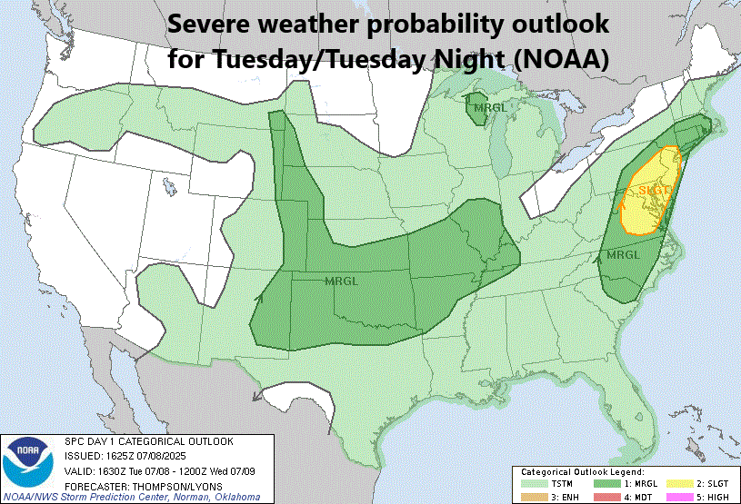
Severe weather probability outlook for later today and tonight as predicted by NOAA’s Storm Prediction Center.
Given the already well-saturated grounds in the Mid-Atlantic region and the very high moisture levels in the atmosphere, the greatest concern for later today/early tonight is flash flooding. However, steepening low-level lapse rates can produce strong downdrafts in thunderstorm cells which raises the risk of wind damage in some spots. The surface frontal system that plays a role in today’s severe weather threat will hang around on Wednesday and the PM hours tomorrow are likely to feature a similar performance by the atmosphere in the Mid-Atlantic region with strong-to-severe thunderstorms and flooding downpours. The weather pattern remains unsettled in the Thursday-to-Sunday time period with a continuing shot each day of PM showers and thunderstorms.
Meteorologist Paul Dorian
Arcfield
arcfieldweather.com
Follow us on Facebook, Twitter, YouTube
Video discussion: