**A brief taste of winter this weekend across the Great Lakes, Mid-Atlantic, Northeast US**
Paul Dorian
Overview
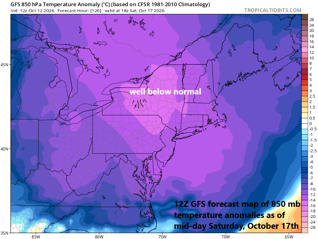
The next couple of days will feature quite warm conditions across the Great Lakes, Mid-Atlantic, and Northeast US with temperatures well above normal for the middle of October. However, a big change is coming for the weekend, and it will result in the first taste of winter to the same part of the country. A strong cold front should pass through the northeastern states on Friday night, and the weekend may feature temperatures way down in the 30’s in many spots and “lake-effect” snow showers are possible just downstream of the still relatively warm Great Lakes. The chill down will be brief, and warmer weather returns next week, but for a couple of days this weekend, it may be difficult to have thoughts about the upcoming winter season.
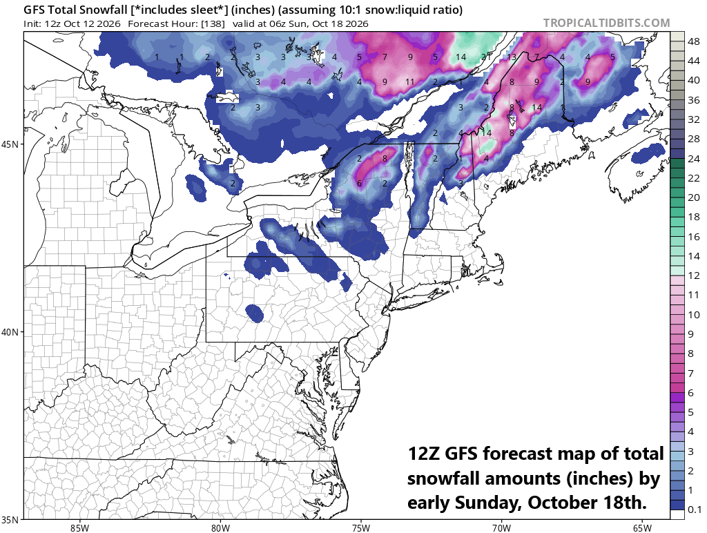
With cold air flowing over the still relatively warm waters of the Great Lakes, the first “lake-effect” snows of the season could fall later Friday night into Saturday in those prone areas just downstream of the lakes. Following a strong cold frontal passage, winds will become quite strong from a N-NW direction and this transfer of cold air above warm water will allow for the atmosphere to destabilize enough to generate “lake-effect” snow showers and accumulations are even possible across upstate NY and New England. Map courtesy NOAA, tropicaltidbits.com
Details
Temperatures could peak in the lower to middle 80’s in parts of the Great Lakes, Mid-Atlantic and Northeast during the next couple of days, which is well above normal for this time of year, but a strong cold front at week’s end will bring about big-time changes for the upcoming weekend. Actually, there will be an initial frontal passage late Wednesday that may knock off about ten degrees or so from Thursday’s afternoon highs as compared with Wednesday, but an even bigger impact will come following the second and stronger cold frontal passage on Friday night. That second front could be accompanied by shower activity in the northeastern states and maybe a thunderstorm or two, but this will likely not be a heavy rain event.
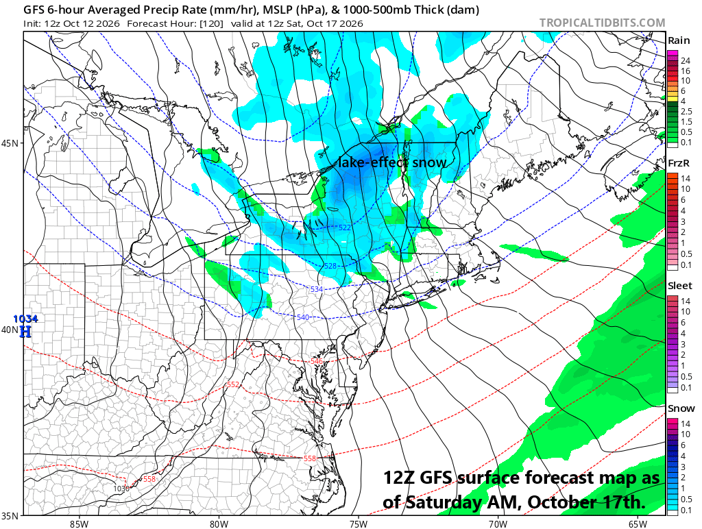
Following a cold frontal passage on Friday night, the pressure gradient will tighten in the northeastern states between departing low pressure and incoming high pressure and this will result in stiffening N-NW winds to add to the taste of winter as temperatures drop markedly. Map courtesy NOAA, tropicaltidbits.com
By late Friday night, following the passage of the strong cold front, Arctic air will begin pouring into the northeastern states on strong N-NW winds and temperatures here this weekend will be a far cry than they will be at mid-week. As the cold air flows over the still relatively warm waters of the Great Lakes, the first “lake-effect” snows are likely to form just downstream of the lakes with some accumulations on the table; especially, in some of the higher elevations of upstate NY and New England.
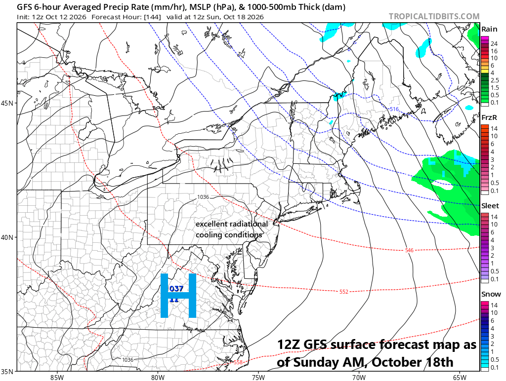
Temperatures could drop markedly on late Saturday night/early Sunday morning with the possibility of excellent radiational cooling conditions thanks to large high pressure sitting overhead of the Mid-Atlantic. This system raises the chance for clear skies and light winds and throw in an Arctic air mass and you may have the first frost or freeze of the season in some spots. Map courtesy NOAA, tropicaltidbits.com
On Saturday, high temperatures in the Mid-Atlantic’s I-95 corridor will likely be confined to the 50’s and overnight lows going into early Sunday should be well down in the 30’s. In fact, with high pressure sitting overhead, radiational cooling conditions may be fabulous (clear skies, light winds) for temperatures to plunge to near freezing in some suburban locations along the I-95 corridor...potentially the first frost (or freeze) in some spots.
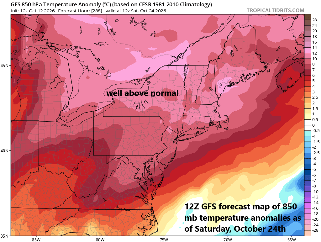
Once high pressure pushes off the eastern seaboard early next week, it’ll open the door for a rebound in temperatures across the northeastern states such that we’ll be well above normal for the middle and latter parts of next week. Map courtesy NOAA, tropicaltidbits.com
Looking ahead, the high-pressure system that will nearby on Saturday night/Sunday morning will drift off the east coast early next week and this will open the door for low-level southwesterly flow to develop and a quick rebound in temperatures across the Great Lakes, Mid-Atlantic and Northeast US. By the middle and end of next week, highs are likely to return to the 70’s and 80’s once again in much of the northeastern quadrant of the country and the first taste of winter will be just a distant memory.
Meteorologist Paul Dorian
Arcfield
arcfieldweather.com
Follow us on Facebook, Twitter, YouTube
Video discussion: