****Some accumulating snow on Sunday night across eastern PA, New Jersey, and NYC...dynamical cooling results in changeover to snow to the north of the PA/MD border****
Paul Dorian

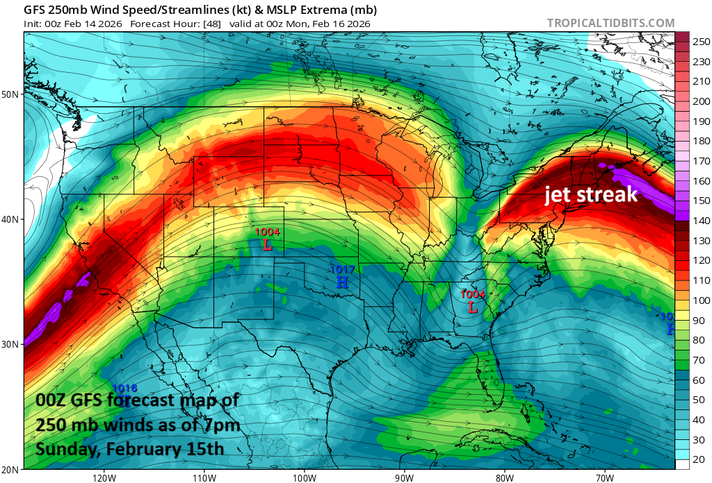
A key player in the late weekend storm will be an upper-level jet streak centered over the northeastern states which will lead to strong upward motion in the Mid-Atlantic region. As a result, dynamical cooling will likely result in a changeover to all snow near and to the north of the PA/MD border and accumulations of up to a few inches are on the table across much of eastern PA, NJ and the NYC metro region. Map courtesy NOAA, tropicaltidbits.com
Overview
A storm system that came ashore in California at mid-week is crossing the southern states and will spread its precipitation shield into the Mid-Atlantic region from later Sunday into Sunday night. The air mass will initially be only marginally cold enough to support frozen precipitation; however, dynamical cooling in the atmosphere associated with a strong upper level jet streak should result in more favorable conditions for snow by Sunday night across eastern Pennsylvania, New Jersey, and New York City and up to a few inches are on the table. To the south of the PA/MD border, rain is likely to be the predominate precipitation type in the immediate DC metro area with no accumulations expected. However, snow and/or ice can mix in across some of DC’s far northern suburbs, and the northern part of Maryland that is close to the Pennsylvania border and northern Delaware can certainly see some small accumulations.
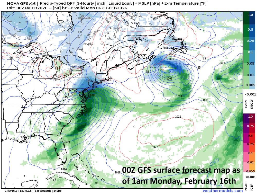
While precipitation may begin as a rain and snow mix to the north of the PA/MD border, dynamical cooling in the atmosphere should result in all snow across much of eastern PA, NJ and as far north as the NYC metro by later Sunday night. Plain rain will fall in the DC metro region, but there can be a mix of snow and/or ice in some of its far northern suburbs…northern MD/northern DE can certainly see some small snow accumulations. Map courtesy NOAA, weathermodels.com (Dr. Ryan Maue, X)
Details
Low pressure pushed through California at mid-week and is now crossing over the southern states as it heads in a general eastward direction towards the Mid-Atlantic coastline where it’ll reach by early Monday. There has been beneficial rainfall across the Deep South and even some severe thunderstorm activity across Texas and Louisiana and the risk of severe weather will shift to the southeastern states on Sunday.
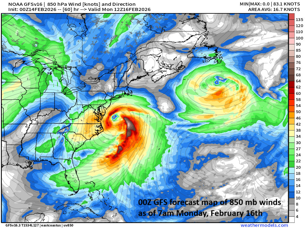
Low pressure will likely be situated just off the Mid-Atlantic coastline by early Monday with precipitation winding down across the Mid-Atlantic region. Map courtesy NOAA, weathermodels.com (Dr. Ryan Maue, X)
On Sunday, this low pressure system will continue to head in a general eastward direction - riding along the southern branch of the jet stream - and it’ll head towards the eastern seaboard. The moisture shield will extend northward into Mid-Atlantic region by later in the day on Sunday with only marginally cold air in place to support frozen precipitation…at least during the initial phase of the storm.
Breakdown in the Mid-Atlantic region
To the south of the PA/MD border…
it looks like plain rain will be the predominant type of precipitation in the immediate DC metro region with no accumulations expected; however, there is the chance for some mixing of snow and/or ice across some its far northern suburbs during the latter stage of the storm. In northern Delaware and northern Maryland, there can be a small snow accumulation; especially, in those areas right near the Pennsylvania border.
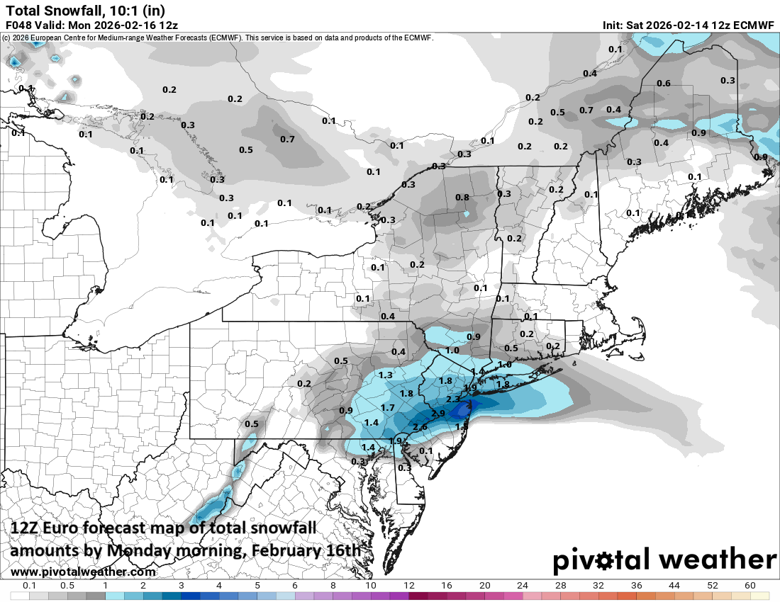
12Z Euro forecast map of total snowfall amounts by Monday morning, February 16th. Map courtesy ECMWF, Pivotal Weather
To the north (and east) of the PA/MD border…
Dynamical cooling in the atmosphere will result in enhanced upward motion and an increased chance of a changeover to snow across much of eastern Pennsylvania, New Jersey, and the NYC metro area. The dynamical cooling will be associated with an upper-level jet streak that will produce strong lifting in those areas to the north and east of the Mason-Dixon Line.
Snow accumulations of up to a few inches are on the table across much of eastern PA including the Philly metro, New Jersey, and likely as far north as the NYC metro. The bulk of the snow accumulations would take place the nighttime hours since the initial burst of precipitation on Sunday afternoon should feature rain or a mixture of rain and snow which should then change to all snow during the overnight hours. (This time of year is noted for cold air in the upper levels of the atmosphere so it is somewhat easier to get a “rain changing to snow” scenario). The storm pulls away from the coast on Monday morning leading to a moderately cold President’s Day holiday.
Stay tuned to arcfieldweather.com for updates…a very dynamic storm system.
Meteorologist Paul Dorian
Arcfield
arcfieldweather.com