***Still closely monitoring late weekend storm threat for the Mid-Atlantic region...highest impact could be along coastal sections from NJ to the Delmarva Peninsula to eastern VA***
Paul Dorian

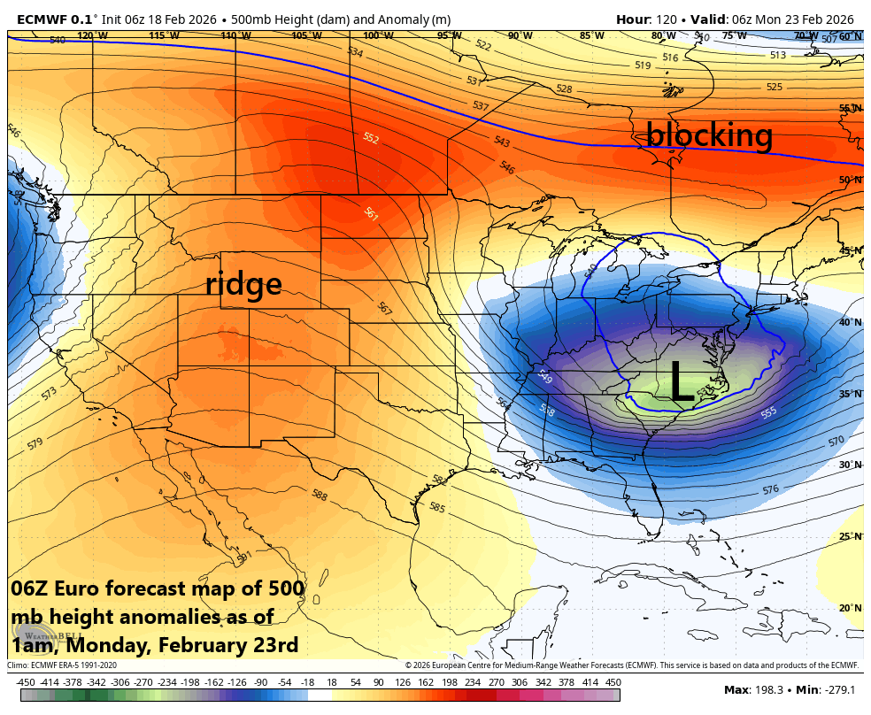
A few of the key upper atmosphere players to watch in coming days include a deep trough of low pressure centered over the Carolinas, blocking to the north over Canada, and a ridge of high pressure across the western states. Map courtesy ECMWF, Weather Bell
Overview
The threat of a late weekend storm system continues for the Mid-Atlantic region, and many details still must be ironed out to determine potential impact levels. The greatest impact may come in coastal sections from New Jersey to the Delmarva Peninsula to the eastern part of Virginia, still a few days away to fine-tune this idea. Low pressure will likely push towards the Carolina coastline by later Sunday and then intensify rapidly thereafter as it moves in an east-to-northeast fashion out over the open waters of the western Atlantic. The exact track and timing of the intensification of the low-pressure system remain open questions at this point int time and are critical in the determination of the ultimate impact in the Mid-Atlantic region.
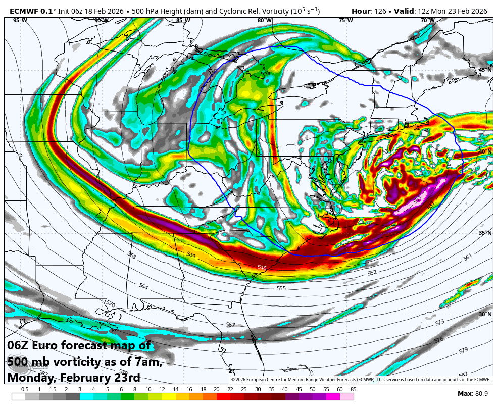
A complicated picture when it comes to the upper-level vorticity field by the early part of next week which makes for a difficult forecast this many days ahead of the possible event. Map courtesy ECMWF, Weather Bell
Details
The subtropical jet stream has become much more active in recent days leading to a change in the overall pattern that has produced much more precipitation in the western US compared to a recent dry stretch of weather for that part of the nation. As was the case last weekend, energy from the system impacting the western states will work its way to the east riding along the southern branch of the jet stream. Low pressure is likely to form over the southeastern states by Sunday and head towards the Carolina coastline.
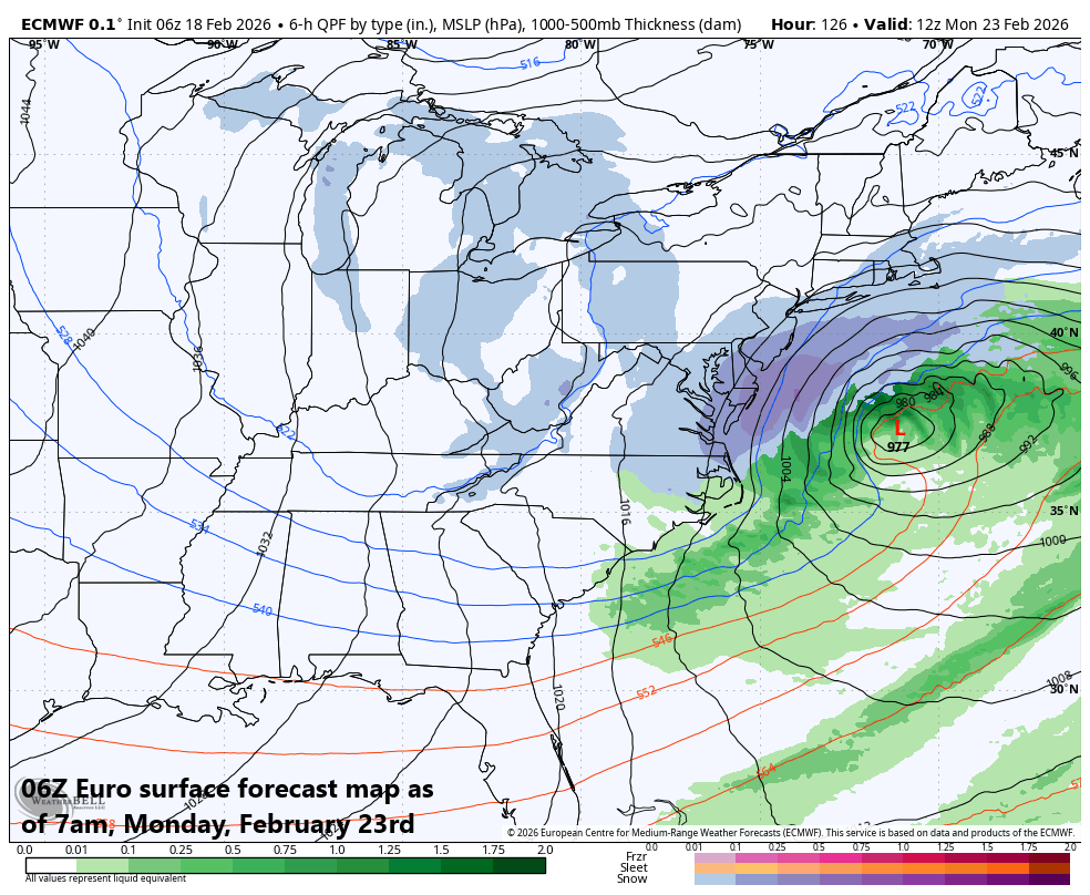
The surface forecast map of the 06Z Euro for late Sunday night feature low pressure over the western Atlantic and quite decent snow (darker shade of blue) across NJ, the Delmarva Peninsula, and eastern VA. Map courtesy ECMWF, Weather Bell
At this point, there is going to be the chance for significant intensification of the low-pressure system assuming there is a “phasing” together of this southern stream of energy with a second wave of energy riding along the polar jet to the north. The timing of the “phase” of these two disturbances leading to the rapid intensification of the low-pressure system is one of the questions that will have to be answered in coming days, and another revolves around the ultimate track of the storm. A turn to the east for the low-pressure system over the western Atlantic would tend to lessen impacts inland across the Mid-Atlantic region, but a turn to the northeast would increase the chance for more significant impact; especially, along coastal sections from New Jersey to the Delmarva Peninsula to eastern Virginia.
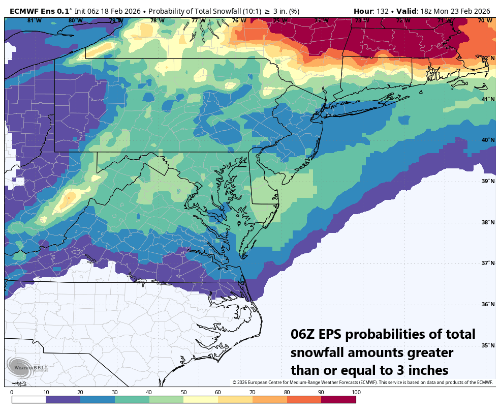
The probabilities of snowfall amounts greater than or equal to 3 inches for this late weekend storm system are depicted on this forecast map by the 06Z Euro Ensembles model run. Map courtesy ECMWF, Weather Bell
Stay tuned...by no means can this storm threat be written off just yet…still lots of details to be ironed out. One thing that is quite certain…it gets very cold behind the storm system in the eastern US for the early part of next week.
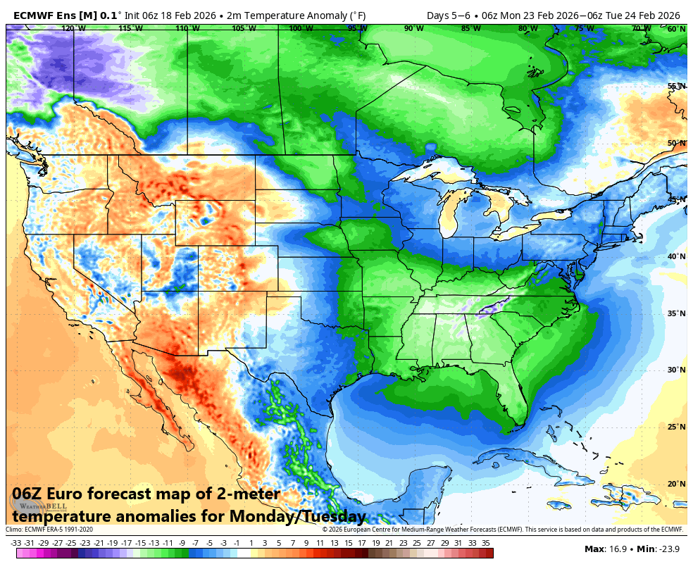
A much colder-than-normal air mass will flood the eastern part of the nation early next week on the heels of the late weekend storm system. The coldest air - relative to normal - will be centered over the TN Valley and SE US. Map courtesy ECMWF, Weather Bell
Meteorologist Paul Dorian
Arcfield
arcfieldweather.com
Follow us on Facebook, Twitter, YouTube
Video discussion: